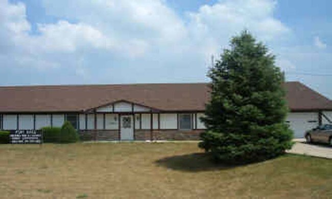
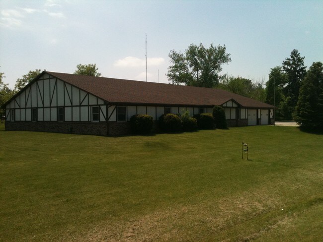
Property Record
2584 E 350Th Rd, Oglesby, IL 61348

Property Detail
2584 E 350Th Rd
18-27-231000
.726AC NW1/4 NE/1/4 SEC 27-33-1 AS DESC DOC# 2008-13217
Commercialnec
La Salle
B and X Area of moderate flood hazard, usually the area between the limits of the 100-year and 500-year floods.
Illinois
2024
0.73 AC
2024
I-39 Corr/LaSalle County
963400
Chicago
6,000 SF
Ottawa, IL
NEARBY LISTINGS FOR SALE OR LEASE
DEMOGRAPHICS near 2584 E 350Th Rd
1 mile
3 mile
5 mile
2025 Total Population
181
21,059
25,913
2030 Population
181
20,930
25,745
Pop Growth 2025-2030
0.00%
(0.61%)
(0.65%)
Average Age
44
42
43
2025 Total Households
81
9,248
11,280
HH Growth 2025-2030
0.00%
(0.61%)
(0.64%)
Median Household Inc
$75,893
$61,098
$63,638
Avg Household Size
2.20
2.20
2.20
2025 Avg HH Vehicles
2.00
2.00
2.00
Median Home Value
$174,999
$149,575
$156,435
Median Year Built
1967
1955
1958
Nearby Places
Map Layers
Map Styles
 Street
 Aerial
Transit
 Traffic
 Biking
Places
Listings with unknown addresses are not visible on the map
- Restaurants
- Banks
- Shops
- Fitness
- Groceries
SALE & LEASE HISTORY
LISTING DATE
SALE/LEASE

Oct 20, 2017
For Sale
Nearby Properties
Address
Land Use
TOTAL SIZE
Lot Size
Zoning
Address
Land Use
TOTAL SIZE
Lot Size
Zoning
507,934 SF
39.89 AC
Address
Land Use
TOTAL SIZE
Lot Size
Zoning
221,701 SF
20.73 AC
Address
Land Use
TOTAL SIZE
Lot Size
Zoning
10,494 SF
26.28 AC
Address
Land Use
TOTAL SIZE
Lot Size
Zoning
100 SF
40.13 AC
Address
Land Use
TOTAL SIZE
Lot Size
Zoning
70,080 SF
15.72 AC
Address
Land Use
TOTAL SIZE
Lot Size
Zoning
200 SF
32.64 AC
Address
Land Use
TOTAL SIZE
Lot Size
Zoning
55,917 SF
16.95 AC
Address
Land Use
TOTAL SIZE
Lot Size
Zoning
11,192 SF
16.23 AC
Address
Land Use
TOTAL SIZE
Lot Size
Zoning
66,340 SF
187.83 AC
Address
Land Use
TOTAL SIZE
Lot Size
Zoning
3,136 SF
45 AC
Address
Land Use
TOTAL SIZE
Lot Size
Zoning
32,436 SF
14.40 AC
Address
Land Use
TOTAL SIZE
Lot Size
Zoning
2,880 SF
15.38 AC
Address
Land Use
TOTAL SIZE
Lot Size
Zoning
4,704 SF
9.08 AC
Address
Land Use
TOTAL SIZE
Lot Size
Zoning
114,842 SF
20 AC
Address
Land Use
TOTAL SIZE
Lot Size
Zoning
7,138 SF
3.01 AC
Address
Land Use
TOTAL SIZE
Lot Size
Zoning
8,923 SF
2.27 AC
Address
Land Use
TOTAL SIZE
Lot Size
Zoning
266,741 SF
16.72 AC
Address
Land Use
TOTAL SIZE
Lot Size
Zoning
11,591 SF
0.35 AC
Address
Land Use
TOTAL SIZE
Lot Size
Zoning
89,709 SF
14.87 AC
Address
Land Use
TOTAL SIZE
Lot Size
Zoning
22,863 SF
5.80 AC
Address
Land Use
TOTAL SIZE
Lot Size
Zoning
5,014 SF
2.82 AC
Address
Land Use
TOTAL SIZE
Lot Size
Zoning
22,260 SF
1.50 AC
Address
Land Use
TOTAL SIZE
Lot Size
Zoning
23,070 SF
0.34 AC
Address
Land Use
TOTAL SIZE
Lot Size
Zoning
35,818 SF
2.14 AC
Address
Land Use
TOTAL SIZE
Lot Size
Zoning
3,344 SF
11.17 AC
Address
Land Use
TOTAL SIZE
Lot Size
Zoning
13,372 SF
1.06 AC
Address
Land Use
TOTAL SIZE
Lot Size
Zoning
13,374 SF
18.14 AC
Address
Land Use
TOTAL SIZE
Lot Size
Zoning
57,420 SF
21.39 AC
Address
Land Use
TOTAL SIZE
Lot Size
Zoning
1,849 SF
92.53 AC
Address
Land Use
TOTAL SIZE
Lot Size
Zoning
22,320 SF
1.25 AC
The World's #1 Commercial Real Estate Marketplace
Connect with us
© 2026 CoStar Group
The information above has been obtained from sources believed reliable. While we do not doubt its accuracy we have not verified it and make no guarantee, warranty or representation about it. It is your responsibility to independently confirm its accuracy and completeness. Any projections, opinions, assumptions, or estimates used are for example only and do not represent the current or future performance of the property. The value of this transaction to you depends on tax and other factors which should be evaluated by your tax, financial, and legal advisors. You and your advisors should conduct a careful, independent investigation of the property to determine to your satisfaction the suitability of the property for your needs.