Property Record
2585 Cochran St, Simi Valley, CA 93065
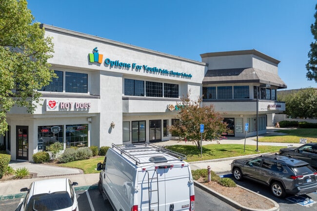


This Property Is For Sale
Property Detail
2585 Cochran St
613-0-240-145
LOT: 3 REF: 53 PM 50
Storebuilding
Ventura
MULT
California
B and X Area of moderate flood hazard, usually the area between the limits of the 100-year and 500-year floods.
3
2024
0.96 AC
2025
Moorpark/Simi Valley
007904
Los Angeles
19,459 SF
Oxnard-Thousand Oaks-Ventura, CA
NEARBY LISTINGS FOR SALE OR LEASE
DEMOGRAPHICS near 2585 Cochran St
1 mile
3 mile
5 mile
2025 Total Population
19,881
84,243
123,926
2030 Population
19,865
83,642
122,737
Pop Growth 2025-2030
(0.08%)
(0.71%)
(0.96%)
Average Age
41
41
42
2025 Total Households
6,245
27,186
41,885
HH Growth 2025-2030
(0.21%)
(0.85%)
(1.19%)
Median Household Inc
$115,322
$117,722
$119,633
Avg Household Size
3.10
3.00
2.90
2025 Avg HH Vehicles
2.00
2.00
2.00
Median Home Value
$750,630
$774,468
$785,933
Median Year Built
1971
1974
1979
Nearby Places
Map Layers
Map Styles
 Street
 Aerial
Transit
 Traffic
 Biking
Places
Listings with unknown addresses are not visible on the map
- Restaurants
- Banks
- Shops
- Fitness
- Groceries
PUBLIC TRANSPORTATION
COMMUTER RAIL
Simi Valley (Ventura County Line - Southern California Regional Rail Authority (Metrolink))
Drive
Walk
Distance
Simi Valley (Ventura County Line - Southern California Regional Rail Authority (Metrolink))
7 min
3.6 mi
Moorpark (Ventura County Line - Southern California Regional Rail Authority (Metrolink))
Drive
Walk
Distance
Moorpark (Ventura County Line - Southern California Regional Rail Authority (Metrolink))
15 min
9.7 mi
AIRPORT
Bob Hope
Drive
Walk
Distance
Bob Hope
33 min
26.0 mi
Los Angeles International
Drive
Walk
Distance
Los Angeles International
53 min
41.9 mi
Freight Ports
The Port of Hueneme
Drive
Walk
Distance
The Port of Hueneme
49 min
31.7 mi
Nearby Properties
Address
Land Use
TOTAL SIZE
Lot Size
Zoning
Address
Land Use
TOTAL SIZE
Lot Size
Zoning
4.77 AC
CO
Address
Land Use
TOTAL SIZE
Lot Size
Zoning
28,561 SF
43.55 AC
BP-S
Address
Land Use
TOTAL SIZE
Lot Size
Zoning
45,594 SF
15.99 AC
RVH-2
Address
Land Use
TOTAL SIZE
Lot Size
Zoning
265,102 SF
12.30 AC
Address
Land Use
TOTAL SIZE
Lot Size
Zoning
238,578 SF
10.85 AC
Address
Land Use
TOTAL SIZE
Lot Size
Zoning
57,707 SF
14.76 AC
L-I
Address
Land Use
TOTAL SIZE
Lot Size
Zoning
18,057 SF
10.23 AC
L-I
Address
Land Use
TOTAL SIZE
Lot Size
Zoning
135,768 SF
5.27 AC
Address
Land Use
TOTAL SIZE
Lot Size
Zoning
71,166 SF
12.44 AC
GI
Address
Land Use
TOTAL SIZE
Lot Size
Zoning
25,277 SF
14.64 AC
RM-3
Address
Land Use
TOTAL SIZE
Lot Size
Zoning
21,873 SF
17.04 AC
Address
Land Use
TOTAL SIZE
Lot Size
Zoning
20,461 SF
2.92 AC
Address
Land Use
TOTAL SIZE
Lot Size
Zoning
14.66 AC
Address
Land Use
TOTAL SIZE
Lot Size
Zoning
3.15 AC
RL-1
Address
Land Use
TOTAL SIZE
Lot Size
Zoning
18,820 SF
11.46 AC
Address
Land Use
TOTAL SIZE
Lot Size
Zoning
157,745 SF
7.53 AC
L-I
Address
Land Use
TOTAL SIZE
Lot Size
Zoning
14,120 SF
8.22 AC
Address
Land Use
TOTAL SIZE
Lot Size
Zoning
4.81 AC
Address
Land Use
TOTAL SIZE
Lot Size
Zoning
159,664 SF
7.50 AC
L-I
Address
Land Use
TOTAL SIZE
Lot Size
Zoning
20,660 SF
8.15 AC
Address
Land Use
TOTAL SIZE
Lot Size
Zoning
11,242 SF
13.70 AC
Address
Land Use
TOTAL SIZE
Lot Size
Zoning
66,724 SF
2.83 AC
Address
Land Use
TOTAL SIZE
Lot Size
Zoning
18,889 SF
10.29 AC
A1
Address
Land Use
TOTAL SIZE
Lot Size
Zoning
13,585 SF
8.28 AC
BP-S
Address
Land Use
TOTAL SIZE
Lot Size
Zoning
157,065 SF
4.30 AC
Address
Land Use
TOTAL SIZE
Lot Size
Zoning
Address
Land Use
TOTAL SIZE
Lot Size
Zoning
10,368 SF
13.36 AC
Address
Land Use
TOTAL SIZE
Lot Size
Zoning
1,051.63 AC
OS160AC
The World's #1 Commercial Real Estate Marketplace
Connect with us
© 2026 CoStar Group
The information above has been obtained from sources believed reliable. While we do not doubt its accuracy we have not verified it and make no guarantee, warranty or representation about it. It is your responsibility to independently confirm its accuracy and completeness. Any projections, opinions, assumptions, or estimates used are for example only and do not represent the current or future performance of the property. The value of this transaction to you depends on tax and other factors which should be evaluated by your tax, financial, and legal advisors. You and your advisors should conduct a careful, independent investigation of the property to determine to your satisfaction the suitability of the property for your needs.