Property Record
2585 N State Highway 19 Rd, Palestine, TX 75803
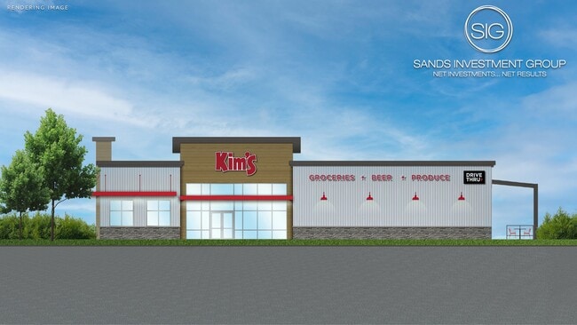

Property Detail
2585 N State Highway 19 Rd
R853368
A0034 KIMBROUGH, WILLIAM BLOCK 1263 TRACT 1E
Commercialnec
ANDERSON
B and X Area of moderate flood hazard, usually the area between the limits of the 100-year and 500-year floods.
Texas
2025
2.38 AC
2025
Texas East Area
950901
Other Market Areas
5,630 SF
Palestine, TX
NEARBY LISTINGS FOR SALE OR LEASE
-
-
View all Palestine listings for sale on LoopNet.com
DEMOGRAPHICS near 2585 N State Highway 19 Rd
1 mile
3 mile
5 mile
2025 Total Population
548
10,071
23,528
2030 Population
564
10,208
23,888
Pop Growth 2025-2030
+ 2.92%
+ 1.36%
+ 1.53%
Average Age
40
40
40
2025 Total Households
187
2,844
7,713
HH Growth 2025-2030
+ 2.67%
+ 1.48%
+ 1.56%
Median Household Inc
$44,999
$52,206
$49,122
Avg Household Size
2.70
2.60
2.60
2025 Avg HH Vehicles
1.00
2.00
2.00
Median Home Value
$206,522
$210,221
$171,063
Median Year Built
1982
1980
1979
Nearby Places
Map Layers
Map Styles
 Street
 Aerial
Transit
 Traffic
 Biking
Places
Listings with unknown addresses are not visible on the map
- Restaurants
- Banks
- Shops
- Fitness
- Groceries
SALE & LEASE HISTORY
LISTING DATE
SALE/LEASE

Jun 18, 2021
For Sale
Nearby Properties
Address
Land Use
TOTAL SIZE
Lot Size
Zoning
Address
Land Use
TOTAL SIZE
Lot Size
Zoning
80,156 SF
76.64 AC
Address
Land Use
TOTAL SIZE
Lot Size
Zoning
53,465 SF
7.49 AC
Address
Land Use
TOTAL SIZE
Lot Size
Zoning
36,849 SF
6.22 AC
Address
Land Use
TOTAL SIZE
Lot Size
Zoning
102,052 SF
7 AC
Address
Land Use
TOTAL SIZE
Lot Size
Zoning
27,014 SF
2.70 AC
Address
Land Use
TOTAL SIZE
Lot Size
Zoning
35,808 SF
2.32 AC
Address
Land Use
TOTAL SIZE
Lot Size
Zoning
40,554 SF
9.71 AC
Address
Land Use
TOTAL SIZE
Lot Size
Zoning
19,808 SF
33.38 AC
Address
Land Use
TOTAL SIZE
Lot Size
Zoning
22,800 SF
5.14 AC
Address
Land Use
TOTAL SIZE
Lot Size
Zoning
35,220 SF
14.47 AC
Address
Land Use
TOTAL SIZE
Lot Size
Zoning
12,780 SF
2.02 AC
Address
Land Use
TOTAL SIZE
Lot Size
Zoning
13,044 SF
6.29 AC
Address
Land Use
TOTAL SIZE
Lot Size
Zoning
26,074 SF
2.38 AC
Address
Land Use
TOTAL SIZE
Lot Size
Zoning
14,924 SF
116.19 AC
Address
Land Use
TOTAL SIZE
Lot Size
Zoning
76,399 SF
7.18 AC
Address
Land Use
TOTAL SIZE
Lot Size
Zoning
7,776 SF
281.10 AC
Address
Land Use
TOTAL SIZE
Lot Size
Zoning
18,116 SF
9.44 AC
Address
Land Use
TOTAL SIZE
Lot Size
Zoning
4,074 SF
1.07 AC
Address
Land Use
TOTAL SIZE
Lot Size
Zoning
1.59 AC
Address
Land Use
TOTAL SIZE
Lot Size
Zoning
222.69 AC
Address
Land Use
TOTAL SIZE
Lot Size
Zoning
Address
Land Use
TOTAL SIZE
Lot Size
Zoning
25,136 SF
9.75 AC
Address
Land Use
TOTAL SIZE
Lot Size
Zoning
36,127 SF
8.37 AC
Address
Land Use
TOTAL SIZE
Lot Size
Zoning
77.12 AC
Address
Land Use
TOTAL SIZE
Lot Size
Zoning
13,806 SF
0.54 AC
Address
Land Use
TOTAL SIZE
Lot Size
Zoning
17,359 SF
97.75 AC
Address
Land Use
TOTAL SIZE
Lot Size
Zoning
15,159 SF
6.10 AC
Address
Land Use
TOTAL SIZE
Lot Size
Zoning
173.95 AC
Address
Land Use
TOTAL SIZE
Lot Size
Zoning
13,042 SF
1.09 AC
The World's #1 Commercial Real Estate Marketplace
Connect with us
© 2026 CoStar Group
The information above has been obtained from sources believed reliable. While we do not doubt its accuracy we have not verified it and make no guarantee, warranty or representation about it. It is your responsibility to independently confirm its accuracy and completeness. Any projections, opinions, assumptions, or estimates used are for example only and do not represent the current or future performance of the property. The value of this transaction to you depends on tax and other factors which should be evaluated by your tax, financial, and legal advisors. You and your advisors should conduct a careful, independent investigation of the property to determine to your satisfaction the suitability of the property for your needs.