Property Record
259 City Lake Rd, Lexington, NC 27295

NEARBY LISTINGS FOR SALE OR LEASE
Property Detail
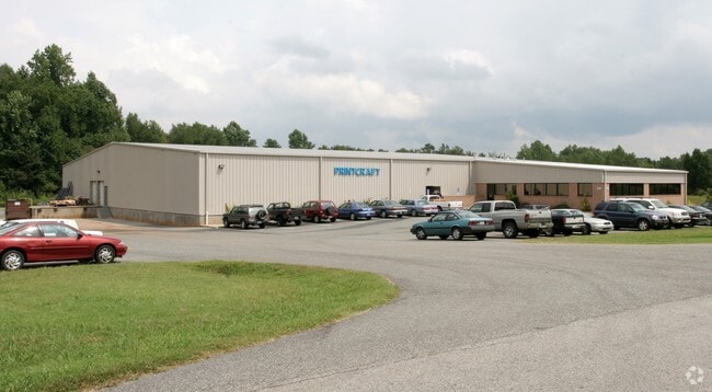
259 City Lake Rd
11-322-0-000-0013-A-0-0
L13A BK1097-1597
Publicstorage
Davidson
X
North Carolina
3710673700J
8.95 AC
2025
South Davidson County
2025
Greensboro/Winston-Salem
060400
Winston-Salem, NC
27,182 SF
DEMOGRAPHICS near 259 City Lake Rd
1 Mile
3 Mile
5 Mile
2024 Total Population
1,177
16,617
38,781
2029 Population
1,253
17,624
41,085
Pop Growth 2024-2029
+ 6.46%
+ 6.06%
+ 5.94%
Average Age
41
41
41
2024 Total Households
466
6,770
15,613
HH Growth 2024-2029
+ 6.22%
+ 5.98%
+ 5.86%
Median Household Inc
$51,451
$39,439
$39,820
Avg Household Size
2.50
2.40
2.40
2024 Avg HH Vehicles
2.00
2.00
2.00
Median Home Value
$147,950
$150,869
$155,172
Median Year Built
1981
1977
1978
Nearby Places
Map Layers
Map Styles
 Street
 Aerial
- Restaurants
- Banks
- Shops
- Fitness
- Groceries
PUBLIC TRANSPORTATION
AIRPORT
Piedmont Triad International
DRIVE
WALK
Distance
Piedmont Triad International
48 min
34.4 mi
Concord-Padgett Regional
DRIVE
WALK
Distance
Concord-Padgett Regional
59 min
48.7 mi
Nearby Properties
Address
Land Use
TOTAL SIZE
Lot Size
Zoning
Address
Land Use
TOTAL SIZE
Lot Size
Zoning
4,788 SF
11.95 AC
HC
Address
Land Use
TOTAL SIZE
Lot Size
Zoning
2,736 SF
4.77 AC
U
Address
Land Use
TOTAL SIZE
Lot Size
Zoning
32,834 SF
30 AC
RA3
Address
Land Use
TOTAL SIZE
Lot Size
Zoning
28,176 SF
16.01 AC
B
Address
Land Use
TOTAL SIZE
Lot Size
Zoning
33,282 SF
4.41 AC
B
Address
Land Use
TOTAL SIZE
Lot Size
Zoning
40,047 SF
8.75 AC
B
Address
Land Use
TOTAL SIZE
Lot Size
Zoning
63,794 SF
2.84 AC
B
Address
Land Use
TOTAL SIZE
Lot Size
Zoning
85,425 SF
1.16 AC
U
Address
Land Use
TOTAL SIZE
Lot Size
Zoning
115,748 SF
8.14 AC
B
Address
Land Use
TOTAL SIZE
Lot Size
Zoning
10,248 SF
9 AC
OI
Address
Land Use
TOTAL SIZE
Lot Size
Zoning
8,586 SF
5.15 AC
LI
Address
Land Use
TOTAL SIZE
Lot Size
Zoning
42,132 SF
6.33 AC
B
Address
Land Use
TOTAL SIZE
Lot Size
Zoning
2,414 SF
16.14 AC
TN
Address
Land Use
TOTAL SIZE
Lot Size
Zoning
2,148 SF
6.62 AC
TN
Address
Land Use
TOTAL SIZE
Lot Size
Zoning
90,496 SF
10.99 AC
LI
Address
Land Use
TOTAL SIZE
Lot Size
Zoning
18,986 SF
6.79 AC
TN
Address
Land Use
TOTAL SIZE
Lot Size
Zoning
135,603 SF
3.76 AC
TN
Address
Land Use
TOTAL SIZE
Lot Size
Zoning
10,396 SF
11.70 AC
B
Address
Land Use
TOTAL SIZE
Lot Size
Zoning
60,944 SF
10.70 AC
B
Address
Land Use
TOTAL SIZE
Lot Size
Zoning
9,054 SF
24.77 AC
TN
Address
Land Use
TOTAL SIZE
Lot Size
Zoning
147,689 SF
29.23 AC
OI
Address
Land Use
TOTAL SIZE
Lot Size
Zoning
36,014 SF
0.73 AC
U
Address
Land Use
TOTAL SIZE
Lot Size
Zoning
35,396 SF
10.31 AC
I
Address
Land Use
TOTAL SIZE
Lot Size
Zoning
9,248 SF
14.71 AC
RM2
Address
Land Use
TOTAL SIZE
Lot Size
Zoning
14,551 SF
10.81 AC
RA3
Address
Land Use
TOTAL SIZE
Lot Size
Zoning
90,833 SF
9.34 AC
B
Address
Land Use
TOTAL SIZE
Lot Size
Zoning
22,415 SF
5 AC
B
Address
Land Use
TOTAL SIZE
Lot Size
Zoning
15,532 SF
0.67 AC
U
Address
Land Use
TOTAL SIZE
Lot Size
Zoning
16,696 SF
2.02 AC
B
Address
Land Use
TOTAL SIZE
Lot Size
Zoning
219.34 AC
HI
The World's #1 Commercial Real Estate Marketplace
Connect with us
© 2025 CoStar Group
The information above has been obtained from sources believed reliable. While we do not doubt its accuracy we have not verified it and make no guarantee, warranty or representation about it. It is your responsibility to independently confirm its accuracy and completeness. Any projections, opinions, assumptions, or estimates used are for example only and do not represent the current or future performance of the property. The value of this transaction to you depends on tax and other factors which should be evaluated by your tax, financial, and legal advisors. You and your advisors should conduct a careful, independent investigation of the property to determine to your satisfaction the suitability of the property for your needs.