Property Record
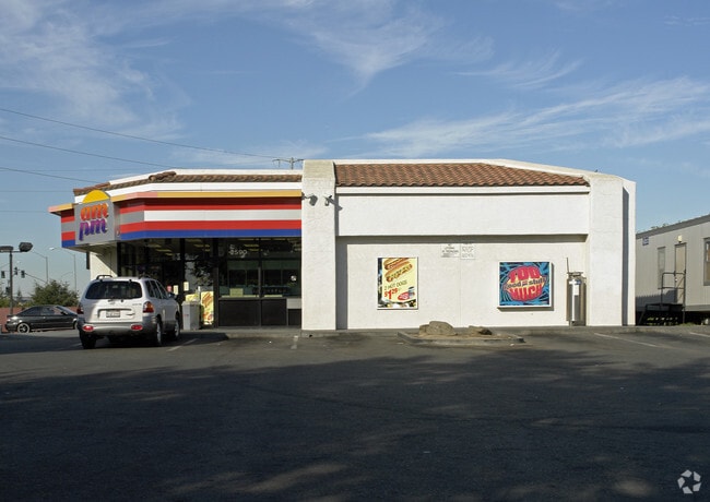
2590 S Cherry Ave, Fresno, CA 93706


Property Detail
2590 S Cherry Ave
479-224-37
1.30 AC IN LOT 13 BUENA VISTA TR
Industrialgeneral
Fresno
M1
California
B and X Area of moderate flood hazard, usually the area between the limits of the 100-year and 500-year floods.
13
2025
1.30 AC
2025
West Fresno
001100
Fresno
2,768 SF
Fresno, CA
NEARBY LISTINGS FOR SALE OR LEASE
DEMOGRAPHICS near 2590 S Cherry Ave
1 mile
3 mile
5 mile
2024 Total Population
7,242
84,391
213,942
2029 Population
7,276
84,943
215,735
Pop Growth 2024-2029
+ 0.47%
+ 0.65%
+ 0.84%
Average Age
32
34
35
2024 Total Households
1,892
22,902
62,191
HH Growth 2024-2029
+ 0.42%
+ 0.78%
+ 0.89%
Median Household Inc
$28,845
$38,455
$49,836
Avg Household Size
3.70
3.30
3.20
2024 Avg HH Vehicles
1.00
2.00
2.00
Median Home Value
$181,839
$228,568
$281,784
Median Year Built
1968
1967
1965
Nearby Places
Map Layers
Map Styles
 Street
 Aerial
Transit
 Traffic
 Biking
Places
Listings with unknown addresses are not visible on the map
- Restaurants
- Banks
- Shops
- Fitness
- Groceries
PUBLIC TRANSPORTATION
COMMUTER RAIL
Drive
Walk
Distance
5 min
2.6 mi
AIRPORT
Fresno Yosemite International
Drive
Walk
Distance
Fresno Yosemite International
13 min
7.7 mi
Nearby Properties
Address
Land Use
TOTAL SIZE
Lot Size
Zoning
Address
Land Use
TOTAL SIZE
Lot Size
Zoning
855,000 SF
63.99 AC
IH
Address
Land Use
TOTAL SIZE
Lot Size
Zoning
660,486 SF
39.04 AC
M3
Address
Land Use
TOTAL SIZE
Lot Size
Zoning
226,597 SF
12.80 AC
M3
Address
Land Use
TOTAL SIZE
Lot Size
Zoning
0.01 AC
P
Address
Land Use
TOTAL SIZE
Lot Size
Zoning
534,993 SF
5.23 AC
CP
Address
Land Use
TOTAL SIZE
Lot Size
Zoning
288,597 SF
1.18 AC
C4
Address
Land Use
TOTAL SIZE
Lot Size
Zoning
147,101 SF
6.31 AC
SPLIT
Address
Land Use
TOTAL SIZE
Lot Size
Zoning
184,130 SF
1.87 AC
PI
Address
Land Use
TOTAL SIZE
Lot Size
Zoning
141,959 SF
35.39 AC
SPLIT
Address
Land Use
TOTAL SIZE
Lot Size
Zoning
176,926 SF
9.79 AC
IH
Address
Land Use
TOTAL SIZE
Lot Size
Zoning
291,527 SF
28.85 AC
M3
Address
Land Use
TOTAL SIZE
Lot Size
Zoning
670,680 SF
30.16 AC
IH
Address
Land Use
TOTAL SIZE
Lot Size
Zoning
50,450 SF
16.84 AC
M3
Address
Land Use
TOTAL SIZE
Lot Size
Zoning
101,510 SF
3.37 AC
CM
Address
Land Use
TOTAL SIZE
Lot Size
Zoning
343,038 SF
19.54 AC
AE20
Address
Land Use
TOTAL SIZE
Lot Size
Zoning
193,440 SF
16.82 AC
Address
Land Use
TOTAL SIZE
Lot Size
Zoning
238,160 SF
18.77 AC
M3
Address
Land Use
TOTAL SIZE
Lot Size
Zoning
471,760 SF
1.98 AC
CP
Address
Land Use
TOTAL SIZE
Lot Size
Zoning
213,874 SF
4.17 AC
SPLIT
Address
Land Use
TOTAL SIZE
Lot Size
Zoning
206,766 SF
17.11 AC
R2
Address
Land Use
TOTAL SIZE
Lot Size
Zoning
259,852 SF
56.49 AC
AE20
Address
Land Use
TOTAL SIZE
Lot Size
Zoning
61,575 SF
3.50 AC
SPLIT
Address
Land Use
TOTAL SIZE
Lot Size
Zoning
198,436 SF
20.85 AC
M3
Address
Land Use
TOTAL SIZE
Lot Size
Zoning
79,518 SF
2.03 AC
R4
Address
Land Use
TOTAL SIZE
Lot Size
Zoning
409,374 SF
24.73 AC
SPLIT
Address
Land Use
TOTAL SIZE
Lot Size
Zoning
480,570 SF
2.98 AC
P
Address
Land Use
TOTAL SIZE
Lot Size
Zoning
90,500 SF
1.29 AC
CM
Address
Land Use
TOTAL SIZE
Lot Size
Zoning
54,526 SF
5.88 AC
M3
Address
Land Use
TOTAL SIZE
Lot Size
Zoning
314,915 SF
14.12 AC
M2
The World's #1 Commercial Real Estate Marketplace
Connect with us
© 2026 CoStar Group
The information above has been obtained from sources believed reliable. While we do not doubt its accuracy we have not verified it and make no guarantee, warranty or representation about it. It is your responsibility to independently confirm its accuracy and completeness. Any projections, opinions, assumptions, or estimates used are for example only and do not represent the current or future performance of the property. The value of this transaction to you depends on tax and other factors which should be evaluated by your tax, financial, and legal advisors. You and your advisors should conduct a careful, independent investigation of the property to determine to your satisfaction the suitability of the property for your needs.