Property Record
25932 471St Ave, Sioux Falls, SD 57107
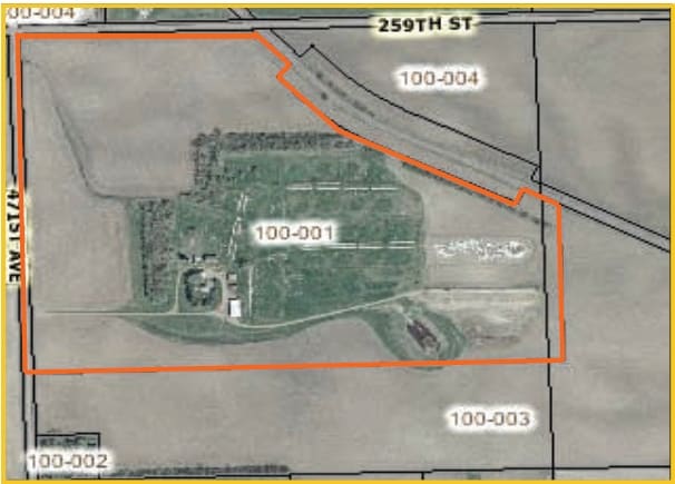

Property Detail
25932 471St Ave
15658
N2020.27 W2766.61 N12 LYING S & W OF BN RR ROW (EX FOUNDATION PARK ADDN & TRACT BEGINNING AT NE CORNER LOT 3A BLK1 FOUNDATION
Commercialacreage
MINNEHAHA
A1
South Dakota
B and X Area of moderate flood hazard, usually the area between the limits of the 100-year and 500-year floods.
3a
2024
52.97 AC
2024
Sioux Falls
010404
Other Market Areas
1,598 SF
Sioux Falls, SD-MN
NEARBY LISTINGS FOR SALE OR LEASE
DEMOGRAPHICS near 25932 471St Ave
1 mile
3 mile
5 mile
2025 Total Population
39
5,243
15,643
2030 Population
41
5,653
16,641
Pop Growth 2025-2030
+ 5.13%
+ 7.82%
+ 6.38%
Average Age
38
36
38
2025 Total Households
13
2,046
6,334
HH Growth 2025-2030
+ 7.69%
+ 8.36%
+ 6.76%
Median Household Inc
$93,749
$81,416
$72,497
Avg Household Size
2.60
2.50
2.40
2025 Avg HH Vehicles
3.00
2.00
2.00
Median Home Value
$350,000
$335,269
$285,802
Median Year Built
1999
2008
2006
Nearby Places
Map Layers
Map Styles
 Street
 Aerial
Transit
 Traffic
 Biking
Places
Listings with unknown addresses are not visible on the map
- Restaurants
- Banks
- Shops
- Fitness
- Groceries
PUBLIC TRANSPORTATION
AIRPORT
Joe Foss Field
Drive
Walk
Distance
Joe Foss Field
27 min
9.1 mi
Freight Ports
Port Milwaukee
Drive
Walk
Distance
Port Milwaukee
548 min
505.2 mi
SALE & LEASE HISTORY
LISTING DATE
SALE/LEASE

Sep 25, 2016
For Lease
Nearby Properties
Address
Land Use
TOTAL SIZE
Lot Size
Zoning
Address
Land Use
TOTAL SIZE
Lot Size
Zoning
80.61 AC
Address
Land Use
TOTAL SIZE
Lot Size
Zoning
Address
Land Use
TOTAL SIZE
Lot Size
Zoning
Address
Land Use
TOTAL SIZE
Lot Size
Zoning
Address
Land Use
TOTAL SIZE
Lot Size
Zoning
193,993 SF
34.68 AC
Address
Land Use
TOTAL SIZE
Lot Size
Zoning
140,816 SF
13.80 AC
Address
Land Use
TOTAL SIZE
Lot Size
Zoning
35,688 SF
8.27 AC
FP;FP
Address
Land Use
TOTAL SIZE
Lot Size
Zoning
49.45 AC
C;COMMERCI
Address
Land Use
TOTAL SIZE
Lot Size
Zoning
134,102 SF
11.77 AC
Address
Land Use
TOTAL SIZE
Lot Size
Zoning
Address
Land Use
TOTAL SIZE
Lot Size
Zoning
53,738 SF
6.04 AC
Address
Land Use
TOTAL SIZE
Lot Size
Zoning
30,712 SF
2 AC
C;COMMERCI
Address
Land Use
TOTAL SIZE
Lot Size
Zoning
1.92 AC
C;COMMERCI
Address
Land Use
TOTAL SIZE
Lot Size
Zoning
189,766 SF
16.53 AC
I1;LIGHT I
Address
Land Use
TOTAL SIZE
Lot Size
Zoning
1.84 AC
C;COMMERCI
Address
Land Use
TOTAL SIZE
Lot Size
Zoning
11.65 AC
I1;LIGHT I
Address
Land Use
TOTAL SIZE
Lot Size
Zoning
Address
Land Use
TOTAL SIZE
Lot Size
Zoning
Address
Land Use
TOTAL SIZE
Lot Size
Zoning
46,944 SF
6.50 AC
Address
Land Use
TOTAL SIZE
Lot Size
Zoning
97,572 SF
10.89 AC
I1;LIGHT I
Address
Land Use
TOTAL SIZE
Lot Size
Zoning
40,846 SF
10.30 AC
Address
Land Use
TOTAL SIZE
Lot Size
Zoning
32,734 SF
7.46 AC
Address
Land Use
TOTAL SIZE
Lot Size
Zoning
49,380 SF
3.10 AC
Address
Land Use
TOTAL SIZE
Lot Size
Zoning
2.15 AC
C;COMMERCI
Address
Land Use
TOTAL SIZE
Lot Size
Zoning
75,460 SF
4.43 AC
C;COMMERCI
Address
Land Use
TOTAL SIZE
Lot Size
Zoning
42,472 SF
10.04 AC
Address
Land Use
TOTAL SIZE
Lot Size
Zoning
36,460 SF
5.20 AC
C;COMMERCI
Address
Land Use
TOTAL SIZE
Lot Size
Zoning
53,724 SF
6.49 AC
Address
Land Use
TOTAL SIZE
Lot Size
Zoning
16,011 SF
18.79 AC
The World's #1 Commercial Real Estate Marketplace
Connect with us
© 2026 CoStar Group
The information above has been obtained from sources believed reliable. While we do not doubt its accuracy we have not verified it and make no guarantee, warranty or representation about it. It is your responsibility to independently confirm its accuracy and completeness. Any projections, opinions, assumptions, or estimates used are for example only and do not represent the current or future performance of the property. The value of this transaction to you depends on tax and other factors which should be evaluated by your tax, financial, and legal advisors. You and your advisors should conduct a careful, independent investigation of the property to determine to your satisfaction the suitability of the property for your needs.