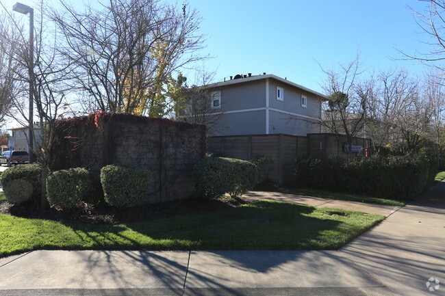
Property Record
2594 Guerneville Rd, Santa Rosa, CA 95401


NEARBY LISTINGS FOR SALE OR LEASE
Property Detail
2594 Guerneville Rd
034-110-084
Parcel Map No 571
Apartment
98 FM PTN 034-110-063 SRPM 571 PCL 1
X
Sonoma
06097C0709E
California
2024
3.51 AC
2025
Outer Santa Rosa
153002
North Bay/Santa Rosa
53,599 SF
Santa Rosa, CA
DEMOGRAPHICS near 2594 Guerneville Rd
1 Mile
3 Mile
5 Mile
2024 Total Population
9,657
82,519
168,301
2029 Population
9,469
81,691
166,942
Pop Growth 2024-2029
(1.95%)
(1.00%)
(0.81%)
Average Age
43
39
41
2024 Total Households
3,606
28,951
61,113
HH Growth 2024-2029
(2.00%)
(0.97%)
(0.76%)
Median Household Inc
$106,340
$89,073
$89,281
Avg Household Size
2.60
2.70
2.60
2024 Avg HH Vehicles
2.00
2.00
2.00
Median Home Value
$699,859
$667,114
$717,849
Median Year Built
1981
1982
1980
Nearby Places
Map Layers
Map Styles
 Street
 Aerial
- Restaurants
- Banks
- Shops
- Fitness
- Groceries
PUBLIC TRANSPORTATION
COMMUTER RAIL
Santa Rosa North Smart (Main Line - Sonoma Marin Area Rail Transit)
DRIVE
WALK
Distance
Santa Rosa North Smart (Main Line - Sonoma Marin Area Rail Transit)
5 min
2.3 mi
Santa Rosa Downtown Smart (Main Line - Sonoma Marin Area Rail Transit)
DRIVE
WALK
Distance
Santa Rosa Downtown Smart (Main Line - Sonoma Marin Area Rail Transit)
8 min
3.8 mi
AIRPORT
Charles M Schulz - Sonoma County
DRIVE
WALK
Distance
Charles M Schulz - Sonoma County
13 min
6.3 mi
Freight Ports
Port of Richmond
DRIVE
WALK
Distance
Port of Richmond
69 min
52.4 mi
Nearby Properties
Address
Land Use
TOTAL SIZE
Lot Size
Zoning
Address
Land Use
TOTAL SIZE
Lot Size
Zoning
22.45 AC
MCPD
Address
Land Use
TOTAL SIZE
Lot Size
Zoning
222,278 SF
13.39 AC
CITYSR
Address
Land Use
TOTAL SIZE
Lot Size
Zoning
447,600 SF
22.01 AC
Address
Land Use
TOTAL SIZE
Lot Size
Zoning
260,417 SF
9.13 AC
CITYSR
Address
Land Use
TOTAL SIZE
Lot Size
Zoning
74,000 SF
0.51 AC
Address
Land Use
TOTAL SIZE
Lot Size
Zoning
116,188 SF
6.55 AC
CITYSR
Address
Land Use
TOTAL SIZE
Lot Size
Zoning
8.06 AC
Address
Land Use
TOTAL SIZE
Lot Size
Zoning
136,609 SF
9.33 AC
CITYSR
Address
Land Use
TOTAL SIZE
Lot Size
Zoning
90,330 SF
6.72 AC
Address
Land Use
TOTAL SIZE
Lot Size
Zoning
105,696 SF
5.46 AC
Address
Land Use
TOTAL SIZE
Lot Size
Zoning
87,300 SF
6.64 AC
Address
Land Use
TOTAL SIZE
Lot Size
Zoning
71,800 SF
7.76 AC
CIPD
Address
Land Use
TOTAL SIZE
Lot Size
Zoning
146,611 SF
9.44 AC
Address
Land Use
TOTAL SIZE
Lot Size
Zoning
85,920 SF
5.69 AC
CITYSR
Address
Land Use
TOTAL SIZE
Lot Size
Zoning
3.95 AC
Address
Land Use
TOTAL SIZE
Lot Size
Zoning
205,776 SF
9.96 AC
CITYSR
Address
Land Use
TOTAL SIZE
Lot Size
Zoning
106,005 SF
10.45 AC
Address
Land Use
TOTAL SIZE
Lot Size
Zoning
60,165 SF
4.38 AC
Address
Land Use
TOTAL SIZE
Lot Size
Zoning
95,238 SF
4.96 AC
CITYSR
Address
Land Use
TOTAL SIZE
Lot Size
Zoning
71,739 SF
3.14 AC
Address
Land Use
TOTAL SIZE
Lot Size
Zoning
144,066 SF
0.52 AC
Address
Land Use
TOTAL SIZE
Lot Size
Zoning
109,126 SF
3.91 AC
Address
Land Use
TOTAL SIZE
Lot Size
Zoning
Address
Land Use
TOTAL SIZE
Lot Size
Zoning
152,560 SF
10.92 AC
CITYSR
Address
Land Use
TOTAL SIZE
Lot Size
Zoning
25,200 SF
7.91 AC
CITYSR
Address
Land Use
TOTAL SIZE
Lot Size
Zoning
52,764 SF
3.56 AC
Address
Land Use
TOTAL SIZE
Lot Size
Zoning
103,894 SF
4.27 AC
CITYSR
Address
Land Use
TOTAL SIZE
Lot Size
Zoning
98,358 SF
8.02 AC
CITYSR
Address
Land Use
TOTAL SIZE
Lot Size
Zoning
208,379 SF
0.16 AC
CITYSR
Address
Land Use
TOTAL SIZE
Lot Size
Zoning
93,967 SF
4.06 AC
The World's #1 Commercial Real Estate Marketplace
Connect with us
© 2026 CoStar Group
The information above has been obtained from sources believed reliable. While we do not doubt its accuracy we have not verified it and make no guarantee, warranty or representation about it. It is your responsibility to independently confirm its accuracy and completeness. Any projections, opinions, assumptions, or estimates used are for example only and do not represent the current or future performance of the property. The value of this transaction to you depends on tax and other factors which should be evaluated by your tax, financial, and legal advisors. You and your advisors should conduct a careful, independent investigation of the property to determine to your satisfaction the suitability of the property for your needs.