Property Record
2594 N 400 E, Ogden, UT 84414
NEARBY LISTINGS FOR SALE OR LEASE
Property Detail
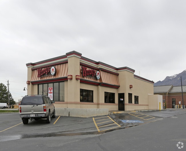
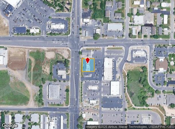
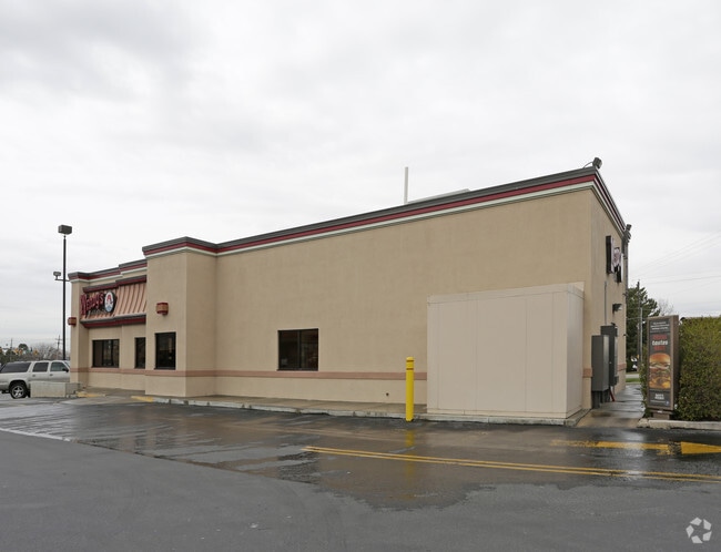
2594 N 400 E
18-047-0016
Plat B North Ogden Survey
Restaurantdrivein
PART OF LOTS 10 AND 11, PLAT B, NORTH OGDEN SURVEY, WEBER COUNTY, UTAH: BEGINNING AT A POINT ON THE WEST LINE OF SAID LOT 11,
X
Weber
49057C0212F
Utah
2025
0.38 AC
2025
Davis/Weber Counties
210204
Salt Lake City
2,320 SF
Ogden, UT
DEMOGRAPHICS near 2594 N 400 E
1 Mile
3 Mile
5 Mile
2024 Total Population
11,709
56,932
97,034
2029 Population
12,524
61,323
104,559
Pop Growth 2024-2029
+ 6.96%
+ 7.71%
+ 7.76%
Average Age
37
36
36
2024 Total Households
4,001
18,306
32,087
HH Growth 2024-2029
+ 7.12%
+ 7.88%
+ 7.94%
Median Household Inc
$84,704
$82,768
$73,610
Avg Household Size
2.90
3.10
3.00
2024 Avg HH Vehicles
2.00
2.00
2.00
Median Home Value
$365,333
$372,366
$363,555
Median Year Built
1991
1994
1990
Nearby Places
Map Layers
Map Styles
 Street
 Aerial
- Restaurants
- Banks
- Shops
- Fitness
- Groceries
PUBLIC TRANSPORTATION
COMMUTER RAIL
Ogden (FrontRunner North - Utah Transit Authority (UTA))
DRIVE
WALK
Distance
Ogden (FrontRunner North - Utah Transit Authority (UTA))
13 min
6.1 mi
Freight Ports
Port of Stockton
DRIVE
WALK
Distance
Port of Stockton
758 min
738.2 mi
Nearby Properties
Address
Land Use
TOTAL SIZE
Lot Size
Zoning
Address
Land Use
TOTAL SIZE
Lot Size
Zoning
1,154,674 SF
133.48 AC
Address
Land Use
TOTAL SIZE
Lot Size
Zoning
1,001,933 SF
40.73 AC
Address
Land Use
TOTAL SIZE
Lot Size
Zoning
292,940 SF
17.83 AC
Address
Land Use
TOTAL SIZE
Lot Size
Zoning
264,373 SF
13.52 AC
Address
Land Use
TOTAL SIZE
Lot Size
Zoning
596 SF
8.08 AC
Address
Land Use
TOTAL SIZE
Lot Size
Zoning
14,328 SF
4.28 AC
Address
Land Use
TOTAL SIZE
Lot Size
Zoning
202,499 SF
20.48 AC
Address
Land Use
TOTAL SIZE
Lot Size
Zoning
247,962 SF
19.14 AC
Address
Land Use
TOTAL SIZE
Lot Size
Zoning
10,336 SF
7.05 AC
Address
Land Use
TOTAL SIZE
Lot Size
Zoning
7,632 SF
6.87 AC
Address
Land Use
TOTAL SIZE
Lot Size
Zoning
228,832 SF
4.61 AC
Address
Land Use
TOTAL SIZE
Lot Size
Zoning
26,418 SF
9.81 AC
Address
Land Use
TOTAL SIZE
Lot Size
Zoning
178,655 SF
11.61 AC
Address
Land Use
TOTAL SIZE
Lot Size
Zoning
21,756 SF
2.32 AC
Address
Land Use
TOTAL SIZE
Lot Size
Zoning
122,173 SF
10.95 AC
Address
Land Use
TOTAL SIZE
Lot Size
Zoning
4,686 SF
28.74 AC
Address
Land Use
TOTAL SIZE
Lot Size
Zoning
102,522 SF
13.14 AC
Address
Land Use
TOTAL SIZE
Lot Size
Zoning
130,740 SF
21.64 AC
Address
Land Use
TOTAL SIZE
Lot Size
Zoning
9,744 SF
3.15 AC
Address
Land Use
TOTAL SIZE
Lot Size
Zoning
164,694 SF
10 AC
Address
Land Use
TOTAL SIZE
Lot Size
Zoning
36,456 SF
4.49 AC
Address
Land Use
TOTAL SIZE
Lot Size
Zoning
43,946 SF
5.83 AC
Address
Land Use
TOTAL SIZE
Lot Size
Zoning
5,368 SF
53.37 AC
The World's #1 Commercial Real Estate Marketplace
Connect with us
© 2026 CoStar Group
The information above has been obtained from sources believed reliable. While we do not doubt its accuracy we have not verified it and make no guarantee, warranty or representation about it. It is your responsibility to independently confirm its accuracy and completeness. Any projections, opinions, assumptions, or estimates used are for example only and do not represent the current or future performance of the property. The value of this transaction to you depends on tax and other factors which should be evaluated by your tax, financial, and legal advisors. You and your advisors should conduct a careful, independent investigation of the property to determine to your satisfaction the suitability of the property for your needs.