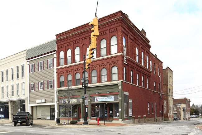
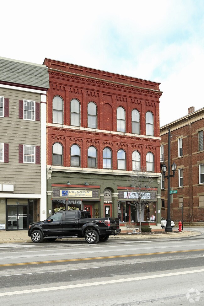
Property Record
28 W Main St, Norwalk, OH 44857
NEARBY LISTINGS FOR SALE OR LEASE
Property Detail
28 W Main St
Commercialnec
Huron
X
Ohio
39077C0201D
0.10 AC
2024
Huron County
2024
Cleveland
915800
Norwalk, OH
3,040 SF
33-0200-01-039-0000
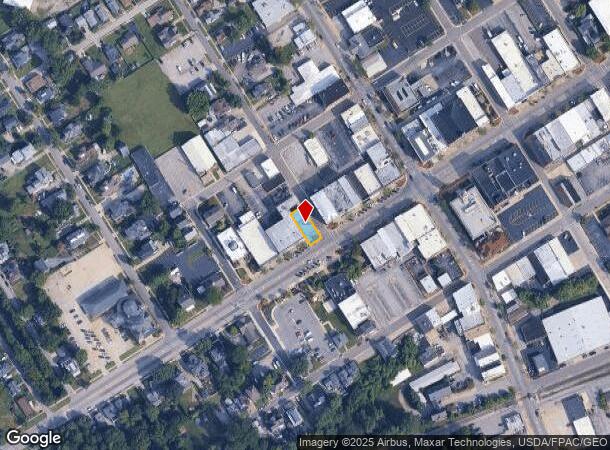
DEMOGRAPHICS near 28 W Main St
1 Mile
3 Mile
5 Mile
2024 Total Population
9,955
21,650
27,016
2029 Population
9,956
21,656
26,881
Pop Growth 2024-2029
+ 0.01%
+ 0.03%
(0.50%)
Average Age
40
41
41
2024 Total Households
4,040
8,937
11,031
HH Growth 2024-2029
(0.07%)
(0.03%)
(0.56%)
Median Household Inc
$51,400
$58,156
$60,487
Avg Household Size
2.30
2.30
2.40
2024 Avg HH Vehicles
2.00
2.00
2.00
Median Home Value
$144,198
$159,043
$161,998
Median Year Built
1961
1974
1972
Nearby Places
Map Layers
Map Styles
 Street
 Aerial
- Restaurants
- Banks
- Shops
- Fitness
- Groceries
PUBLIC TRANSPORTATION
AIRPORT
Cleveland-Hopkins International
DRIVE
WALK
Distance
Cleveland-Hopkins International
58 min
47.5 mi
SALE & LEASE HISTORY
LISTING DATE
SALE/LEASE

Sep 25, 2016
For Lease
Apr 18, 2023
For Lease
Nearby Properties
Address
Land Use
TOTAL SIZE
Lot Size
Zoning
Address
Land Use
TOTAL SIZE
Lot Size
Zoning
29,304 SF
10.83 AC
Address
Land Use
TOTAL SIZE
Lot Size
Zoning
66,953 SF
30.03 AC
Address
Land Use
TOTAL SIZE
Lot Size
Zoning
2,964 SF
11.66 AC
Address
Land Use
TOTAL SIZE
Lot Size
Zoning
150,176 SF
Address
Land Use
TOTAL SIZE
Lot Size
Zoning
99,960 SF
Address
Land Use
TOTAL SIZE
Lot Size
Zoning
207,908 SF
16.74 AC
Address
Land Use
TOTAL SIZE
Lot Size
Zoning
28,149 SF
6.77 AC
Address
Land Use
TOTAL SIZE
Lot Size
Zoning
9,152 SF
24.17 AC
Address
Land Use
TOTAL SIZE
Lot Size
Zoning
4,586 SF
122.14 AC
Address
Land Use
TOTAL SIZE
Lot Size
Zoning
7,042 SF
10.22 AC
Address
Land Use
TOTAL SIZE
Lot Size
Zoning
5,600 SF
11.48 AC
Address
Land Use
TOTAL SIZE
Lot Size
Zoning
16,618 SF
8.51 AC
Address
Land Use
TOTAL SIZE
Lot Size
Zoning
50,854 SF
18.62 AC
Address
Land Use
TOTAL SIZE
Lot Size
Zoning
2,040 SF
1.47 AC
Address
Land Use
TOTAL SIZE
Lot Size
Zoning
70,000 SF
11.72 AC
Address
Land Use
TOTAL SIZE
Lot Size
Zoning
7,852 SF
0.21 AC
Address
Land Use
TOTAL SIZE
Lot Size
Zoning
1,860 SF
9.08 AC
Address
Land Use
TOTAL SIZE
Lot Size
Zoning
20,824 SF
2 AC
Address
Land Use
TOTAL SIZE
Lot Size
Zoning
4,860 SF
7.05 AC
Address
Land Use
TOTAL SIZE
Lot Size
Zoning
4,608 SF
15.01 AC
Address
Land Use
TOTAL SIZE
Lot Size
Zoning
42,754 SF
6.81 AC
Address
Land Use
TOTAL SIZE
Lot Size
Zoning
220,880 SF
21.19 AC
Address
Land Use
TOTAL SIZE
Lot Size
Zoning
5,280 SF
14.35 AC
Address
Land Use
TOTAL SIZE
Lot Size
Zoning
115,200 SF
10 AC
Address
Land Use
TOTAL SIZE
Lot Size
Zoning
9,717 SF
0.54 AC
Address
Land Use
TOTAL SIZE
Lot Size
Zoning
49,000 SF
Address
Land Use
TOTAL SIZE
Lot Size
Zoning
1,600 SF
35.10 AC
Address
Land Use
TOTAL SIZE
Lot Size
Zoning
56,432 SF
7.09 AC
Address
Land Use
TOTAL SIZE
Lot Size
Zoning
90,300 SF
6.62 AC
Address
Land Use
TOTAL SIZE
Lot Size
Zoning
10,658 SF
11.50 AC
The World's #1 Commercial Real Estate Marketplace
Connect with us
© 2025 CoStar Group
The information above has been obtained from sources believed reliable. While we do not doubt its accuracy we have not verified it and make no guarantee, warranty or representation about it. It is your responsibility to independently confirm its accuracy and completeness. Any projections, opinions, assumptions, or estimates used are for example only and do not represent the current or future performance of the property. The value of this transaction to you depends on tax and other factors which should be evaluated by your tax, financial, and legal advisors. You and your advisors should conduct a careful, independent investigation of the property to determine to your satisfaction the suitability of the property for your needs.