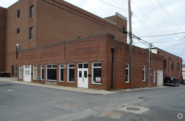
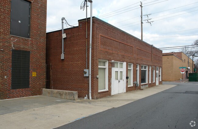
Property Record
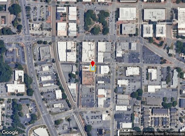
26 Winters St Se, Marietta, GA 30060
NEARBY LISTINGS FOR SALE OR LEASE
Property Detail
26 Winters St Se
Storebuilding
Cobb
X
Georgia
13067C0108J
0.09 AC
2025
Kennesaw/Town Center
2025
Atlanta
030912
Atlanta-Sandy Springs-Roswell, GA
3,477 SF
16-1231-0-069-0
DEMOGRAPHICS near 26 Winters St Se
1 Mile
3 Mile
5 Mile
2024 Total Population
10,186
66,844
203,233
2029 Population
10,469
68,482
207,724
Pop Growth 2024-2029
+ 2.78%
+ 2.45%
+ 2.21%
Average Age
42
38
38
2024 Total Households
4,387
25,678
79,993
HH Growth 2024-2029
+ 2.78%
+ 2.43%
+ 2.25%
Median Household Inc
$68,873
$65,251
$71,176
Avg Household Size
2.20
2.40
2.40
2024 Avg HH Vehicles
2.00
2.00
2.00
Median Home Value
$446,994
$346,950
$335,471
Median Year Built
1976
1982
1985
Nearby Places
Map Layers
Map Styles
 Street
 Aerial
- Restaurants
- Banks
- Shops
- Fitness
- Groceries
PUBLIC TRANSPORTATION
AIRPORT
Hartsfield - Jackson Atlanta International
DRIVE
WALK
Distance
Hartsfield - Jackson Atlanta International
41 min
28.3 mi
SALE & LEASE HISTORY
LISTING DATE
SALE/LEASE

Nov 09, 2018
For Lease
Jan 25, 2017
For Lease
Jan 17, 2018
For Lease
Nearby Properties
Address
Land Use
TOTAL SIZE
Lot Size
Zoning
Address
Land Use
TOTAL SIZE
Lot Size
Zoning
379,750 SF
11.14 AC
Address
Land Use
TOTAL SIZE
Lot Size
Zoning
452,366 SF
27.27 AC
PRD MF
Address
Land Use
TOTAL SIZE
Lot Size
Zoning
494,076 SF
33.30 AC
PRD MF
Address
Land Use
TOTAL SIZE
Lot Size
Zoning
183,262 SF
19.35 AC
RM-12
Address
Land Use
TOTAL SIZE
Lot Size
Zoning
8,000 SF
9.57 AC
PRD MF
Address
Land Use
TOTAL SIZE
Lot Size
Zoning
284,832 SF
19.56 AC
PRD MF
Address
Land Use
TOTAL SIZE
Lot Size
Zoning
243,574 SF
40.05 AC
RM-8
Address
Land Use
TOTAL SIZE
Lot Size
Zoning
129,168 SF
0.82 AC
OI
Address
Land Use
TOTAL SIZE
Lot Size
Zoning
8,980 SF
51.17 AC
Address
Land Use
TOTAL SIZE
Lot Size
Zoning
225,315 SF
17.10 AC
RM-12
Address
Land Use
TOTAL SIZE
Lot Size
Zoning
509,792 SF
4.45 AC
OHR
Address
Land Use
TOTAL SIZE
Lot Size
Zoning
226,769 SF
13.40 AC
RM-16
Address
Land Use
TOTAL SIZE
Lot Size
Zoning
236,808 SF
29.38 AC
PRD MF
Address
Land Use
TOTAL SIZE
Lot Size
Zoning
222,906 SF
18.96 AC
RM-12
Address
Land Use
TOTAL SIZE
Lot Size
Zoning
232,894 SF
13.88 AC
PRD MF
Address
Land Use
TOTAL SIZE
Lot Size
Zoning
198,488 SF
16.79 AC
RM-12
Address
Land Use
TOTAL SIZE
Lot Size
Zoning
176,350 SF
19.56 AC
PRD MF
Address
Land Use
TOTAL SIZE
Lot Size
Zoning
143,362 SF
1.61 AC
OI
Address
Land Use
TOTAL SIZE
Lot Size
Zoning
431,575 SF
7.16 AC
OHR
Address
Land Use
TOTAL SIZE
Lot Size
Zoning
213,318 SF
19.28 AC
PRD MF
Address
Land Use
TOTAL SIZE
Lot Size
Zoning
325,227 SF
22.42 AC
RM-12
Address
Land Use
TOTAL SIZE
Lot Size
Zoning
13.17 AC
LI
Address
Land Use
TOTAL SIZE
Lot Size
Zoning
180,508 SF
21.88 AC
RM-8
Address
Land Use
TOTAL SIZE
Lot Size
Zoning
147,029 SF
3.05 AC
PRD MF
Address
Land Use
TOTAL SIZE
Lot Size
Zoning
217,980 SF
12.61 AC
PRD MF
Address
Land Use
TOTAL SIZE
Lot Size
Zoning
200,134 SF
12.60 AC
RM-8
Address
Land Use
TOTAL SIZE
Lot Size
Zoning
188,789 SF
8.88 AC
PRD MF
Address
Land Use
TOTAL SIZE
Lot Size
Zoning
402,202 SF
32.52 AC
HI
Address
Land Use
TOTAL SIZE
Lot Size
Zoning
276,095 SF
13.77 AC
HI
Address
Land Use
TOTAL SIZE
Lot Size
Zoning
133,813 SF
10 AC
RM-12
The World's #1 Commercial Real Estate Marketplace
Connect with us
© 2025 CoStar Group
The information above has been obtained from sources believed reliable. While we do not doubt its accuracy we have not verified it and make no guarantee, warranty or representation about it. It is your responsibility to independently confirm its accuracy and completeness. Any projections, opinions, assumptions, or estimates used are for example only and do not represent the current or future performance of the property. The value of this transaction to you depends on tax and other factors which should be evaluated by your tax, financial, and legal advisors. You and your advisors should conduct a careful, independent investigation of the property to determine to your satisfaction the suitability of the property for your needs.