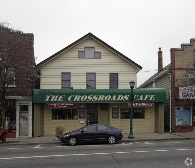
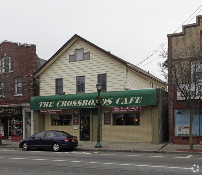
Property Record
26 Laurel Rd, Lindenhurst, NY 11757
NEARBY LISTINGS FOR SALE OR LEASE
Property Detail
26 Laurel Rd
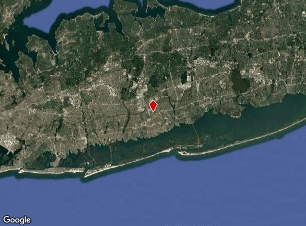
Nassau County-Suffolk County, NY
BLK LOT
0400-120-00-02-00-086-000
Suffolk
Bartavern
New York
X
86
36103C0339H
0.13 AC
2024
Western Suffolk
2024
Long Island (New York)
123403
DEMOGRAPHICS near 26 Laurel Rd
1 Mile
3 Mile
5 Mile
2024 Total Population
12,755
65,211
154,158
2029 Population
12,411
63,962
151,481
Pop Growth 2024-2029
(2.70%)
(1.92%)
(1.74%)
Average Age
42
43
43
2024 Total Households
4,427
22,409
52,093
HH Growth 2024-2029
(3.03%)
(2.20%)
(2.02%)
Median Household Inc
$136,953
$153,729
$148,579
Avg Household Size
2.80
2.80
2.80
2024 Avg HH Vehicles
2.00
2.00
2.00
Median Home Value
$619,121
$697,264
$682,910
Median Year Built
1957
1961
1962
Nearby Places
Map Layers
Map Styles
 Street
 Aerial
- Restaurants
- Banks
- Shops
- Fitness
- Groceries
PUBLIC TRANSPORTATION
COMMUTER RAIL
Lindenhurst Station (Babylon Branch - Long Island Rail Road)
DRIVE
WALK
Distance
Lindenhurst Station (Babylon Branch - Long Island Rail Road)
4 min
2.0 mi
Copiague Station (Babylon Branch - Long Island Rail Road)
DRIVE
WALK
Distance
Copiague Station (Babylon Branch - Long Island Rail Road)
4 min
2.3 mi
AIRPORT
Long Island MacArthur
DRIVE
WALK
Distance
Long Island MacArthur
28 min
19.0 mi
John F Kennedy International
DRIVE
WALK
Distance
John F Kennedy International
36 min
25.0 mi
LaGuardia
DRIVE
WALK
Distance
LaGuardia
46 min
32.0 mi
Freight Ports
NY - Red Hook Container Terminal
DRIVE
WALK
Distance
NY - Red Hook Container Terminal
56 min
36.4 mi
Nearby Properties
Address
Land Use
TOTAL SIZE
Lot Size
Zoning
Address
Land Use
TOTAL SIZE
Lot Size
Zoning
9.95 AC
BUS3
Address
Land Use
TOTAL SIZE
Lot Size
Zoning
24.90 AC
B
Address
Land Use
TOTAL SIZE
Lot Size
Zoning
3,518 SF
0.44 AC
VILLA
Address
Land Use
TOTAL SIZE
Lot Size
Zoning
6.37 AC
BUS3
Address
Land Use
TOTAL SIZE
Lot Size
Zoning
2,520 SF
0.89 AC
HC
Address
Land Use
TOTAL SIZE
Lot Size
Zoning
1.70 AC
R40
Address
Land Use
TOTAL SIZE
Lot Size
Zoning
336,442 SF
43.50 AC
G
Address
Land Use
TOTAL SIZE
Lot Size
Zoning
22.10 AC
Address
Land Use
TOTAL SIZE
Lot Size
Zoning
0.99 AC
HB
Address
Land Use
TOTAL SIZE
Lot Size
Zoning
0.90 AC
HC
Address
Land Use
TOTAL SIZE
Lot Size
Zoning
7.15 AC
Address
Land Use
TOTAL SIZE
Lot Size
Zoning
6,891 SF
0.75 AC
HC
Address
Land Use
TOTAL SIZE
Lot Size
Zoning
400 AC
A
Address
Land Use
TOTAL SIZE
Lot Size
Zoning
13.63 AC
B
Address
Land Use
TOTAL SIZE
Lot Size
Zoning
Address
Land Use
TOTAL SIZE
Lot Size
Zoning
44 AC
E
Address
Land Use
TOTAL SIZE
Lot Size
Zoning
9.68 AC
SC
Address
Land Use
TOTAL SIZE
Lot Size
Zoning
0.76 AC
HD
Address
Land Use
TOTAL SIZE
Lot Size
Zoning
3.80 AC
BUS1
Address
Land Use
TOTAL SIZE
Lot Size
Zoning
74.90 AC
G
Address
Land Use
TOTAL SIZE
Lot Size
Zoning
157,191 SF
17.70 AC
G
Address
Land Use
TOTAL SIZE
Lot Size
Zoning
114.70 AC
A
Address
Land Use
TOTAL SIZE
Lot Size
Zoning
0.46 AC
R40
Address
Land Use
TOTAL SIZE
Lot Size
Zoning
248.60 AC
A
Address
Land Use
TOTAL SIZE
Lot Size
Zoning
163.50 AC
A
Address
Land Use
TOTAL SIZE
Lot Size
Zoning
49,004 SF
13.34 AC
Address
Land Use
TOTAL SIZE
Lot Size
Zoning
12.50 AC
C
Address
Land Use
TOTAL SIZE
Lot Size
Zoning
18.30 AC
Address
Land Use
TOTAL SIZE
Lot Size
Zoning
9.39 AC
SC
Address
Land Use
TOTAL SIZE
Lot Size
Zoning
The World's #1 Commercial Real Estate Marketplace
Connect with us
© 2025 CoStar Group
The information above has been obtained from sources believed reliable. While we do not doubt its accuracy we have not verified it and make no guarantee, warranty or representation about it. It is your responsibility to independently confirm its accuracy and completeness. Any projections, opinions, assumptions, or estimates used are for example only and do not represent the current or future performance of the property. The value of this transaction to you depends on tax and other factors which should be evaluated by your tax, financial, and legal advisors. You and your advisors should conduct a careful, independent investigation of the property to determine to your satisfaction the suitability of the property for your needs.