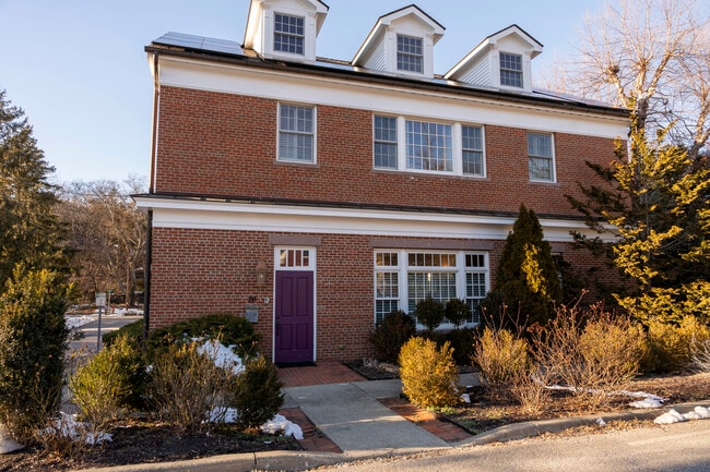
Property Record
26 Main St, Cold Spring, NY 10516


Current Lease Availabilities
Property Detail
26 Main St
372601-048-012-0001-057-000-0000
LAND & GARAGE
Commercialnec
Putnam
R10
New York
C and X Area of minimal flood hazard, usually depicted on FIRMs as above the 500-year flood level.
57.00
2024
0.09 AC
2025
Carmel
010700
Westchester/So Connecticut
3,072 SF
New York-Jersey City-White Plains, NY-NJ
NEARBY LISTINGS FOR SALE OR LEASE
DEMOGRAPHICS near 26 Main St
1 mile
3 mile
5 mile
2025 Total Population
3,186
13,555
31,044
2030 Population
3,241
13,881
31,716
Pop Growth 2025-2030
+ 1.73%
+ 2.41%
+ 2.16%
Average Age
42
33
39
2025 Total Households
1,211
3,352
10,430
HH Growth 2025-2030
+ 1.73%
+ 2.80%
+ 2.33%
Median Household Inc
$116,841
$129,907
$114,434
Avg Household Size
2.30
2.80
2.50
2025 Avg HH Vehicles
1.00
2.00
2.00
Median Home Value
$645,749
$634,815
$477,087
Median Year Built
1953
1966
1962
Nearby Places
Map Layers
Map Styles
 Street
 Aerial
Layers
 Traffic
 Biking
Places
Listings with unknown addresses are not visible on the map
- Restaurants
- Banks
- Shops
- Fitness
- Groceries
PUBLIC TRANSPORTATION
TRANSIT/SUBWAY
Cold Spring Station (Hudson Line - Metro-North Commuter Railroad Company (Metro-North))
Drive
Walk
Distance
Cold Spring Station (Hudson Line - Metro-North Commuter Railroad Company (Metro-North))
1 min
4 min
0.2 mi
COMMUTER RAIL
Cold Spring Station (Hudson Line - Metro-North Commuter Railroad Company (Metro-North))
Drive
Walk
Distance
Cold Spring Station (Hudson Line - Metro-North Commuter Railroad Company (Metro-North))
1 min
4 min
0.2 mi
Breakneck Ridge Station (Hudson Line - Metro-North Commuter Railroad Company (Metro-North))
Drive
Walk
Distance
Breakneck Ridge Station (Hudson Line - Metro-North Commuter Railroad Company (Metro-North))
6 min
2.9 mi
AIRPORT
New York Stewart International
Drive
Walk
Distance
New York Stewart International
35 min
18.6 mi
Westchester County
Drive
Walk
Distance
Westchester County
60 min
40.4 mi
Nearby Properties
Address
Land Use
TOTAL SIZE
Lot Size
Zoning
Address
Land Use
TOTAL SIZE
Lot Size
Zoning
119,474 SF
214.27 AC
R80
Address
Land Use
TOTAL SIZE
Lot Size
Zoning
20,518 SF
1.70 AC
Address
Land Use
TOTAL SIZE
Lot Size
Zoning
100,369 SF
11.96 AC
R10
Address
Land Use
TOTAL SIZE
Lot Size
Zoning
42,411 SF
5.17 AC
R10
Address
Land Use
TOTAL SIZE
Lot Size
Zoning
37,616 SF
25.10 AC
Address
Land Use
TOTAL SIZE
Lot Size
Zoning
Address
Land Use
TOTAL SIZE
Lot Size
Zoning
40,796 SF
125.03 AC
R80
Address
Land Use
TOTAL SIZE
Lot Size
Zoning
44,052 SF
23.97 AC
R80
Address
Land Use
TOTAL SIZE
Lot Size
Zoning
12,747 SF
35.73 AC
R80
Address
Land Use
TOTAL SIZE
Lot Size
Zoning
Address
Land Use
TOTAL SIZE
Lot Size
Zoning
76.06 AC
PI
Address
Land Use
TOTAL SIZE
Lot Size
Zoning
324 AC
R80
Address
Land Use
TOTAL SIZE
Lot Size
Zoning
Address
Land Use
TOTAL SIZE
Lot Size
Zoning
21,120 SF
43.91 AC
R80
Address
Land Use
TOTAL SIZE
Lot Size
Zoning
Address
Land Use
TOTAL SIZE
Lot Size
Zoning
44.70 AC
02
Address
Land Use
TOTAL SIZE
Lot Size
Zoning
19,138 SF
8.49 AC
R40
Address
Land Use
TOTAL SIZE
Lot Size
Zoning
39,971 SF
10.39 AC
R10
Address
Land Use
TOTAL SIZE
Lot Size
Zoning
17,420 SF
21 AC
Address
Land Use
TOTAL SIZE
Lot Size
Zoning
19,474 SF
9.39 AC
R40
Address
Land Use
TOTAL SIZE
Lot Size
Zoning
29,176 SF
66.77 AC
R80
Address
Land Use
TOTAL SIZE
Lot Size
Zoning
Address
Land Use
TOTAL SIZE
Lot Size
Zoning
21,729 SF
7.32 AC
B1
Address
Land Use
TOTAL SIZE
Lot Size
Zoning
40,796 SF
2.33 AC
R80
Address
Land Use
TOTAL SIZE
Lot Size
Zoning
11,880 SF
5 AC
R80
Address
Land Use
TOTAL SIZE
Lot Size
Zoning
48,758 SF
3.51 AC
R10
Address
Land Use
TOTAL SIZE
Lot Size
Zoning
19,232 SF
0.52 AC
R10
Address
Land Use
TOTAL SIZE
Lot Size
Zoning
24,480 SF
0.55 AC
R-4
Address
Land Use
TOTAL SIZE
Lot Size
Zoning
13,814 SF
2.94 AC
R10
The World's #1 Commercial Real Estate Marketplace
Connect with us
© 2026 CoStar Group
The information above has been obtained from sources believed reliable. While we do not doubt its accuracy we have not verified it and make no guarantee, warranty or representation about it. It is your responsibility to independently confirm its accuracy and completeness. Any projections, opinions, assumptions, or estimates used are for example only and do not represent the current or future performance of the property. The value of this transaction to you depends on tax and other factors which should be evaluated by your tax, financial, and legal advisors. You and your advisors should conduct a careful, independent investigation of the property to determine to your satisfaction the suitability of the property for your needs.