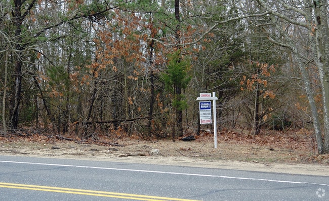
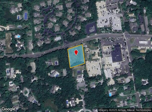
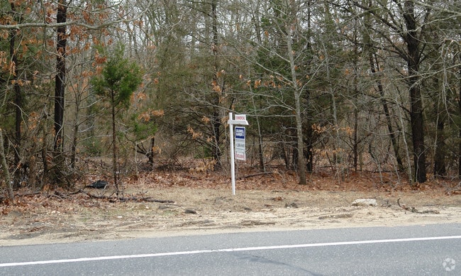
Property Record
26 Montauk Hwy, Copiague, NY 11726

NEARBY LISTINGS FOR SALE OR LEASE
Property Detail
26 Montauk Hwy
Nassau County-Suffolk County, NY
Pen Craig
0902-007-00-02-00-050-012
02 INC FILE MAP 10703
Residentialacreage
Suffolk
X
New York
36103C0778H
50
2024
0.93 AC
2024
Eastern Suffolk
123801
Long Island (New York)
DEMOGRAPHICS near 26 Montauk Hwy
1 Mile
3 Mile
5 Mile
2024 Total Population
1,549
12,818
23,996
2029 Population
1,547
13,410
24,926
Pop Growth 2024-2029
(0.13%)
+ 4.62%
+ 3.88%
Average Age
44
44
44
2024 Total Households
592
4,960
9,159
HH Growth 2024-2029
(0.68%)
+ 4.76%
+ 4.02%
Median Household Inc
$109,531
$110,111
$108,739
Avg Household Size
2.60
2.50
2.60
2024 Avg HH Vehicles
2.00
2.00
2.00
Median Home Value
$850,215
$834,986
$798,392
Median Year Built
1976
1978
1979
Nearby Places
- Restaurants
- Banks
- Shops
- Fitness
- Groceries
PUBLIC TRANSPORTATION
COMMUTER RAIL
Westhampton Station (Montauk Branch - Long Island Rail Road)
DRIVE
WALK
Distance
Westhampton Station (Montauk Branch - Long Island Rail Road)
6 min
2.6 mi
Speonk Station (Montauk Branch - Long Island Rail Road)
DRIVE
WALK
Distance
Speonk Station (Montauk Branch - Long Island Rail Road)
12 min
6.0 mi
AIRPORT
Long Island MacArthur
DRIVE
WALK
Distance
Long Island MacArthur
40 min
28.0 mi
SALE & LEASE HISTORY
LISTING DATE
SALE/LEASE

Sep 24, 2016
For Sale
Aug 28, 2018
For Sale
Apr 23, 2018
For Sale
Nearby Properties
Address
Land Use
TOTAL SIZE
Lot Size
Zoning
Address
Land Use
TOTAL SIZE
Lot Size
Zoning
1,229.10 AC
LI200
Address
Land Use
TOTAL SIZE
Lot Size
Zoning
53,067 SF
6.20 AC
R2
Address
Land Use
TOTAL SIZE
Lot Size
Zoning
55,202 SF
18.50 AC
R2
Address
Land Use
TOTAL SIZE
Lot Size
Zoning
11.41 AC
LI200
Address
Land Use
TOTAL SIZE
Lot Size
Zoning
8.26 AC
LI200
Address
Land Use
TOTAL SIZE
Lot Size
Zoning
11,129 SF
2.40 AC
R80
Address
Land Use
TOTAL SIZE
Lot Size
Zoning
9,191 SF
14.39 AC
VILLA
Address
Land Use
TOTAL SIZE
Lot Size
Zoning
28,458 SF
9.60 AC
LI40
Address
Land Use
TOTAL SIZE
Lot Size
Zoning
2,947 SF
8.59 AC
VILLA
Address
Land Use
TOTAL SIZE
Lot Size
Zoning
28.62 AC
R40
Address
Land Use
TOTAL SIZE
Lot Size
Zoning
12,001 SF
2.80 AC
VILLA
Address
Land Use
TOTAL SIZE
Lot Size
Zoning
9,952 SF
2.30 AC
VILLA
Address
Land Use
TOTAL SIZE
Lot Size
Zoning
17,772 SF
8.86 AC
VILLA
Address
Land Use
TOTAL SIZE
Lot Size
Zoning
22,629 SF
2.10 AC
VILLA
Address
Land Use
TOTAL SIZE
Lot Size
Zoning
19.50 AC
PC
Address
Land Use
TOTAL SIZE
Lot Size
Zoning
20,697 SF
1.91 AC
B1
Address
Land Use
TOTAL SIZE
Lot Size
Zoning
36,918 SF
6.27 AC
R40
Address
Land Use
TOTAL SIZE
Lot Size
Zoning
8,418 SF
2.40 AC
R80
Address
Land Use
TOTAL SIZE
Lot Size
Zoning
2.04 AC
VILLA
Address
Land Use
TOTAL SIZE
Lot Size
Zoning
12.90 AC
R80
Address
Land Use
TOTAL SIZE
Lot Size
Zoning
13.90 AC
PC
Address
Land Use
TOTAL SIZE
Lot Size
Zoning
24,396 SF
7.60 AC
R80
Address
Land Use
TOTAL SIZE
Lot Size
Zoning
7,270 SF
4.20 AC
R2
Address
Land Use
TOTAL SIZE
Lot Size
Zoning
30,124 SF
10.20 AC
R20
Address
Land Use
TOTAL SIZE
Lot Size
Zoning
6,673 SF
4.50 AC
R20
Address
Land Use
TOTAL SIZE
Lot Size
Zoning
19,866 SF
14.37 AC
LI200
Address
Land Use
TOTAL SIZE
Lot Size
Zoning
28,544 SF
4.70 AC
R1
Address
Land Use
TOTAL SIZE
Lot Size
Zoning
6,720 SF
1.96 AC
VILLA
Address
Land Use
TOTAL SIZE
Lot Size
Zoning
20,822 SF
2.60 AC
B1
Address
Land Use
TOTAL SIZE
Lot Size
Zoning
6.42 AC
LI200
The World's #1 Commercial Real Estate Marketplace
Connect with us
© 2025 CoStar Group
The information above has been obtained from sources believed reliable. While we do not doubt its accuracy we have not verified it and make no guarantee, warranty or representation about it. It is your responsibility to independently confirm its accuracy and completeness. Any projections, opinions, assumptions, or estimates used are for example only and do not represent the current or future performance of the property. The value of this transaction to you depends on tax and other factors which should be evaluated by your tax, financial, and legal advisors. You and your advisors should conduct a careful, independent investigation of the property to determine to your satisfaction the suitability of the property for your needs.