Property Record
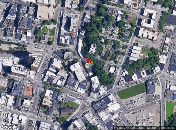
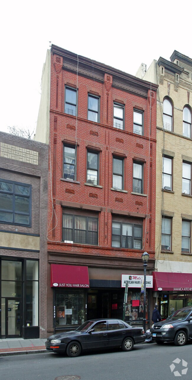
26 N Broadway, Yonkers, NY 10701

NEARBY LISTINGS FOR SALE OR LEASE
Property Detail
26 N Broadway
1800-002-000-02018-000-0055
Westchester
Commercialofficeresidentialmixeduse
New York
X
55.000
34003C0220H
0.04 AC
2025
Getty Square
2024
Westchester/So Connecticut
000401
New York-Jersey City-White Plains, NY-NJ
5,155 SF
DEMOGRAPHICS near 26 N Broadway
1 Mile
3 Mile
5 Mile
2024 Total Population
68,934
204,540
774,040
2029 Population
68,107
198,576
736,816
Pop Growth 2024-2029
(1.20%)
(2.92%)
(4.81%)
Average Age
37
40
40
2024 Total Households
25,118
77,349
286,633
HH Growth 2024-2029
(1.37%)
(3.15%)
(5.15%)
Median Household Inc
$42,082
$71,760
$68,005
Avg Household Size
2.60
2.50
2.60
2024 Avg HH Vehicles
1.00
1.00
1.00
Median Home Value
$316,022
$445,912
$540,929
Median Year Built
1962
1956
1951
Nearby Places
Map Layers
Map Styles
 Street
 Aerial
- Restaurants
- Banks
- Shops
- Fitness
- Groceries
PUBLIC TRANSPORTATION
TRANSIT/SUBWAY
Yonkers Station (Hudson Line - Metro-North Commuter Railroad Company (Metro-North))
DRIVE
WALK
Distance
Yonkers Station (Hudson Line - Metro-North Commuter Railroad Company (Metro-North))
3 min
11 min
0.6 mi
COMMUTER RAIL
Yonkers Station (Hudson Line - Metro-North Commuter Railroad Company (Metro-North))
DRIVE
WALK
Distance
Yonkers Station (Hudson Line - Metro-North Commuter Railroad Company (Metro-North))
3 min
11 min
0.6 mi
Ludlow Station (Hudson Line - Metro-North Commuter Railroad Company (Metro-North))
DRIVE
WALK
Distance
Ludlow Station (Hudson Line - Metro-North Commuter Railroad Company (Metro-North))
4 min
1.5 mi
AIRPORT
LaGuardia
DRIVE
WALK
Distance
LaGuardia
29 min
15.6 mi
Westchester County
DRIVE
WALK
Distance
Westchester County
31 min
21.8 mi
John F Kennedy International
DRIVE
WALK
Distance
John F Kennedy International
39 min
25.7 mi
Freight Ports
NY - Red Hook Container Terminal
DRIVE
WALK
Distance
NY - Red Hook Container Terminal
42 min
23.8 mi
Nearby Properties
Address
Land Use
TOTAL SIZE
Lot Size
Zoning
Address
Land Use
TOTAL SIZE
Lot Size
Zoning
689 SF
423.72 AC
P
Address
Land Use
TOTAL SIZE
Lot Size
Zoning
289.02 AC
P
Address
Land Use
TOTAL SIZE
Lot Size
Zoning
185.35 AC
P
Address
Land Use
TOTAL SIZE
Lot Size
Zoning
219.71 AC
O
Address
Land Use
TOTAL SIZE
Lot Size
Zoning
166.61 AC
P
Address
Land Use
TOTAL SIZE
Lot Size
Zoning
135.51 AC
RR
Address
Land Use
TOTAL SIZE
Lot Size
Zoning
94.42 AC
P
Address
Land Use
TOTAL SIZE
Lot Size
Zoning
225.36 AC
O
Address
Land Use
TOTAL SIZE
Lot Size
Zoning
450,784 SF
42.36 AC
R4
Address
Land Use
TOTAL SIZE
Lot Size
Zoning
163.19 AC
Address
Land Use
TOTAL SIZE
Lot Size
Zoning
61,055 SF
343.42 AC
R6
Address
Land Use
TOTAL SIZE
Lot Size
Zoning
202,062 SF
29 AC
O
Address
Land Use
TOTAL SIZE
Lot Size
Zoning
58.78 AC
P
Address
Land Use
TOTAL SIZE
Lot Size
Zoning
193,520 SF
4.32 AC
R4
Address
Land Use
TOTAL SIZE
Lot Size
Zoning
Address
Land Use
TOTAL SIZE
Lot Size
Zoning
174,896 SF
8.69 AC
R4
Address
Land Use
TOTAL SIZE
Lot Size
Zoning
15,828 SF
17.71 AC
Address
Land Use
TOTAL SIZE
Lot Size
Zoning
159,260 SF
12.19 AC
R4
Address
Land Use
TOTAL SIZE
Lot Size
Zoning
192,939 SF
12.57 AC
R4
Address
Land Use
TOTAL SIZE
Lot Size
Zoning
109,914 SF
2.09 AC
R4
Address
Land Use
TOTAL SIZE
Lot Size
Zoning
30.29 AC
P
Address
Land Use
TOTAL SIZE
Lot Size
Zoning
97,000 SF
1.91 AC
R4
Address
Land Use
TOTAL SIZE
Lot Size
Zoning
13,225 SF
136.69 AC
PARK
Address
Land Use
TOTAL SIZE
Lot Size
Zoning
25.58 AC
P
Address
Land Use
TOTAL SIZE
Lot Size
Zoning
54,500 SF
13.96 AC
R1-1
Address
Land Use
TOTAL SIZE
Lot Size
Zoning
115,904 SF
4.87 AC
R1-1
Address
Land Use
TOTAL SIZE
Lot Size
Zoning
51,818 SF
10.20 AC
R40
Address
Land Use
TOTAL SIZE
Lot Size
Zoning
47,712 SF
6.27 AC
R1-1
Address
Land Use
TOTAL SIZE
Lot Size
Zoning
83,366 SF
5.92 AC
R4
Address
Land Use
TOTAL SIZE
Lot Size
Zoning
39,625 SF
20.85 AC
PARK
The World's #1 Commercial Real Estate Marketplace
Connect with us
© 2025 CoStar Group
The information above has been obtained from sources believed reliable. While we do not doubt its accuracy we have not verified it and make no guarantee, warranty or representation about it. It is your responsibility to independently confirm its accuracy and completeness. Any projections, opinions, assumptions, or estimates used are for example only and do not represent the current or future performance of the property. The value of this transaction to you depends on tax and other factors which should be evaluated by your tax, financial, and legal advisors. You and your advisors should conduct a careful, independent investigation of the property to determine to your satisfaction the suitability of the property for your needs.