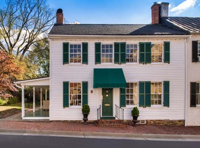
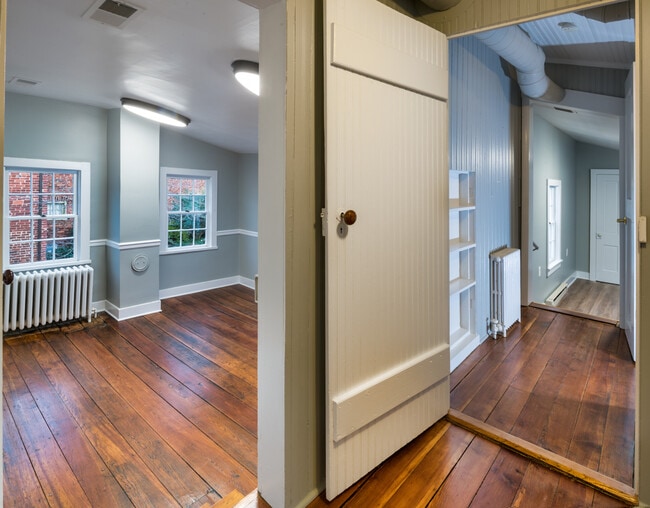
Property Record
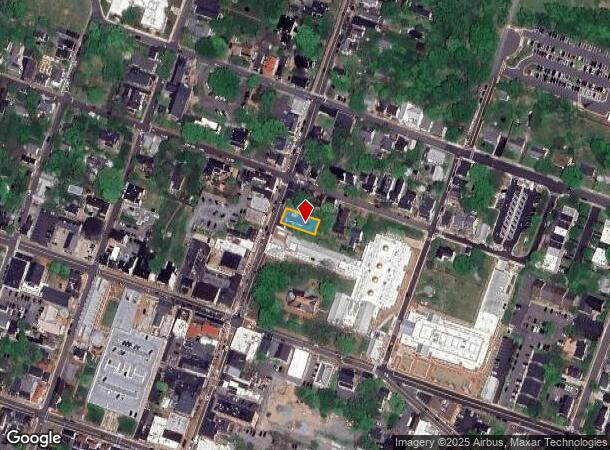
26 N King St, Leesburg, VA 20176
Current Lease Availabilities
NEARBY LISTINGS FOR SALE OR LEASE
Property Detail
26 N King St
231-48-5423
King St
Officebuilding
KING STREET 889--382
X
Loudoun
51107C0227E
Virginia
2025
0.11 AC
2025
Leesburg/West Loudoun
610505
Washington, DC
6,383 SF
Washington-Arlington-Alexandria, DC-VA-MD-WV
DEMOGRAPHICS near 26 N King St
1 Mile
3 Mile
5 Mile
2024 Total Population
14,449
55,576
79,546
2029 Population
15,708
59,936
85,654
Pop Growth 2024-2029
+ 8.71%
+ 7.85%
+ 7.68%
Average Age
38
37
38
2024 Total Households
4,817
18,371
25,906
HH Growth 2024-2029
+ 8.62%
+ 7.90%
+ 7.79%
Median Household Inc
$96,919
$126,163
$149,083
Avg Household Size
2.80
2.90
3.00
2024 Avg HH Vehicles
2.00
2.00
2.00
Median Home Value
$545,072
$614,411
$686,625
Median Year Built
1983
1993
1997
Nearby Places
- Restaurants
- Banks
- Shops
- Fitness
- Groceries
PUBLIC TRANSPORTATION
AIRPORT
Washington Dulles International
DRIVE
WALK
Distance
Washington Dulles International
28 min
17.2 mi
Freight Ports
Port of Baltimore
DRIVE
WALK
Distance
Port of Baltimore
97 min
73.4 mi
Nearby Properties
Address
Land Use
TOTAL SIZE
Lot Size
Zoning
Address
Land Use
TOTAL SIZE
Lot Size
Zoning
413,297 SF
21.77 AC
LB:MC
Address
Land Use
TOTAL SIZE
Lot Size
Zoning
485,476 SF
54.14 AC
LB:B3
Address
Land Use
TOTAL SIZE
Lot Size
Zoning
553,617 SF
592.60 AC
PDSA
Address
Land Use
TOTAL SIZE
Lot Size
Zoning
420,787 SF
LB:B4
Address
Land Use
TOTAL SIZE
Lot Size
Zoning
300,570 SF
OP
Address
Land Use
TOTAL SIZE
Lot Size
Zoning
331,227 SF
21.75 AC
LB:PRN
Address
Land Use
TOTAL SIZE
Lot Size
Zoning
279,428 SF
132.70 AC
LB:RE
Address
Land Use
TOTAL SIZE
Lot Size
Zoning
248,513 SF
15.77 AC
LB:R22
Address
Land Use
TOTAL SIZE
Lot Size
Zoning
323,043 SF
27.90 AC
LB:B3
Address
Land Use
TOTAL SIZE
Lot Size
Zoning
228,886 SF
29.43 AC
LB:B3
Address
Land Use
TOTAL SIZE
Lot Size
Zoning
388,150 SF
PDIP
Address
Land Use
TOTAL SIZE
Lot Size
Zoning
261,445 SF
17.95 AC
LB:I1
Address
Land Use
TOTAL SIZE
Lot Size
Zoning
242,603 SF
67.48 AC
LB:RE
Address
Land Use
TOTAL SIZE
Lot Size
Zoning
245,886 SF
52.32 AC
LB:RE
Address
Land Use
TOTAL SIZE
Lot Size
Zoning
158,560 SF
2.44 AC
LB:GC
Address
Land Use
TOTAL SIZE
Lot Size
Zoning
258,867 SF
12.57 AC
LB:R22
Address
Land Use
TOTAL SIZE
Lot Size
Zoning
131,283 SF
27.84 AC
LB:B3
Address
Land Use
TOTAL SIZE
Lot Size
Zoning
148,448 SF
9.71 AC
LB:PEC
Address
Land Use
TOTAL SIZE
Lot Size
Zoning
190,454 SF
31.50 AC
LB:R4
Address
Land Use
TOTAL SIZE
Lot Size
Zoning
83,169 SF
138.05 AC
LB:R1
Address
Land Use
TOTAL SIZE
Lot Size
Zoning
196,665 SF
18.96 AC
LB:PRN
Address
Land Use
TOTAL SIZE
Lot Size
Zoning
72,408 SF
197.99 AC
AR1
Address
Land Use
TOTAL SIZE
Lot Size
Zoning
156,958 SF
17.63 AC
LB:PRC
Address
Land Use
TOTAL SIZE
Lot Size
Zoning
92,412 SF
18.27 AC
LB:I1
Address
Land Use
TOTAL SIZE
Lot Size
Zoning
79,388 SF
1.86 AC
LB:GC
Address
Land Use
TOTAL SIZE
Lot Size
Zoning
201,306 SF
9.94 AC
LB:R22
Address
Land Use
TOTAL SIZE
Lot Size
Zoning
169,800 SF
9.61 AC
LB:R16
Address
Land Use
TOTAL SIZE
Lot Size
Zoning
90,756 SF
7.91 AC
LB:PRN
Address
Land Use
TOTAL SIZE
Lot Size
Zoning
166,309 SF
3.28 AC
LB:GC
Address
Land Use
TOTAL SIZE
Lot Size
Zoning
172,066 SF
35.10 AC
LB:PRC
The World's #1 Commercial Real Estate Marketplace
Connect with us
© 2025 CoStar Group
The information above has been obtained from sources believed reliable. While we do not doubt its accuracy we have not verified it and make no guarantee, warranty or representation about it. It is your responsibility to independently confirm its accuracy and completeness. Any projections, opinions, assumptions, or estimates used are for example only and do not represent the current or future performance of the property. The value of this transaction to you depends on tax and other factors which should be evaluated by your tax, financial, and legal advisors. You and your advisors should conduct a careful, independent investigation of the property to determine to your satisfaction the suitability of the property for your needs.