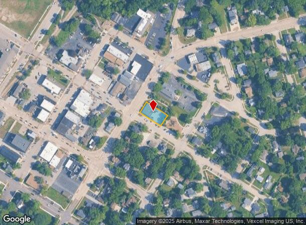
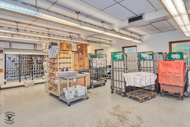
Property Record
26 S Madison St, Oswego, IL 60543
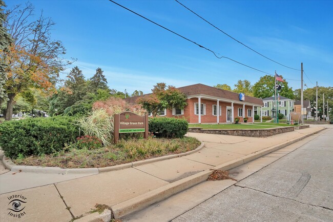
This Property Is For Sale
NEARBY LISTINGS FOR SALE OR LEASE
Property Detail
26 S Madison St
03-17-333-003
Oswego Orig. Town
Commercialnec
72 X 150 SW COR BLK 1 OSWEGO ORIG. TOWN
X
Kendall
17093C0065H
Illinois
2024
0.24 AC
2024
Western East/West Corr
890106
Chicago
3,213 SF
Chicago-Naperville-Elgin, IL-IN-WI
DEMOGRAPHICS near 26 S Madison St
1 Mile
3 Mile
5 Mile
2024 Total Population
8,405
50,734
115,839
2029 Population
9,298
55,841
124,229
Pop Growth 2024-2029
+ 10.62%
+ 10.07%
+ 7.24%
Average Age
39
37
36
2024 Total Households
2,883
17,072
37,798
HH Growth 2024-2029
+ 10.86%
+ 10.11%
+ 7.43%
Median Household Inc
$96,517
$88,875
$88,906
Avg Household Size
2.80
2.90
3.00
2024 Avg HH Vehicles
2.00
2.00
2.00
Median Home Value
$268,294
$266,672
$250,169
Median Year Built
1993
1995
1996
Nearby Places
Map Layers
Map Styles
 Street
 Aerial
- Restaurants
- Banks
- Shops
- Fitness
- Groceries
PUBLIC TRANSPORTATION
COMMUTER RAIL
Aurora Station (Burlington Northern-Santa Fe Railway Line - Northeast Illinois Regional Commuter Railroad (Metra))
DRIVE
WALK
Distance
Aurora Station (Burlington Northern-Santa Fe Railway Line - Northeast Illinois Regional Commuter Railroad (Metra))
13 min
7.0 mi
AIRPORT
Chicago Midway International
DRIVE
WALK
Distance
Chicago Midway International
57 min
36.9 mi
Chicago O'Hare International
DRIVE
WALK
Distance
Chicago O'Hare International
64 min
41.5 mi
Nearby Properties
Address
Land Use
TOTAL SIZE
Lot Size
Zoning
Address
Land Use
TOTAL SIZE
Lot Size
Zoning
121,608 SF
27.48 AC
Address
Land Use
TOTAL SIZE
Lot Size
Zoning
296,502 SF
19.01 AC
Address
Land Use
TOTAL SIZE
Lot Size
Zoning
350.78 AC
Address
Land Use
TOTAL SIZE
Lot Size
Zoning
56.02 AC
Address
Land Use
TOTAL SIZE
Lot Size
Zoning
218,020 SF
21.35 AC
Address
Land Use
TOTAL SIZE
Lot Size
Zoning
20.76 AC
Address
Land Use
TOTAL SIZE
Lot Size
Zoning
9.86 AC
Address
Land Use
TOTAL SIZE
Lot Size
Zoning
220,091 SF
22.09 AC
Address
Land Use
TOTAL SIZE
Lot Size
Zoning
156,614 SF
17.63 AC
Address
Land Use
TOTAL SIZE
Lot Size
Zoning
207,596 SF
20.63 AC
Address
Land Use
TOTAL SIZE
Lot Size
Zoning
122,387 SF
21.92 AC
Address
Land Use
TOTAL SIZE
Lot Size
Zoning
118,236 SF
20.93 AC
Address
Land Use
TOTAL SIZE
Lot Size
Zoning
140,888 SF
16.31 AC
Address
Land Use
TOTAL SIZE
Lot Size
Zoning
56.13 AC
Address
Land Use
TOTAL SIZE
Lot Size
Zoning
581,048 SF
37.29 AC
Address
Land Use
TOTAL SIZE
Lot Size
Zoning
287,902 SF
3.31 AC
Address
Land Use
TOTAL SIZE
Lot Size
Zoning
87,746 SF
8.01 AC
Address
Land Use
TOTAL SIZE
Lot Size
Zoning
49,292 SF
1.70 AC
Address
Land Use
TOTAL SIZE
Lot Size
Zoning
49,292 SF
1.70 AC
Address
Land Use
TOTAL SIZE
Lot Size
Zoning
49,292 SF
1.70 AC
Address
Land Use
TOTAL SIZE
Lot Size
Zoning
125,513 SF
9.94 AC
Address
Land Use
TOTAL SIZE
Lot Size
Zoning
120,750 SF
11.07 AC
Address
Land Use
TOTAL SIZE
Lot Size
Zoning
224,589 SF
4.95 AC
Address
Land Use
TOTAL SIZE
Lot Size
Zoning
62,164 SF
6.76 AC
Address
Land Use
TOTAL SIZE
Lot Size
Zoning
39,020 SF
1.70 AC
Address
Land Use
TOTAL SIZE
Lot Size
Zoning
31.35 AC
Address
Land Use
TOTAL SIZE
Lot Size
Zoning
65,040 SF
6.04 AC
Address
Land Use
TOTAL SIZE
Lot Size
Zoning
65,982 SF
5.21 AC
Address
Land Use
TOTAL SIZE
Lot Size
Zoning
33,730 SF
6.95 AC
Address
Land Use
TOTAL SIZE
Lot Size
Zoning
44,720 SF
6.17 AC
The World's #1 Commercial Real Estate Marketplace
Connect with us
© 2025 CoStar Group
The information above has been obtained from sources believed reliable. While we do not doubt its accuracy we have not verified it and make no guarantee, warranty or representation about it. It is your responsibility to independently confirm its accuracy and completeness. Any projections, opinions, assumptions, or estimates used are for example only and do not represent the current or future performance of the property. The value of this transaction to you depends on tax and other factors which should be evaluated by your tax, financial, and legal advisors. You and your advisors should conduct a careful, independent investigation of the property to determine to your satisfaction the suitability of the property for your needs.