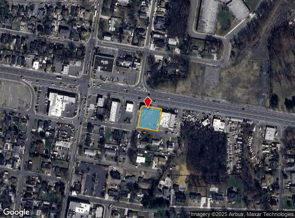
Property Record
26 State Route 36 E, North Middletown, NJ 07748

Current Lease Availabilities
NEARBY LISTINGS FOR SALE OR LEASE
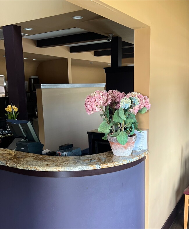
Property Detail
26 State Route 36 E
32-00187-0000-00001
ALSO LOT 2 NIT 1A
Commercialnec
Monmouth
X
New Jersey
34025C0042F
1
2024
0.39 AC
2025
Eastern Monmouth
800602
Northern New Jersey
2,387 SF
New York-Jersey City-White Plains, NY-NJ
DEMOGRAPHICS near 26 State Route 36 E
1 Mile
3 Mile
5 Mile
2024 Total Population
16,291
61,919
106,288
2029 Population
16,156
61,518
105,397
Pop Growth 2024-2029
(0.83%)
(0.65%)
(0.84%)
Average Age
41
41
42
2024 Total Households
5,989
22,295
38,621
HH Growth 2024-2029
(1.02%)
(0.85%)
(1.03%)
Median Household Inc
$91,702
$104,414
$110,129
Avg Household Size
2.60
2.70
2.70
2024 Avg HH Vehicles
2.00
2.00
2.00
Median Home Value
$308,343
$411,143
$430,896
Median Year Built
1963
1965
1966
Nearby Places
- Restaurants
- Banks
- Shops
- Fitness
- Groceries
PUBLIC TRANSPORTATION
COMMUTER RAIL
Hazlet (North Jersey Coast Line - NJ Transit Commuter Rail (NJ Transit))
DRIVE
WALK
Distance
Hazlet (North Jersey Coast Line - NJ Transit Commuter Rail (NJ Transit))
8 min
5.5 mi
Middletown Nj (North Jersey Coast Line - NJ TRANSIT RAIL)
DRIVE
WALK
Distance
Middletown Nj (North Jersey Coast Line - NJ TRANSIT RAIL)
10 min
5.5 mi
AIRPORT
Newark Liberty International
DRIVE
WALK
Distance
Newark Liberty International
44 min
32.3 mi
LaGuardia
DRIVE
WALK
Distance
LaGuardia
73 min
49.7 mi
Freight Ports
New York Container Terminal
DRIVE
WALK
Distance
New York Container Terminal
37 min
27.4 mi
Nearby Properties
Address
Land Use
TOTAL SIZE
Lot Size
Zoning
Address
Land Use
TOTAL SIZE
Lot Size
Zoning
836,881 SF
253 AC
R-45
Address
Land Use
TOTAL SIZE
Lot Size
Zoning
2.91 AC
Address
Land Use
TOTAL SIZE
Lot Size
Zoning
6,500 SF
48.71 AC
CI
Address
Land Use
TOTAL SIZE
Lot Size
Zoning
37.83 AC
PUD
Address
Land Use
TOTAL SIZE
Lot Size
Zoning
10.44 AC
TMHO
Address
Land Use
TOTAL SIZE
Lot Size
Zoning
158,298 SF
20.01 AC
MU15
Address
Land Use
TOTAL SIZE
Lot Size
Zoning
29.59 AC
CI
Address
Land Use
TOTAL SIZE
Lot Size
Zoning
118,375 SF
18.20 AC
MU15
Address
Land Use
TOTAL SIZE
Lot Size
Zoning
151,463 SF
20.58 AC
M-2
Address
Land Use
TOTAL SIZE
Lot Size
Zoning
39,965 SF
17.14 AC
BH
Address
Land Use
TOTAL SIZE
Lot Size
Zoning
82,166 SF
25.10 AC
R-7
Address
Land Use
TOTAL SIZE
Lot Size
Zoning
3,641 SF
22.58 AC
C1
Address
Land Use
TOTAL SIZE
Lot Size
Zoning
1.67 AC
Address
Land Use
TOTAL SIZE
Lot Size
Zoning
237,821 SF
38.92 AC
R-22
Address
Land Use
TOTAL SIZE
Lot Size
Zoning
196,948 SF
19.80 AC
BH
Address
Land Use
TOTAL SIZE
Lot Size
Zoning
126,177 SF
14.10 AC
B-3
Address
Land Use
TOTAL SIZE
Lot Size
Zoning
42,314 SF
52 AC
IA
Address
Land Use
TOTAL SIZE
Lot Size
Zoning
127,410 SF
0.01 AC
RHA
Address
Land Use
TOTAL SIZE
Lot Size
Zoning
3,864 SF
260 AC
M-1
Address
Land Use
TOTAL SIZE
Lot Size
Zoning
83,416 SF
44.01 AC
R-22
Address
Land Use
TOTAL SIZE
Lot Size
Zoning
5 AC
PUD
Address
Land Use
TOTAL SIZE
Lot Size
Zoning
141,313 SF
23.19 AC
R-22
Address
Land Use
TOTAL SIZE
Lot Size
Zoning
4,005 SF
87 SF
B-2
Address
Land Use
TOTAL SIZE
Lot Size
Zoning
9,904 SF
135.45 AC
M-2
Address
Land Use
TOTAL SIZE
Lot Size
Zoning
67,832 SF
10.46 AC
RGA2
Address
Land Use
TOTAL SIZE
Lot Size
Zoning
41,140 SF
3.15 AC
R-7
Address
Land Use
TOTAL SIZE
Lot Size
Zoning
28 AC
RO3
Address
Land Use
TOTAL SIZE
Lot Size
Zoning
4,078 SF
15.14 AC
SC2
Address
Land Use
TOTAL SIZE
Lot Size
Zoning
124,651 SF
25.02 AC
CD
Address
Land Use
TOTAL SIZE
Lot Size
Zoning
200,514 SF
37.60 AC
R100
The World's #1 Commercial Real Estate Marketplace
Connect with us
© 2025 CoStar Group
The information above has been obtained from sources believed reliable. While we do not doubt its accuracy we have not verified it and make no guarantee, warranty or representation about it. It is your responsibility to independently confirm its accuracy and completeness. Any projections, opinions, assumptions, or estimates used are for example only and do not represent the current or future performance of the property. The value of this transaction to you depends on tax and other factors which should be evaluated by your tax, financial, and legal advisors. You and your advisors should conduct a careful, independent investigation of the property to determine to your satisfaction the suitability of the property for your needs.