Property Record
26 Stuart Ave, Norwalk, CT 06850


Save to a Folder
{{folder.Name}}
{{folder.ListingIds.length}} Properties
{{folder.ListingIds.length}} Property
Create a New Folder
Property Detail
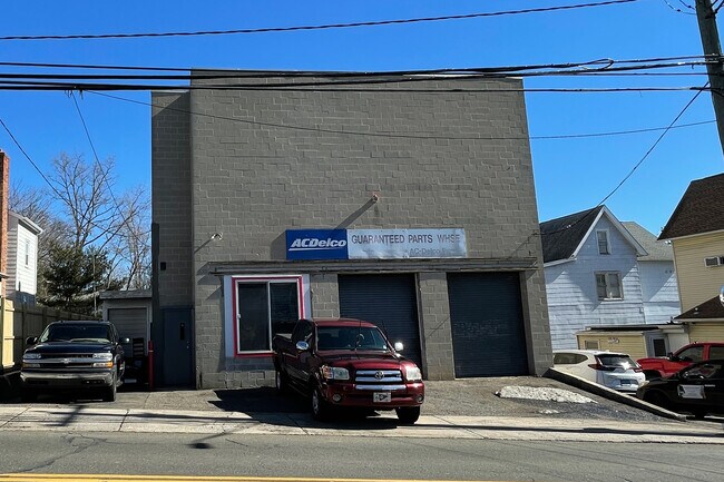
26 Stuart Ave
NORW-000001-000002-000002
Western Ct
Commercialbuilding
Connecticut
D
2
B and X Area of moderate flood hazard, usually the area between the limits of the 100-year and 500-year floods.
0.11 AC
2025
Norwalk
2025
Westchester/So Connecticut
043800
Bridgeport-Stamford-Danbury, CT
6,296 SF
NEARBY LISTINGS FOR SALE OR LEASE
DEMOGRAPHICS near 26 Stuart Ave
1 mile
3 mile
5 mile
2025 Total Population
27,642
92,384
149,434
2030 Population
28,233
94,105
152,994
Pop Growth 2025-2030
+ 2.14%
+ 1.86%
+ 2.38%
Average Age
39
41
41
2025 Total Households
11,361
36,055
56,280
HH Growth 2025-2030
+ 2.31%
+ 1.92%
+ 2.39%
Median Household Inc
$84,955
$107,764
$132,127
Avg Household Size
2.30
2.50
2.60
2025 Avg HH Vehicles
2.00
2.00
2.00
Median Home Value
$430,542
$647,195
$836,576
Median Year Built
1970
1965
1965
Nearby Places
Map Layers
Map Styles
 Street
 Aerial
Layers
 Traffic
 Biking
Places
Listings with unknown addresses are not visible on the map
- Restaurants
- Banks
- Shops
- Fitness
- Groceries
PUBLIC TRANSPORTATION
TRANSIT/SUBWAY
South Norwalk Station (New Haven Line - Metro-North Commuter Railroad Company (Metro-North))
Drive
Walk
Distance
South Norwalk Station (New Haven Line - Metro-North Commuter Railroad Company (Metro-North))
3 min
20 min
1.1 mi
COMMUTER RAIL
South Norwalk Station (New Haven Line - Metro-North Commuter Railroad Company (Metro-North))
Drive
Walk
Distance
South Norwalk Station (New Haven Line - Metro-North Commuter Railroad Company (Metro-North))
3 min
1.1 mi
East Norwalk Station (New Haven Line - Metro-North Commuter Railroad Company (Metro-North))
Drive
Walk
Distance
East Norwalk Station (New Haven Line - Metro-North Commuter Railroad Company (Metro-North))
3 min
1.7 mi
AIRPORT
Westchester County
Drive
Walk
Distance
Westchester County
33 min
20.3 mi
Tweed/New Haven
Drive
Walk
Distance
Tweed/New Haven
55 min
37.1 mi
Freight Ports
Port of New Haven
Drive
Walk
Distance
Port of New Haven
50 min
34.2 mi
SALE & LEASE HISTORY
LISTING DATE
SALE/LEASE

Mar 20, 2018
For Lease
Mar 20, 2018
For Sale
Mar 05, 2021
For Lease
Mar 05, 2021
For Sale
Nearby Properties
Address
Land Use
TOTAL SIZE
Lot Size
Zoning
Address
Land Use
TOTAL SIZE
Lot Size
Zoning
4.49 AC
CBDB
Address
Land Use
TOTAL SIZE
Lot Size
Zoning
749,988 SF
4.52 AC
CBDB
Address
Land Use
TOTAL SIZE
Lot Size
Zoning
339,272 SF
4.07 AC
EO
Address
Land Use
TOTAL SIZE
Lot Size
Zoning
6.80 AC
B2
Address
Land Use
TOTAL SIZE
Lot Size
Zoning
226,920 SF
24.75 AC
B
Address
Land Use
TOTAL SIZE
Lot Size
Zoning
4.44 AC
CBDB
Address
Land Use
TOTAL SIZE
Lot Size
Zoning
248,486 SF
6.57 AC
EO
Address
Land Use
TOTAL SIZE
Lot Size
Zoning
269,100 SF
38.37 AC
RI
Address
Land Use
TOTAL SIZE
Lot Size
Zoning
320,588 SF
3.22 AC
EO
Address
Land Use
TOTAL SIZE
Lot Size
Zoning
252,316 SF
Address
Land Use
TOTAL SIZE
Lot Size
Zoning
271,344 SF
2.36 AC
EO
Address
Land Use
TOTAL SIZE
Lot Size
Zoning
124,373 SF
13.87 AC
A2
Address
Land Use
TOTAL SIZE
Lot Size
Zoning
101,688 SF
5 AC
RI
Address
Land Use
TOTAL SIZE
Lot Size
Zoning
17 AC
A2
Address
Land Use
TOTAL SIZE
Lot Size
Zoning
Address
Land Use
TOTAL SIZE
Lot Size
Zoning
128,459 SF
1.49 AC
I1
Address
Land Use
TOTAL SIZE
Lot Size
Zoning
13.46 AC
RB
Address
Land Use
TOTAL SIZE
Lot Size
Zoning
130,394 SF
28.72 AC
B
Address
Land Use
TOTAL SIZE
Lot Size
Zoning
13.10 AC
RBD
Address
Land Use
TOTAL SIZE
Lot Size
Zoning
108,119 SF
3.62 AC
I1
Address
Land Use
TOTAL SIZE
Lot Size
Zoning
41.63 AC
A2
Address
Land Use
TOTAL SIZE
Lot Size
Zoning
200,704 SF
Address
Land Use
TOTAL SIZE
Lot Size
Zoning
175,791 SF
1.58 AC
CBDB
Address
Land Use
TOTAL SIZE
Lot Size
Zoning
9.76 AC
B1
Address
Land Use
TOTAL SIZE
Lot Size
Zoning
12.30 AC
AA
Address
Land Use
TOTAL SIZE
Lot Size
Zoning
132,185 SF
3.99 AC
DO
Address
Land Use
TOTAL SIZE
Lot Size
Zoning
165,384 SF
18.78 AC
B
Address
Land Use
TOTAL SIZE
Lot Size
Zoning
141,174 SF
10.75 AC
B2
Address
Land Use
TOTAL SIZE
Lot Size
Zoning
3.40 AC
RPDD
Address
Land Use
TOTAL SIZE
Lot Size
Zoning
4.79 AC
EO
The World's #1 Commercial Real Estate Marketplace
Connect with us
© 2026 CoStar Group
The information above has been obtained from sources believed reliable. While we do not doubt its accuracy we have not verified it and make no guarantee, warranty or representation about it. It is your responsibility to independently confirm its accuracy and completeness. Any projections, opinions, assumptions, or estimates used are for example only and do not represent the current or future performance of the property. The value of this transaction to you depends on tax and other factors which should be evaluated by your tax, financial, and legal advisors. You and your advisors should conduct a careful, independent investigation of the property to determine to your satisfaction the suitability of the property for your needs.