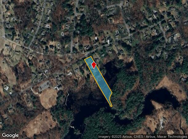
Property Record
260 Eliot St, Natick, MA 01760
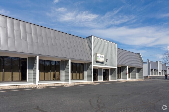
Current Lease Availabilities
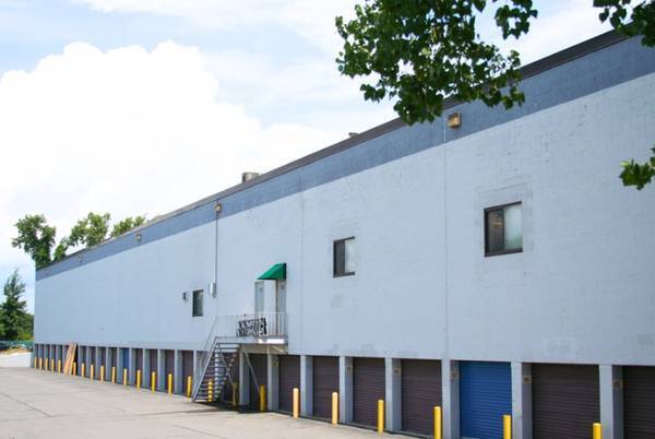
NEARBY LISTINGS FOR SALE OR LEASE
-
-
View all Natick listings for lease on LoopNet.com
Property Detail
260 Eliot St
Sfr
Middlesex
A
Massachusetts
25021C0014F
2.80 AC
2025
Hopkinton/Holliston
2025
Boston
382300
Boston-Cambridge-Newton, MA-NH
2,836 SF
NATI-000073-000000-000008E
DEMOGRAPHICS near 260 Eliot St
1 mile
3 mile
5 mile
2024 Total Population
6,746
46,820
117,640
2029 Population
6,678
46,600
116,989
Pop Growth 2024-2029
(1.01%)
(0.47%)
(0.55%)
Average Age
43
39
40
2024 Total Households
2,701
17,038
44,383
HH Growth 2024-2029
(1.11%)
(0.53%)
(0.63%)
Median Household Inc
$110,202
$96,973
$108,159
Avg Household Size
2.50
2.60
2.50
2024 Avg HH Vehicles
2.00
2.00
2.00
Median Home Value
$423,333
$524,475
$615,805
Median Year Built
1983
1970
1972
Nearby Places
Map Layers
Map Styles
 Street
 Aerial
Transit
 Traffic
 Biking
Places
Listings with unknown addresses are not visible on the map
- Restaurants
- Banks
- Shops
- Fitness
- Groceries
PUBLIC TRANSPORTATION
COMMUTER RAIL
Natick (Framingham/Worcester Line - Massachusetts Bay Transportation Authority Commuter Rail (Purple Line))
Drive
Walk
Distance
Natick (Framingham/Worcester Line - Massachusetts Bay Transportation Authority Commuter Rail (Purple Line))
5 min
2.3 mi
West Natick (Framingham/Worcester Line - Massachusetts Bay Transportation Authority Commuter Rail (Purple Line))
Drive
Walk
Distance
West Natick (Framingham/Worcester Line - Massachusetts Bay Transportation Authority Commuter Rail (Purple Line))
9 min
4.5 mi
AIRPORT
General Edward Lawrence Logan International
Drive
Walk
Distance
General Edward Lawrence Logan International
35 min
21.4 mi
Worcester Regional
Drive
Walk
Distance
Worcester Regional
55 min
31.9 mi
Freight Ports
Port of Boston
Drive
Walk
Distance
Port of Boston
34 min
19.8 mi
Nearby Properties
Address
Land Use
TOTAL SIZE
Lot Size
Zoning
Address
Land Use
TOTAL SIZE
Lot Size
Zoning
188,746 SF
46.90 AC
RSA
Address
Land Use
TOTAL SIZE
Lot Size
Zoning
79.30 AC
RSA
Address
Land Use
TOTAL SIZE
Lot Size
Zoning
80.85 AC
SR40
Address
Land Use
TOTAL SIZE
Lot Size
Zoning
36.60 AC
R2
Address
Land Use
TOTAL SIZE
Lot Size
Zoning
29,022 SF
4.89 AC
RG
Address
Land Use
TOTAL SIZE
Lot Size
Zoning
182.10 AC
O
Address
Land Use
TOTAL SIZE
Lot Size
Zoning
184,086 SF
7.96 AC
RM
Address
Land Use
TOTAL SIZE
Lot Size
Zoning
81,685 SF
5.53 AC
RSC
Address
Land Use
TOTAL SIZE
Lot Size
Zoning
25,846 SF
16.67 AC
RSC
Address
Land Use
TOTAL SIZE
Lot Size
Zoning
64,225 SF
5.19 AC
RSC
Address
Land Use
TOTAL SIZE
Lot Size
Zoning
4,508 SF
87.96 AC
SR20
Address
Land Use
TOTAL SIZE
Lot Size
Zoning
30.60 AC
SR15
Address
Land Use
TOTAL SIZE
Lot Size
Zoning
53,878 SF
24.98 AC
RSB
Address
Land Use
TOTAL SIZE
Lot Size
Zoning
189.70 AC
RSB
Address
Land Use
TOTAL SIZE
Lot Size
Zoning
78.50 AC
R2
Address
Land Use
TOTAL SIZE
Lot Size
Zoning
60,088 SF
0.36 AC
DM
Address
Land Use
TOTAL SIZE
Lot Size
Zoning
55,135 SF
20.55 AC
RSC
Address
Land Use
TOTAL SIZE
Lot Size
Zoning
187,411 SF
29.56 AC
H
Address
Land Use
TOTAL SIZE
Lot Size
Zoning
29.56 AC
R2
Address
Land Use
TOTAL SIZE
Lot Size
Zoning
87,312 SF
2.94 AC
INI
Address
Land Use
TOTAL SIZE
Lot Size
Zoning
1,039 SF
3.31 AC
RM
Address
Land Use
TOTAL SIZE
Lot Size
Zoning
22.46 AC
SR40
Address
Land Use
TOTAL SIZE
Lot Size
Zoning
10,863 SF
1.11 AC
SR40
Address
Land Use
TOTAL SIZE
Lot Size
Zoning
112.10 AC
SR40
Address
Land Use
TOTAL SIZE
Lot Size
Zoning
57,072 SF
28.96 AC
RSC
Address
Land Use
TOTAL SIZE
Lot Size
Zoning
11,639 SF
2.10 AC
SR40
Address
Land Use
TOTAL SIZE
Lot Size
Zoning
9,032 SF
10 AC
RSA
Address
Land Use
TOTAL SIZE
Lot Size
Zoning
17,203 SF
3.63 AC
SR40
Address
Land Use
TOTAL SIZE
Lot Size
Zoning
12,608 SF
4.48 AC
SR40
Address
Land Use
TOTAL SIZE
Lot Size
Zoning
30,869 SF
0.45 AC
DM
The World's #1 Commercial Real Estate Marketplace
Connect with us
© 2026 CoStar Group
The information above has been obtained from sources believed reliable. While we do not doubt its accuracy we have not verified it and make no guarantee, warranty or representation about it. It is your responsibility to independently confirm its accuracy and completeness. Any projections, opinions, assumptions, or estimates used are for example only and do not represent the current or future performance of the property. The value of this transaction to you depends on tax and other factors which should be evaluated by your tax, financial, and legal advisors. You and your advisors should conduct a careful, independent investigation of the property to determine to your satisfaction the suitability of the property for your needs.