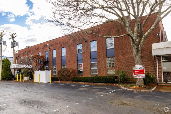
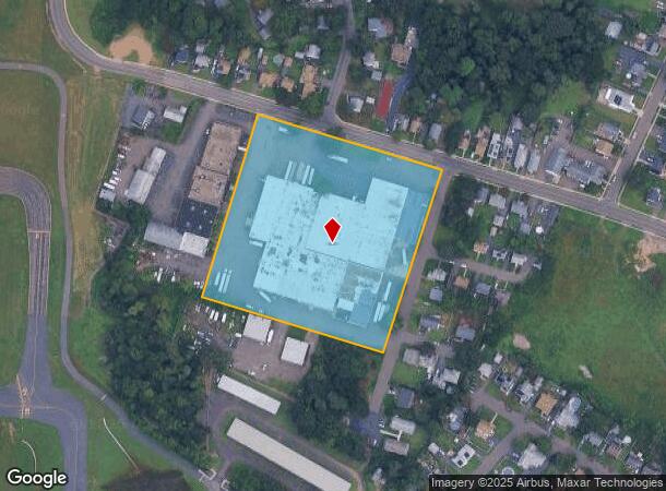
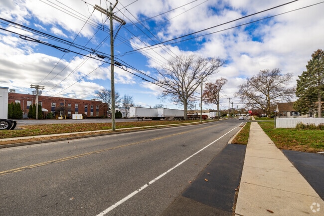
Property Record
260 Dodge Ave, East Haven, CT 06512
NEARBY LISTINGS FOR SALE OR LEASE
Property Detail
260 Dodge Ave
EHAV-000180-002109-000001
New Haven
Industrialgeneral
Connecticut
AE
1
09009C0444J
6 AC
2025
East Haven
2025
Westchester/So Connecticut
180200
New Haven-Milford, CT
118,868 SF
DEMOGRAPHICS near 260 Dodge Ave
1 Mile
3 Mile
5 Mile
2024 Total Population
12,756
57,492
201,996
2029 Population
12,752
56,906
200,199
Pop Growth 2024-2029
(0.03%)
(1.02%)
(0.89%)
Average Age
41
40
38
2024 Total Households
5,213
23,336
81,223
HH Growth 2024-2029
(0.10%)
(0.87%)
(0.82%)
Median Household Inc
$73,032
$63,622
$59,041
Avg Household Size
2.40
2.40
2.30
2024 Avg HH Vehicles
2.00
2.00
1.00
Median Home Value
$250,000
$246,203
$246,190
Median Year Built
1960
1961
1958
Nearby Places
Map Layers
Map Styles
 Street
 Aerial
- Restaurants
- Banks
- Shops
- Fitness
- Groceries
PUBLIC TRANSPORTATION
COMMUTER RAIL
New Haven Union Station (Hartford Line - CONN DOT)
DRIVE
WALK
Distance
New Haven Union Station (Hartford Line - CONN DOT)
9 min
5.0 mi
New Haven-Union Station (New Haven Line - Shore Line East, Shore Line East - Shore Line East)
DRIVE
WALK
Distance
New Haven-Union Station (New Haven Line - Shore Line East, Shore Line East - Shore Line East)
10 min
5.1 mi
AIRPORT
Tweed/New Haven
DRIVE
WALK
Distance
Tweed/New Haven
4 min
0.9 mi
Freight Ports
Port of New Haven
DRIVE
WALK
Distance
Port of New Haven
8 min
3.6 mi
Nearby Properties
Address
Land Use
TOTAL SIZE
Lot Size
Zoning
Address
Land Use
TOTAL SIZE
Lot Size
Zoning
83,314 SF
2.14 AC
BA
Address
Land Use
TOTAL SIZE
Lot Size
Zoning
318,210 SF
2.73 AC
BA
Address
Land Use
TOTAL SIZE
Lot Size
Zoning
68,706 SF
3.34 AC
BA1
Address
Land Use
TOTAL SIZE
Lot Size
Zoning
117,066 SF
71.34 AC
IH
Address
Land Use
TOTAL SIZE
Lot Size
Zoning
287,844 SF
2.11 AC
IL
Address
Land Use
TOTAL SIZE
Lot Size
Zoning
8,655 SF
107.61 AC
AIRPOR
Address
Land Use
TOTAL SIZE
Lot Size
Zoning
163,505 SF
3.96 AC
BA1
Address
Land Use
TOTAL SIZE
Lot Size
Zoning
17,462 SF
86.34 AC
PARK
Address
Land Use
TOTAL SIZE
Lot Size
Zoning
85,679 SF
14.23 AC
RM1
Address
Land Use
TOTAL SIZE
Lot Size
Zoning
111,576 SF
2.51 AC
RM2
Address
Land Use
TOTAL SIZE
Lot Size
Zoning
185,600 SF
1.44 AC
BA
Address
Land Use
TOTAL SIZE
Lot Size
Zoning
197.78 AC
LI-3
Address
Land Use
TOTAL SIZE
Lot Size
Zoning
297,601 SF
16.70 AC
PDD 10
Address
Land Use
TOTAL SIZE
Lot Size
Zoning
25,590 SF
4.50 AC
BE
Address
Land Use
TOTAL SIZE
Lot Size
Zoning
64,240 SF
7.33 AC
BE
Address
Land Use
TOTAL SIZE
Lot Size
Zoning
407,320 SF
2.31 AC
PDD 53
Address
Land Use
TOTAL SIZE
Lot Size
Zoning
7.72 AC
RA-1
Address
Land Use
TOTAL SIZE
Lot Size
Zoning
98,475 SF
2.83 AC
PDD 99
Address
Land Use
TOTAL SIZE
Lot Size
Zoning
29,872 SF
Address
Land Use
TOTAL SIZE
Lot Size
Zoning
98,422 SF
1.78 AC
PDU 93
Address
Land Use
TOTAL SIZE
Lot Size
Zoning
1,932 SF
64.06 AC
PARK
Address
Land Use
TOTAL SIZE
Lot Size
Zoning
16.50 AC
Address
Land Use
TOTAL SIZE
Lot Size
Zoning
322,750 SF
30 AC
IL
Address
Land Use
TOTAL SIZE
Lot Size
Zoning
35 AC
RA-1
Address
Land Use
TOTAL SIZE
Lot Size
Zoning
197,798 SF
13.01 AC
BE
Address
Land Use
TOTAL SIZE
Lot Size
Zoning
150,714 SF
5.23 AC
IL
Address
Land Use
TOTAL SIZE
Lot Size
Zoning
96,449 SF
1.67 AC
RS2
Address
Land Use
TOTAL SIZE
Lot Size
Zoning
48,726 SF
9.46 AC
Address
Land Use
TOTAL SIZE
Lot Size
Zoning
19.26 AC
R-2
Address
Land Use
TOTAL SIZE
Lot Size
Zoning
9.34 AC
CA-1
The World's #1 Commercial Real Estate Marketplace
Connect with us
© 2025 CoStar Group
The information above has been obtained from sources believed reliable. While we do not doubt its accuracy we have not verified it and make no guarantee, warranty or representation about it. It is your responsibility to independently confirm its accuracy and completeness. Any projections, opinions, assumptions, or estimates used are for example only and do not represent the current or future performance of the property. The value of this transaction to you depends on tax and other factors which should be evaluated by your tax, financial, and legal advisors. You and your advisors should conduct a careful, independent investigation of the property to determine to your satisfaction the suitability of the property for your needs.