Property Record
260 E 312Th St, Willowick, OH 44095
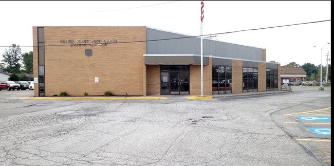
Property Detail
260 E 312Th St
Cleveland-Elyria, OH
LAKE
28-A-043-A-00-018-0
Ohio
Commercialnec
0.15 AC
U-1
Northeast
B and X Area of moderate flood hazard, usually the area between the limits of the 100-year and 500-year floods.
Cleveland
NEARBY LISTINGS FOR SALE OR LEASE
-
-
View all Willowick listings for sale on LoopNet.com
DEMOGRAPHICS near 260 E 312Th St
1 mile
3 mile
5 mile
2025 Total Population
10,899
60,528
119,947
2030 Population
10,835
60,518
120,159
Pop Growth 2025-2030
(0.59%)
(0.02%)
+ 0.18%
Average Age
42
43
43
2025 Total Households
4,942
28,751
55,487
HH Growth 2025-2030
(0.53%)
+ 0.10%
+ 0.26%
Median Household Inc
$68,241
$61,491
$60,703
Avg Household Size
2.20
2.10
2.10
2025 Avg HH Vehicles
2.00
2.00
2.00
Median Home Value
$159,318
$160,751
$170,416
Median Year Built
1956
1959
1961
Nearby Places
Map Layers
Map Styles
 Street
 Aerial
Transit
 Traffic
 Biking
Places
Listings with unknown addresses are not visible on the map
- Restaurants
- Banks
- Shops
- Fitness
- Groceries
PUBLIC TRANSPORTATION
AIRPORT
Cleveland-Hopkins International
Drive
Walk
Distance
Cleveland-Hopkins International
46 min
29.7 mi
Freight Ports
Port of Toledo
Drive
Walk
Distance
Port of Toledo
159 min
130.1 mi
Nearby Properties
Address
Land Use
TOTAL SIZE
Lot Size
Zoning
Address
Land Use
TOTAL SIZE
Lot Size
Zoning
120.34 AC
Address
Land Use
TOTAL SIZE
Lot Size
Zoning
494,378 SF
11.54 AC
R-MFL
Address
Land Use
TOTAL SIZE
Lot Size
Zoning
1,283,872 SF
11.33 AC
U3
Address
Land Use
TOTAL SIZE
Lot Size
Zoning
208,119 SF
72.98 AC
1-R
Address
Land Use
TOTAL SIZE
Lot Size
Zoning
311,955 SF
31.16 AC
S-CMF
Address
Land Use
TOTAL SIZE
Lot Size
Zoning
332,457 SF
15.93 AC
Address
Land Use
TOTAL SIZE
Lot Size
Zoning
120,352 SF
15.05 AC
1FM60
Address
Land Use
TOTAL SIZE
Lot Size
Zoning
392,586 SF
6.50 AC
M
Address
Land Use
TOTAL SIZE
Lot Size
Zoning
263,441 SF
17.18 AC
I
Address
Land Use
TOTAL SIZE
Lot Size
Zoning
827,164 SF
8 AC
U3
Address
Land Use
TOTAL SIZE
Lot Size
Zoning
70,574 SF
6.35 AC
CI
Address
Land Use
TOTAL SIZE
Lot Size
Zoning
417,806 SF
28.90 AC
Address
Land Use
TOTAL SIZE
Lot Size
Zoning
272,400 SF
1.07 AC
U2D
Address
Land Use
TOTAL SIZE
Lot Size
Zoning
53,637 SF
13.45 AC
G-BUS
Address
Land Use
TOTAL SIZE
Lot Size
Zoning
113,801 SF
8.48 AC
I
Address
Land Use
TOTAL SIZE
Lot Size
Zoning
246,997 SF
10 AC
R-100
Address
Land Use
TOTAL SIZE
Lot Size
Zoning
136,722 SF
10.25 AC
GB
Address
Land Use
TOTAL SIZE
Lot Size
Zoning
164,666 SF
8 AC
R-100
Address
Land Use
TOTAL SIZE
Lot Size
Zoning
163,353 SF
12.43 AC
R-BUS
Address
Land Use
TOTAL SIZE
Lot Size
Zoning
447,868 SF
6.22 AC
U3
Address
Land Use
TOTAL SIZE
Lot Size
Zoning
174,098 SF
20.51 AC
U-1
Address
Land Use
TOTAL SIZE
Lot Size
Zoning
431,066 SF
6.15 AC
I
Address
Land Use
TOTAL SIZE
Lot Size
Zoning
111,819 SF
14.13 AC
Address
Land Use
TOTAL SIZE
Lot Size
Zoning
122,130 SF
9.51 AC
Address
Land Use
TOTAL SIZE
Lot Size
Zoning
135,414 SF
4 AC
Address
Land Use
TOTAL SIZE
Lot Size
Zoning
151,690 SF
15.39 AC
Address
Land Use
TOTAL SIZE
Lot Size
Zoning
109,803 SF
9.77 AC
Address
Land Use
TOTAL SIZE
Lot Size
Zoning
120,676 SF
9.07 AC
R-MFL
Address
Land Use
TOTAL SIZE
Lot Size
Zoning
61,068 SF
6.46 AC
1R
Address
Land Use
TOTAL SIZE
Lot Size
Zoning
70,325 SF
9.16 AC
The World's #1 Commercial Real Estate Marketplace
Connect with us
© 2026 CoStar Group
The information above has been obtained from sources believed reliable. While we do not doubt its accuracy we have not verified it and make no guarantee, warranty or representation about it. It is your responsibility to independently confirm its accuracy and completeness. Any projections, opinions, assumptions, or estimates used are for example only and do not represent the current or future performance of the property. The value of this transaction to you depends on tax and other factors which should be evaluated by your tax, financial, and legal advisors. You and your advisors should conduct a careful, independent investigation of the property to determine to your satisfaction the suitability of the property for your needs.