Property Record
260 Hudson River Rd, Waterford, NY 12188


NEARBY LISTINGS FOR SALE OR LEASE
Property Detail
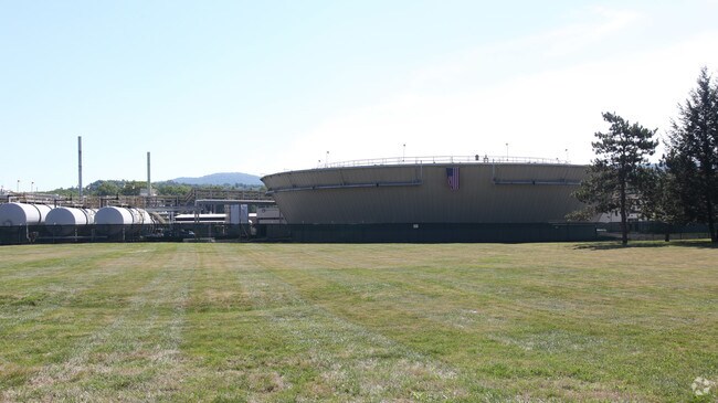
260 Hudson River Rd
Albany/Schenectady/Troy
MAIN PLANT
Albany-Schenectady-Troy, NY
Saratoga
415489-286-000-0001-056-000-0000
New York
Manufacturinglight
56.000
2025
173.09 AC
2024
Saratoga County
062700
DEMOGRAPHICS near 260 Hudson River Rd
1 Mile
3 Mile
5 Mile
2024 Total Population
391
19,133
64,051
2029 Population
396
19,036
63,477
Pop Growth 2024-2029
+ 1.28%
(0.51%)
(0.90%)
Average Age
45
43
42
2024 Total Households
168
8,424
28,386
HH Growth 2024-2029
+ 1.19%
(0.57%)
(1.01%)
Median Household Inc
$106,666
$66,703
$67,279
Avg Household Size
2.30
2.20
2.20
2024 Avg HH Vehicles
2.00
2.00
2.00
Median Home Value
$255,645
$214,573
$220,167
Median Year Built
1966
1958
1963
Nearby Places
Map Layers
Map Styles
 Street
 Aerial
- Restaurants
- Banks
- Shops
- Fitness
- Groceries
PUBLIC TRANSPORTATION
AIRPORT
Albany International
DRIVE
WALK
Distance
Albany International
22 min
12.3 mi
Freight Ports
Albany, NY Port
DRIVE
WALK
Distance
Albany, NY Port
27 min
15.0 mi
Nearby Properties
Address
Land Use
TOTAL SIZE
Lot Size
Zoning
Address
Land Use
TOTAL SIZE
Lot Size
Zoning
5,000 SF
48.44 AC
CR
Address
Land Use
TOTAL SIZE
Lot Size
Zoning
150,000 SF
45.60 AC
07 - MIXED
Address
Land Use
TOTAL SIZE
Lot Size
Zoning
39.06 AC
Address
Land Use
TOTAL SIZE
Lot Size
Zoning
Address
Land Use
TOTAL SIZE
Lot Size
Zoning
193,144 SF
41.18 AC
Address
Land Use
TOTAL SIZE
Lot Size
Zoning
346,727 SF
15.06 AC
03 - MULTI
Address
Land Use
TOTAL SIZE
Lot Size
Zoning
4,680 SF
26.74 AC
Address
Land Use
TOTAL SIZE
Lot Size
Zoning
1.30 AC
Address
Land Use
TOTAL SIZE
Lot Size
Zoning
210,415 SF
1.69 AC
MF
Address
Land Use
TOTAL SIZE
Lot Size
Zoning
723,643 SF
27.56 AC
Address
Land Use
TOTAL SIZE
Lot Size
Zoning
5,500 SF
15.31 AC
MU2
Address
Land Use
TOTAL SIZE
Lot Size
Zoning
3,844 SF
3.18 AC
Address
Land Use
TOTAL SIZE
Lot Size
Zoning
Address
Land Use
TOTAL SIZE
Lot Size
Zoning
95,466 SF
7.64 AC
MF
Address
Land Use
TOTAL SIZE
Lot Size
Zoning
52 AC
CR
Address
Land Use
TOTAL SIZE
Lot Size
Zoning
86,904 SF
150.22 AC
Address
Land Use
TOTAL SIZE
Lot Size
Zoning
2,560 SF
9.30 AC
A3
Address
Land Use
TOTAL SIZE
Lot Size
Zoning
95,800 SF
23.50 AC
Address
Land Use
TOTAL SIZE
Lot Size
Zoning
75,872 SF
8.26 AC
SF
Address
Land Use
TOTAL SIZE
Lot Size
Zoning
15,562 SF
1.91 AC
WMU
Address
Land Use
TOTAL SIZE
Lot Size
Zoning
88.48 AC
Address
Land Use
TOTAL SIZE
Lot Size
Zoning
51,926 SF
2.02 AC
MF
Address
Land Use
TOTAL SIZE
Lot Size
Zoning
30,600 SF
258.51 AC
Address
Land Use
TOTAL SIZE
Lot Size
Zoning
2,192 SF
4.90 AC
Address
Land Use
TOTAL SIZE
Lot Size
Zoning
16,768 SF
9.10 AC
MF
Address
Land Use
TOTAL SIZE
Lot Size
Zoning
30,390 SF
1.20 AC
03 - MULTI
Address
Land Use
TOTAL SIZE
Lot Size
Zoning
114,539 SF
11.64 AC
Address
Land Use
TOTAL SIZE
Lot Size
Zoning
23,700 SF
5.01 AC
SF
Address
Land Use
TOTAL SIZE
Lot Size
Zoning
44,500 SF
6.71 AC
WMU
The World's #1 Commercial Real Estate Marketplace
Connect with us
© 2025 CoStar Group
The information above has been obtained from sources believed reliable. While we do not doubt its accuracy we have not verified it and make no guarantee, warranty or representation about it. It is your responsibility to independently confirm its accuracy and completeness. Any projections, opinions, assumptions, or estimates used are for example only and do not represent the current or future performance of the property. The value of this transaction to you depends on tax and other factors which should be evaluated by your tax, financial, and legal advisors. You and your advisors should conduct a careful, independent investigation of the property to determine to your satisfaction the suitability of the property for your needs.