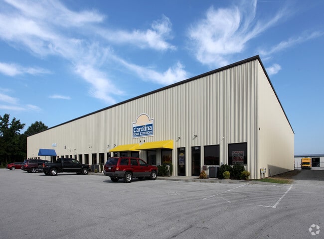
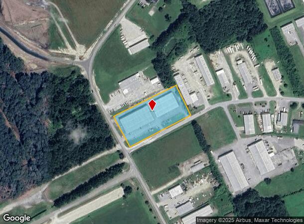
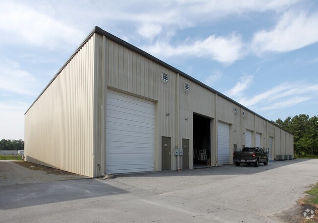
Property Record
260 Kale Rd, New Bern, NC 28562
NEARBY LISTINGS FOR SALE OR LEASE
-
-
View all New Bern listings for lease on LoopNet.com
Property Detail
260 Kale Rd
New Bern, NC
Bernwood Comm
7-108-3-006
LOT 6 & 7 & PT 8 BERNWOOD COMMERCIAL PHASE I
Multipleuses
Craven
X
North Carolina
3720548800K
6
2025
2.29 AC
2025
North Carolina Southeast Area
961003
Other Market Areas
20,000 SF
DEMOGRAPHICS near 260 Kale Rd
1 Mile
3 Mile
5 Mile
2024 Total Population
2,237
13,982
40,028
2029 Population
2,253
14,124
40,438
Pop Growth 2024-2029
+ 0.72%
+ 1.02%
+ 1.02%
Average Age
43
43
44
2024 Total Households
890
5,822
17,134
HH Growth 2024-2029
+ 0.79%
+ 1.13%
+ 1.07%
Median Household Inc
$83,538
$78,077
$63,930
Avg Household Size
2.40
2.30
2.30
2024 Avg HH Vehicles
2.00
2.00
2.00
Median Home Value
$213,580
$254,101
$223,427
Median Year Built
1996
1996
1990
Nearby Places
Map Layers
Map Styles
 Street
 Aerial
- Restaurants
- Banks
- Shops
- Fitness
- Groceries
PUBLIC TRANSPORTATION
AIRPORT
Coastal Carolina Regional
DRIVE
WALK
Distance
Coastal Carolina Regional
3 min
0.9 mi
Freight Ports
Port of Morehead City
DRIVE
WALK
Distance
Port of Morehead City
62 min
38.1 mi
SALE & LEASE HISTORY
LISTING DATE
SALE/LEASE

Sep 25, 2016
For Lease
Nearby Properties
Address
Land Use
TOTAL SIZE
Lot Size
Zoning
Address
Land Use
TOTAL SIZE
Lot Size
Zoning
42,836 SF
474.58 AC
Address
Land Use
TOTAL SIZE
Lot Size
Zoning
18,972 SF
2.70 AC
Address
Land Use
TOTAL SIZE
Lot Size
Zoning
48,742 SF
11.89 AC
Address
Land Use
TOTAL SIZE
Lot Size
Zoning
12,600 SF
10.45 AC
Address
Land Use
TOTAL SIZE
Lot Size
Zoning
53,952 SF
2.95 AC
NC2
Address
Land Use
TOTAL SIZE
Lot Size
Zoning
59,864 SF
2.64 AC
NC2
Address
Land Use
TOTAL SIZE
Lot Size
Zoning
50,687 SF
5.72 AC
NC3
Address
Land Use
TOTAL SIZE
Lot Size
Zoning
68,356 SF
1.21 AC
NC5A
Address
Land Use
TOTAL SIZE
Lot Size
Zoning
47,137 SF
1.91 AC
Address
Land Use
TOTAL SIZE
Lot Size
Zoning
18,016 SF
2.18 AC
Address
Land Use
TOTAL SIZE
Lot Size
Zoning
33,451 SF
0.64 AC
NC1
Address
Land Use
TOTAL SIZE
Lot Size
Zoning
4,880 SF
6.08 AC
Address
Land Use
TOTAL SIZE
Lot Size
Zoning
6,170 SF
2.87 AC
Address
Land Use
TOTAL SIZE
Lot Size
Zoning
3,816 SF
5.49 AC
Address
Land Use
TOTAL SIZE
Lot Size
Zoning
8.06 AC
NC5A
Address
Land Use
TOTAL SIZE
Lot Size
Zoning
50,000 SF
2.01 AC
Address
Land Use
TOTAL SIZE
Lot Size
Zoning
13,688 SF
1.24 AC
NC1
Address
Land Use
TOTAL SIZE
Lot Size
Zoning
3,014.73 AC
Address
Land Use
TOTAL SIZE
Lot Size
Zoning
13,595 SF
1.85 AC
NC1
Address
Land Use
TOTAL SIZE
Lot Size
Zoning
6,513 SF
0.89 AC
NC1
Address
Land Use
TOTAL SIZE
Lot Size
Zoning
3.05 AC
NC2
Address
Land Use
TOTAL SIZE
Lot Size
Zoning
10,649 SF
2.04 AC
Address
Land Use
TOTAL SIZE
Lot Size
Zoning
2.22 AC
NC2
Address
Land Use
TOTAL SIZE
Lot Size
Zoning
1,600 SF
26.91 AC
Address
Land Use
TOTAL SIZE
Lot Size
Zoning
7,883 SF
4.16 AC
Address
Land Use
TOTAL SIZE
Lot Size
Zoning
108.50 AC
Address
Land Use
TOTAL SIZE
Lot Size
Zoning
16,544 SF
0.46 AC
NC1
Address
Land Use
TOTAL SIZE
Lot Size
Zoning
5.42 AC
NC5A
The World's #1 Commercial Real Estate Marketplace
Connect with us
© 2026 CoStar Group
The information above has been obtained from sources believed reliable. While we do not doubt its accuracy we have not verified it and make no guarantee, warranty or representation about it. It is your responsibility to independently confirm its accuracy and completeness. Any projections, opinions, assumptions, or estimates used are for example only and do not represent the current or future performance of the property. The value of this transaction to you depends on tax and other factors which should be evaluated by your tax, financial, and legal advisors. You and your advisors should conduct a careful, independent investigation of the property to determine to your satisfaction the suitability of the property for your needs.