Property Record
260 Pantops Ctr, Charlottesville, VA 22911


NEARBY LISTINGS FOR SALE OR LEASE
Property Detail
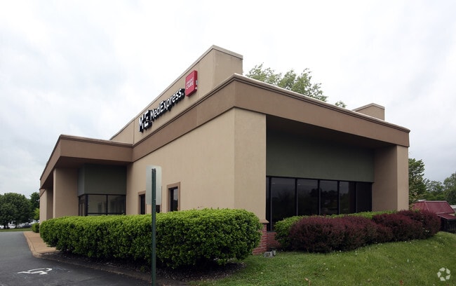
260 Pantops Ctr
07800-00-00-017D6
ACREAGE PARCEL B
Medicalbuilding
Albemarle
X
Virginia
51003C0287D
1.17 AC
2025
Charlottesville
2025
Other Market Areas
010502
Charlottesville, VA
7,333 SF
DEMOGRAPHICS near 260 Pantops Ctr
1 Mile
3 Mile
5 Mile
2024 Total Population
8,929
55,937
100,546
2029 Population
8,898
55,583
101,607
Pop Growth 2024-2029
(0.35%)
(0.63%)
+ 1.06%
Average Age
42
37
37
2024 Total Households
4,391
23,785
40,845
HH Growth 2024-2029
(0.11%)
(0.47%)
+ 1.19%
Median Household Inc
$81,044
$73,810
$75,236
Avg Household Size
2.00
2.10
2.20
2024 Avg HH Vehicles
2.00
2.00
2.00
Median Home Value
$425,294
$415,031
$404,438
Median Year Built
1992
1983
1984
Nearby Places
Map Layers
Map Styles
 Street
 Aerial
- Restaurants
- Banks
- Shops
- Fitness
- Groceries
PUBLIC TRANSPORTATION
COMMUTER RAIL
DRIVE
WALK
Distance
8 min
2.6 mi
AIRPORT
Charlottesville-Albemarle
DRIVE
WALK
Distance
Charlottesville-Albemarle
22 min
10.3 mi
SALE & LEASE HISTORY
LISTING DATE
SALE/LEASE

Sep 24, 2016
For Sale
Jun 29, 2017
For Sale
Jun 29, 2017
For Lease
Jul 10, 2017
For Sale
Feb 28, 2017
For Lease
Nearby Properties
Address
Land Use
TOTAL SIZE
Lot Size
Zoning
Address
Land Use
TOTAL SIZE
Lot Size
Zoning
872,960 SF
20.90 AC
CM
Address
Land Use
TOTAL SIZE
Lot Size
Zoning
45 AC
RURAL AREA
Address
Land Use
TOTAL SIZE
Lot Size
Zoning
61,177 SF
30.40 AC
R1 RESIDEN
Address
Land Use
TOTAL SIZE
Lot Size
Zoning
429,500 SF
38.49 AC
PDMC
Address
Land Use
TOTAL SIZE
Lot Size
Zoning
15 AC
RURAL AREA
Address
Land Use
TOTAL SIZE
Lot Size
Zoning
34.70 AC
RURAL AREA
Address
Land Use
TOTAL SIZE
Lot Size
Zoning
167,708 SF
1.05 AC
CM
Address
Land Use
TOTAL SIZE
Lot Size
Zoning
497,658 SF
39.83 AC
NX-10
Address
Land Use
TOTAL SIZE
Lot Size
Zoning
3,465 SF
145.17 AC
CV
Address
Land Use
TOTAL SIZE
Lot Size
Zoning
254,749 SF
80.72 AC
CM
Address
Land Use
TOTAL SIZE
Lot Size
Zoning
45,873 SF
30 AC
RURAL AREA
Address
Land Use
TOTAL SIZE
Lot Size
Zoning
101,778 SF
11.11 AC
CM
Address
Land Use
TOTAL SIZE
Lot Size
Zoning
99,841 SF
47.68 AC
PLANNED DE
Address
Land Use
TOTAL SIZE
Lot Size
Zoning
62,900 SF
4.71 AC
NX-10
Address
Land Use
TOTAL SIZE
Lot Size
Zoning
3,803 SF
266.70 AC
CV
Address
Land Use
TOTAL SIZE
Lot Size
Zoning
12,180 SF
26.20 AC
RURAL AREA
Address
Land Use
TOTAL SIZE
Lot Size
Zoning
578,208 SF
2.06 AC
CX-8
Address
Land Use
TOTAL SIZE
Lot Size
Zoning
43,616 SF
2.24 AC
CX-8
Address
Land Use
TOTAL SIZE
Lot Size
Zoning
983 SF
0.39 AC
CM
Address
Land Use
TOTAL SIZE
Lot Size
Zoning
10,270 SF
3.59 AC
RX-5
Address
Land Use
TOTAL SIZE
Lot Size
Zoning
12,876 SF
32.70 AC
NEIGHBORHO
Address
Land Use
TOTAL SIZE
Lot Size
Zoning
250,632 SF
1.79 AC
CM
Address
Land Use
TOTAL SIZE
Lot Size
Zoning
393,960 SF
16.14 AC
NMD
Address
Land Use
TOTAL SIZE
Lot Size
Zoning
30,896 SF
0.97 AC
DX
Address
Land Use
TOTAL SIZE
Lot Size
Zoning
78,332 SF
33.82 AC
CM
Address
Land Use
TOTAL SIZE
Lot Size
Zoning
240,936 SF
1.26 AC
NX-10
Address
Land Use
TOTAL SIZE
Lot Size
Zoning
14,000 SF
6.45 AC
CX-5
Address
Land Use
TOTAL SIZE
Lot Size
Zoning
336,000 SF
20.20 AC
R15 RESIDE
Address
Land Use
TOTAL SIZE
Lot Size
Zoning
131,500 SF
65.97 AC
R15 RESIDE
Address
Land Use
TOTAL SIZE
Lot Size
Zoning
20.41 AC
The World's #1 Commercial Real Estate Marketplace
Connect with us
© 2025 CoStar Group
The information above has been obtained from sources believed reliable. While we do not doubt its accuracy we have not verified it and make no guarantee, warranty or representation about it. It is your responsibility to independently confirm its accuracy and completeness. Any projections, opinions, assumptions, or estimates used are for example only and do not represent the current or future performance of the property. The value of this transaction to you depends on tax and other factors which should be evaluated by your tax, financial, and legal advisors. You and your advisors should conduct a careful, independent investigation of the property to determine to your satisfaction the suitability of the property for your needs.