Property Record
2600 E Amity Rd, Boise, ID 83716
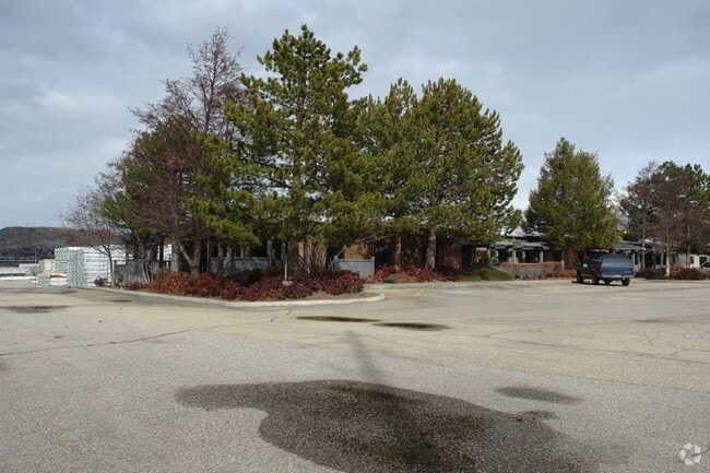

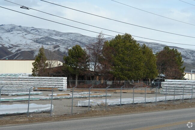
Property Detail
2600 E Amity Rd
S0930336410
PAR #6410 @ SW COR GOV LOT 1 SEC 30 3N 3E PARCEL E R/S 9984 #336400C #346900B
Foundry
Ada
M-1D
Idaho
B and X Area of moderate flood hazard, usually the area between the limits of the 100-year and 500-year floods.
1
2025
32.64 AC
2025
Southeast Boise
010505
Boise City/Nampa
90,300 SF
Boise City, ID
NEARBY LISTINGS FOR SALE OR LEASE
DEMOGRAPHICS near 2600 E Amity Rd
1 mile
3 mile
5 mile
2025 Total Population
8,506
44,486
91,481
2030 Population
8,823
46,570
96,246
Pop Growth 2025-2030
+ 3.73%
+ 4.68%
+ 5.21%
Average Age
41
41
39
2025 Total Households
3,384
18,669
39,777
HH Growth 2025-2030
+ 4.14%
+ 5.10%
+ 5.78%
Median Household Inc
$126,619
$116,379
$86,936
Avg Household Size
2.50
2.30
2.20
2025 Avg HH Vehicles
2.00
2.00
2.00
Median Home Value
$531,203
$631,193
$597,465
Median Year Built
1992
1994
1989
Nearby Places
Map Layers
Map Styles
 Street
 Aerial
Layers
 Traffic
 Biking
Places
Listings with unknown addresses are not visible on the map
- Restaurants
- Banks
- Shops
- Fitness
- Groceries
PUBLIC TRANSPORTATION
AIRPORT
Boise Air Trml/Gowen Field
Drive
Walk
Distance
Boise Air Trml/Gowen Field
20 min
6.5 mi
Freight Ports
Port of Portland
Drive
Walk
Distance
Port of Portland
483 min
436.5 mi
Nearby Properties
Address
Land Use
TOTAL SIZE
Lot Size
Zoning
Address
Land Use
TOTAL SIZE
Lot Size
Zoning
ZC-258
Address
Land Use
TOTAL SIZE
Lot Size
Zoning
851,556 SF
78.75 AC
M-2D
Address
Land Use
TOTAL SIZE
Lot Size
Zoning
900,981 SF
86.35 AC
ZC-263
Address
Land Use
TOTAL SIZE
Lot Size
Zoning
251,614 SF
12.62 AC
L-OD
Address
Land Use
TOTAL SIZE
Lot Size
Zoning
122,110 SF
12.66 AC
T-2D/DA
Address
Land Use
TOTAL SIZE
Lot Size
Zoning
347,991 SF
12.51 AC
SP-02
Address
Land Use
TOTAL SIZE
Lot Size
Zoning
356,969 SF
49.72 AC
M-1D
Address
Land Use
TOTAL SIZE
Lot Size
Zoning
197,268 SF
10.95 AC
R-3D
Address
Land Use
TOTAL SIZE
Lot Size
Zoning
245,240 SF
5.40 AC
R-2D
Address
Land Use
TOTAL SIZE
Lot Size
Zoning
214,318 SF
13.77 AC
R-2D
Address
Land Use
TOTAL SIZE
Lot Size
Zoning
259,565 SF
4.07 AC
SP-02
Address
Land Use
TOTAL SIZE
Lot Size
Zoning
364,998 SF
40.53 AC
M-1D
Address
Land Use
TOTAL SIZE
Lot Size
Zoning
10.03 AC
R-3D
Address
Land Use
TOTAL SIZE
Lot Size
Zoning
215,141 SF
5.25 AC
SP-01
Address
Land Use
TOTAL SIZE
Lot Size
Zoning
157,347 SF
7.97 AC
R-3
Address
Land Use
TOTAL SIZE
Lot Size
Zoning
366,032 SF
10.79 AC
C-4D
Address
Land Use
TOTAL SIZE
Lot Size
Zoning
237,251 SF
20.90 AC
M-1D
Address
Land Use
TOTAL SIZE
Lot Size
Zoning
220,160 SF
12.70 AC
M-1D
Address
Land Use
TOTAL SIZE
Lot Size
Zoning
190,180 SF
14.43 AC
R-2D
Address
Land Use
TOTAL SIZE
Lot Size
Zoning
237,299 SF
20.32 AC
M-1D
Address
Land Use
TOTAL SIZE
Lot Size
Zoning
127,351 SF
4.42 AC
L-OD
Address
Land Use
TOTAL SIZE
Lot Size
Zoning
50,674 SF
49.82 AC
T-2D
Address
Land Use
TOTAL SIZE
Lot Size
Zoning
150,147 SF
3.94 AC
SP-01
Address
Land Use
TOTAL SIZE
Lot Size
Zoning
140,088 SF
8.46 AC
R-2D
Address
Land Use
TOTAL SIZE
Lot Size
Zoning
161,421 SF
10.05 AC
R-1C
Address
Land Use
TOTAL SIZE
Lot Size
Zoning
3.41 AC
SP-02
Address
Land Use
TOTAL SIZE
Lot Size
Zoning
187,820 SF
11.39 AC
M-1D
Address
Land Use
TOTAL SIZE
Lot Size
Zoning
95,092 SF
4.24 AC
R-3D
Address
Land Use
TOTAL SIZE
Lot Size
Zoning
96.73 AC
T-2D
Address
Land Use
TOTAL SIZE
Lot Size
Zoning
165,000 SF
10.60 AC
M-1D
The World's #1 Commercial Real Estate Marketplace
Connect with us
© 2026 CoStar Group
The information above has been obtained from sources believed reliable. While we do not doubt its accuracy we have not verified it and make no guarantee, warranty or representation about it. It is your responsibility to independently confirm its accuracy and completeness. Any projections, opinions, assumptions, or estimates used are for example only and do not represent the current or future performance of the property. The value of this transaction to you depends on tax and other factors which should be evaluated by your tax, financial, and legal advisors. You and your advisors should conduct a careful, independent investigation of the property to determine to your satisfaction the suitability of the property for your needs.