Property Record
2600 E Whitestone Blvd, Cedar Park, TX 78613


Save to a Folder
{{folder.Name}}
{{folder.ListingIds.length}} Properties
{{folder.ListingIds.length}} Property
Create a New Folder
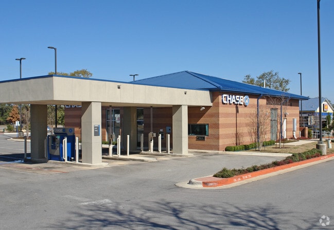
Property Detail
2600 E Whitestone Blvd
R468197
S8759 - SILVERADO PLAZA PH 3, BLOCK A, LOT 1, ACRES 1.042
Commercialnec
Williamson
4-GR
Texas
B and X Area of moderate flood hazard, usually the area between the limits of the 100-year and 500-year floods.
1
2024
1.04 AC
2025
Cedar Park
020348
Austin
4,210 SF
Austin-Round Rock-San Marcos, TX
NEARBY LISTINGS FOR SALE OR LEASE
DEMOGRAPHICS near 2600 E Whitestone Blvd
1 mile
3 mile
5 mile
2025 Total Population
6,722
75,389
231,203
2030 Population
7,624
85,568
261,849
Pop Growth 2025-2030
+ 13.42%
+ 13.50%
+ 13.26%
Average Age
36
36
37
2025 Total Households
2,549
25,892
83,781
HH Growth 2025-2030
+ 14.04%
+ 13.97%
+ 13.76%
Median Household Inc
$127,276
$139,080
$131,701
Avg Household Size
2.60
2.90
2.70
2025 Avg HH Vehicles
2.00
2.00
2.00
Median Home Value
$639,415
$585,366
$541,304
Median Year Built
2009
2007
2006
Nearby Places
Map Layers
Map Styles
 Street
 Aerial
Layers
 Traffic
 Biking
Places
Listings with unknown addresses are not visible on the map
- Restaurants
- Banks
- Shops
- Fitness
- Groceries
PUBLIC TRANSPORTATION
AIRPORT
Austin-Bergstrom International
Drive
Walk
Distance
Austin-Bergstrom International
52 min
35.6 mi
Freight Ports
Calhoun Port
Drive
Walk
Distance
Calhoun Port
217 min
179.1 mi
Nearby Properties
Address
Land Use
TOTAL SIZE
Lot Size
Zoning
Address
Land Use
TOTAL SIZE
Lot Size
Zoning
320,454 SF
19.56 AC
Address
Land Use
TOTAL SIZE
Lot Size
Zoning
325,045 SF
22.75 AC
Address
Land Use
TOTAL SIZE
Lot Size
Zoning
223,681 SF
7.78 AC
Address
Land Use
TOTAL SIZE
Lot Size
Zoning
94,861 SF
12.72 AC
Address
Land Use
TOTAL SIZE
Lot Size
Zoning
151,181 SF
6 AC
Address
Land Use
TOTAL SIZE
Lot Size
Zoning
240,800 SF
17.16 AC
Address
Land Use
TOTAL SIZE
Lot Size
Zoning
264,140 SF
21.37 AC
Address
Land Use
TOTAL SIZE
Lot Size
Zoning
111,518 SF
15.55 AC
Address
Land Use
TOTAL SIZE
Lot Size
Zoning
47,009 SF
1.59 AC
Address
Land Use
TOTAL SIZE
Lot Size
Zoning
201,900 SF
33.81 AC
Address
Land Use
TOTAL SIZE
Lot Size
Zoning
41,891 SF
10.42 AC
Address
Land Use
TOTAL SIZE
Lot Size
Zoning
123,858 SF
6.06 AC
Address
Land Use
TOTAL SIZE
Lot Size
Zoning
60 AC
1-SFU
Address
Land Use
TOTAL SIZE
Lot Size
Zoning
207,697 SF
26.25 AC
4-GR
Address
Land Use
TOTAL SIZE
Lot Size
Zoning
99,223 SF
8.90 AC
Address
Land Use
TOTAL SIZE
Lot Size
Zoning
34,824 SF
4.53 AC
4-GR
Address
Land Use
TOTAL SIZE
Lot Size
Zoning
197,911 SF
9.74 AC
Address
Land Use
TOTAL SIZE
Lot Size
Zoning
77,818 SF
9.80 AC
Address
Land Use
TOTAL SIZE
Lot Size
Zoning
33.13 AC
Address
Land Use
TOTAL SIZE
Lot Size
Zoning
121,524 SF
9.34 AC
Address
Land Use
TOTAL SIZE
Lot Size
Zoning
58,651 SF
5.33 AC
Address
Land Use
TOTAL SIZE
Lot Size
Zoning
158,700 SF
7.82 AC
Address
Land Use
TOTAL SIZE
Lot Size
Zoning
82,798 SF
9.28 AC
Address
Land Use
TOTAL SIZE
Lot Size
Zoning
Address
Land Use
TOTAL SIZE
Lot Size
Zoning
102,717 SF
6.93 AC
Address
Land Use
TOTAL SIZE
Lot Size
Zoning
157,330 SF
5.65 AC
Address
Land Use
TOTAL SIZE
Lot Size
Zoning
103,219 SF
9.71 AC
3-PD
Address
Land Use
TOTAL SIZE
Lot Size
Zoning
36,660 SF
3.83 AC
4-GR
Address
Land Use
TOTAL SIZE
Lot Size
Zoning
14.95 AC
Address
Land Use
TOTAL SIZE
Lot Size
Zoning
45,000 SF
5.01 AC
The World's #1 Commercial Real Estate Marketplace
Connect with us
© 2026 CoStar Group
The information above has been obtained from sources believed reliable. While we do not doubt its accuracy we have not verified it and make no guarantee, warranty or representation about it. It is your responsibility to independently confirm its accuracy and completeness. Any projections, opinions, assumptions, or estimates used are for example only and do not represent the current or future performance of the property. The value of this transaction to you depends on tax and other factors which should be evaluated by your tax, financial, and legal advisors. You and your advisors should conduct a careful, independent investigation of the property to determine to your satisfaction the suitability of the property for your needs.