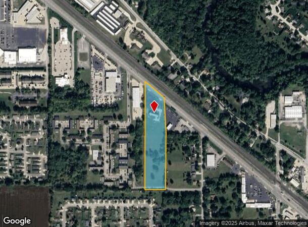
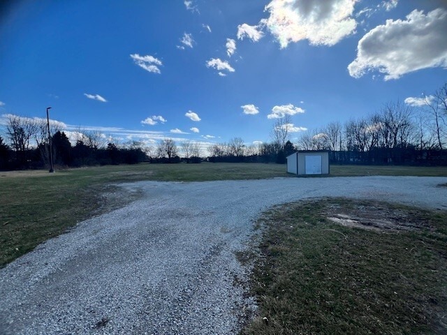
Property Record
2600 Elkhart Rd, Goshen, IN 46526
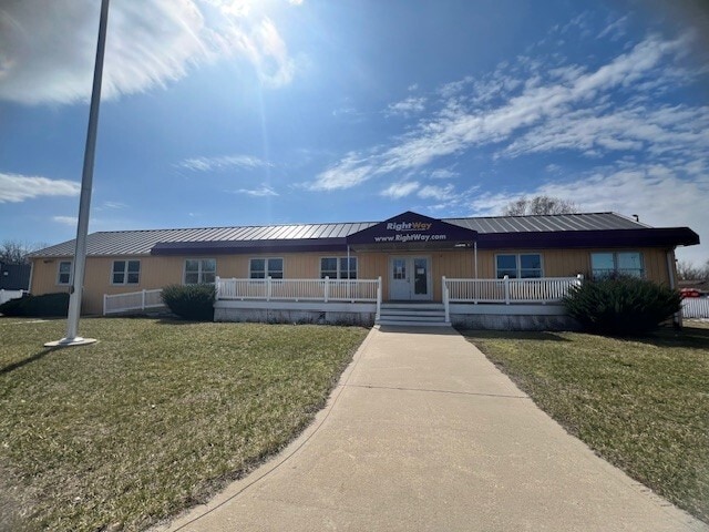
This Property Is For Sale
NEARBY LISTINGS FOR SALE OR LEASE
Property Detail
2600 Elkhart Rd
20-11-06-251-004.000-015
E PT S PT W1/2 NE EX 3.533A EX .589A SEC 6 6.421A
Vehiclerentalsvehiclesales
Elkhart
X
Indiana
18039C0251D
6.42 AC
2023
Outlying Elkhart County
2024
South Bend/Mishawaka
000501
Elkhart-Goshen, IN
2,262 SF
DEMOGRAPHICS near 2600 Elkhart Rd
1 Mile
3 Mile
5 Mile
2024 Total Population
6,825
29,704
59,354
2029 Population
6,833
29,698
59,152
Pop Growth 2024-2029
+ 0.12%
(0.02%)
(0.34%)
Average Age
35
37
38
2024 Total Households
2,266
10,361
21,188
HH Growth 2024-2029
+ 0.09%
(0.11%)
(0.35%)
Median Household Inc
$56,346
$58,090
$63,205
Avg Household Size
2.90
2.80
2.70
2024 Avg HH Vehicles
2.00
2.00
2.00
Median Home Value
$153,416
$160,246
$178,802
Median Year Built
1987
1976
1981
Nearby Places
- Restaurants
- Banks
- Shops
- Fitness
- Groceries
PUBLIC TRANSPORTATION
COMMUTER RAIL
DRIVE
WALK
Distance
13 min
7.5 mi
AIRPORT
South Bend International
DRIVE
WALK
Distance
South Bend International
49 min
30.8 mi
Nearby Properties
Address
Land Use
TOTAL SIZE
Lot Size
Zoning
Address
Land Use
TOTAL SIZE
Lot Size
Zoning
189,808 SF
23.53 AC
ZO01
Address
Land Use
TOTAL SIZE
Lot Size
Zoning
214,958 SF
34.74 AC
ZO01
Address
Land Use
TOTAL SIZE
Lot Size
Zoning
115,238 SF
160 AC
ZO01
Address
Land Use
TOTAL SIZE
Lot Size
Zoning
148,490 SF
19.63 AC
Address
Land Use
TOTAL SIZE
Lot Size
Zoning
46,442 SF
0.97 AC
ZO01
Address
Land Use
TOTAL SIZE
Lot Size
Zoning
259,034 SF
16.33 AC
ZO01
Address
Land Use
TOTAL SIZE
Lot Size
Zoning
126,635 SF
10.97 AC
ZO01
Address
Land Use
TOTAL SIZE
Lot Size
Zoning
65,144 SF
13.30 AC
ZO01
Address
Land Use
TOTAL SIZE
Lot Size
Zoning
89,609 SF
10 AC
ZO01
Address
Land Use
TOTAL SIZE
Lot Size
Zoning
98,582 SF
3.08 AC
ZO01
Address
Land Use
TOTAL SIZE
Lot Size
Zoning
146,526 SF
13.72 AC
Address
Land Use
TOTAL SIZE
Lot Size
Zoning
98,559 SF
33 AC
ZO01
Address
Land Use
TOTAL SIZE
Lot Size
Zoning
114,828 SF
11.29 AC
Address
Land Use
TOTAL SIZE
Lot Size
Zoning
23,457 SF
9.01 AC
ZO01
Address
Land Use
TOTAL SIZE
Lot Size
Zoning
31,746 SF
44.60 AC
ZO01
Address
Land Use
TOTAL SIZE
Lot Size
Zoning
85,750 SF
13.64 AC
Address
Land Use
TOTAL SIZE
Lot Size
Zoning
86,073 SF
9.28 AC
ZO01
Address
Land Use
TOTAL SIZE
Lot Size
Zoning
72,894 SF
4.52 AC
ZO01
Address
Land Use
TOTAL SIZE
Lot Size
Zoning
114,023 SF
10.31 AC
ZO01
Address
Land Use
TOTAL SIZE
Lot Size
Zoning
22,735 SF
3.50 AC
ZO01
Address
Land Use
TOTAL SIZE
Lot Size
Zoning
58,365 SF
5.17 AC
ZO01
Address
Land Use
TOTAL SIZE
Lot Size
Zoning
54,548 SF
13.16 AC
ZO01
Address
Land Use
TOTAL SIZE
Lot Size
Zoning
29,066 SF
13.55 AC
ZO01
Address
Land Use
TOTAL SIZE
Lot Size
Zoning
58,526 SF
7.38 AC
ZO01
Address
Land Use
TOTAL SIZE
Lot Size
Zoning
94,151 SF
6.19 AC
ZO01
Address
Land Use
TOTAL SIZE
Lot Size
Zoning
53,685 SF
13.38 AC
ZO01
Address
Land Use
TOTAL SIZE
Lot Size
Zoning
32,832 SF
3.66 AC
ZO01
Address
Land Use
TOTAL SIZE
Lot Size
Zoning
48,146 SF
29.51 AC
ZO01
Address
Land Use
TOTAL SIZE
Lot Size
Zoning
26,878 SF
5.12 AC
ZO01
Address
Land Use
TOTAL SIZE
Lot Size
Zoning
33,235 SF
2.38 AC
ZO01
The World's #1 Commercial Real Estate Marketplace
Connect with us
© 2025 CoStar Group
The information above has been obtained from sources believed reliable. While we do not doubt its accuracy we have not verified it and make no guarantee, warranty or representation about it. It is your responsibility to independently confirm its accuracy and completeness. Any projections, opinions, assumptions, or estimates used are for example only and do not represent the current or future performance of the property. The value of this transaction to you depends on tax and other factors which should be evaluated by your tax, financial, and legal advisors. You and your advisors should conduct a careful, independent investigation of the property to determine to your satisfaction the suitability of the property for your needs.