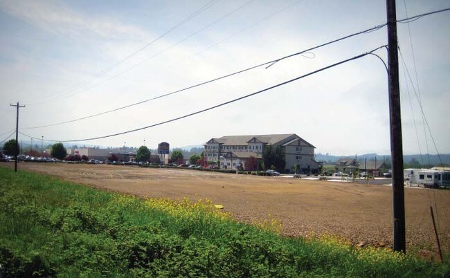
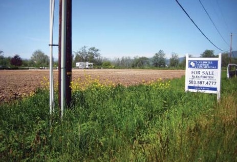
Property Record
2600 Main Ave N, Tillamook, OR 97141


Property Detail
2600 Main Ave N
Charitableorganization
TILLAMOOK
C-H
Oregon
AE The base floodplain where base flood elevations are provided. AE Zones are now used on new format FIRMs instead of A1-A30 Zones.
2.52 AC
0
Oregon West Area
2025
Other Market Areas
960500
R0194337
21,884 SF
NEARBY LISTINGS FOR SALE OR LEASE
DEMOGRAPHICS near 2600 Main Ave N
1 mile
3 mile
5 mile
2025 Total Population
299
6,068
8,953
2030 Population
286
5,569
8,263
Pop Growth 2025-2030
(4.35%)
(8.22%)
(7.71%)
Average Age
42
39
40
2025 Total Households
115
2,357
3,421
HH Growth 2025-2030
(5.22%)
(9.21%)
(8.74%)
Median Household Inc
$53,636
$56,820
$58,704
Avg Household Size
2.50
2.40
2.40
2025 Avg HH Vehicles
2.00
2.00
2.00
Median Home Value
$491,666
$331,591
$364,305
Median Year Built
1973
1976
1978
Nearby Places
Map Layers
Map Styles
 Street
 Aerial
Layers
 Traffic
 Biking
Places
Listings with unknown addresses are not visible on the map
- Restaurants
- Banks
- Shops
- Fitness
- Groceries
Nearby Properties
Address
Land Use
TOTAL SIZE
Lot Size
Zoning
Address
Land Use
TOTAL SIZE
Lot Size
Zoning
13,010 SF
40.38 AC
M-1
Address
Land Use
TOTAL SIZE
Lot Size
Zoning
146,122 SF
17.08 AC
PUB
Address
Land Use
TOTAL SIZE
Lot Size
Zoning
20 SF
40.38 AC
M-1
Address
Land Use
TOTAL SIZE
Lot Size
Zoning
69,831 SF
4.83 AC
TM-P
Address
Land Use
TOTAL SIZE
Lot Size
Zoning
119,848 SF
31.42 AC
TM-P
Address
Land Use
TOTAL SIZE
Lot Size
Zoning
102,627 SF
4.43 AC
TM-P
Address
Land Use
TOTAL SIZE
Lot Size
Zoning
5,676 SF
62.98 AC
PUB
Address
Land Use
TOTAL SIZE
Lot Size
Zoning
154,349 SF
10.35 AC
C-H
Address
Land Use
TOTAL SIZE
Lot Size
Zoning
68,662 SF
4.32 AC
TM-R-0
Address
Land Use
TOTAL SIZE
Lot Size
Zoning
64 SF
3.91 AC
PUB,TM-P
Address
Land Use
TOTAL SIZE
Lot Size
Zoning
41,842 SF
6.30 AC
C-H
Address
Land Use
TOTAL SIZE
Lot Size
Zoning
66,951 SF
4.22 AC
TM-R-0
Address
Land Use
TOTAL SIZE
Lot Size
Zoning
55,312 SF
4.34 AC
TM-R-0
Address
Land Use
TOTAL SIZE
Lot Size
Zoning
30,138 SF
0.79 AC
TM-C-C
Address
Land Use
TOTAL SIZE
Lot Size
Zoning
38,481 SF
0.96 AC
TM-R-5.0
Address
Land Use
TOTAL SIZE
Lot Size
Zoning
20,748 SF
2.30 AC
TM-R-0
Address
Land Use
TOTAL SIZE
Lot Size
Zoning
38,045 SF
5.15 AC
TM-P
Address
Land Use
TOTAL SIZE
Lot Size
Zoning
44,100 SF
3.10 AC
TM-P
Address
Land Use
TOTAL SIZE
Lot Size
Zoning
28,924 SF
8.29 AC
TM-R-0
Address
Land Use
TOTAL SIZE
Lot Size
Zoning
73,307 SF
6.49 AC
R-O
Address
Land Use
TOTAL SIZE
Lot Size
Zoning
65,083 SF
7.10 AC
CH
Address
Land Use
TOTAL SIZE
Lot Size
Zoning
39,593 SF
1.31 AC
TM-C-C
Address
Land Use
TOTAL SIZE
Lot Size
Zoning
10 SF
1.37 AC
TM-C-H
Address
Land Use
TOTAL SIZE
Lot Size
Zoning
43,801 SF
1.52 AC
TM-P
Address
Land Use
TOTAL SIZE
Lot Size
Zoning
24,343 SF
2.35 AC
TM-P
Address
Land Use
TOTAL SIZE
Lot Size
Zoning
Address
Land Use
TOTAL SIZE
Lot Size
Zoning
30 SF
2.08 AC
TM-I-G
Address
Land Use
TOTAL SIZE
Lot Size
Zoning
19,960 SF
0.76 AC
C-C
Address
Land Use
TOTAL SIZE
Lot Size
Zoning
27,400 SF
2.72 AC
TM-C-H
The World's #1 Commercial Real Estate Marketplace
Connect with us
© 2026 CoStar Group
The information above has been obtained from sources believed reliable. While we do not doubt its accuracy we have not verified it and make no guarantee, warranty or representation about it. It is your responsibility to independently confirm its accuracy and completeness. Any projections, opinions, assumptions, or estimates used are for example only and do not represent the current or future performance of the property. The value of this transaction to you depends on tax and other factors which should be evaluated by your tax, financial, and legal advisors. You and your advisors should conduct a careful, independent investigation of the property to determine to your satisfaction the suitability of the property for your needs.