Property Record
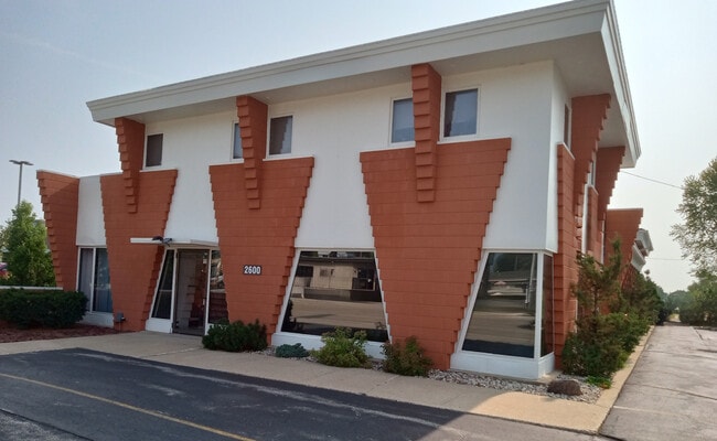
2600 N Richmond St, Appleton, WI 54911


Property Detail
2600 N Richmond St
31-6-7693-00
SEC23 T21N R17E PARC IN N12AC OF S20AC OF NW1/4 OF NW1/4 COM 158FT NORTH OF SW COR N12AC OF S20AC SD NW 1/4 NW1/4 CON N145FT E177.12FT S145FT W177.12FT TO BEG W33FT RESV FOR ST 810R327; LESS DOC2068381 FOR R/W
Commercialnec
Outagamie
C2
Wisconsin
B and X Area of moderate flood hazard, usually the area between the limits of the 100-year and 500-year floods.
0.46 AC
2024
Outagamie County
2024
Green Bay
011400
Appleton, WI
882 SF
NEARBY LISTINGS FOR SALE OR LEASE
DEMOGRAPHICS near 2600 N Richmond St
1 mile
3 mile
5 mile
2025 Total Population
13,459
72,486
140,707
2030 Population
13,497
73,826
143,505
Pop Growth 2025-2030
+ 0.28%
+ 1.85%
+ 1.99%
Average Age
42
40
40
2025 Total Households
5,764
30,458
58,797
HH Growth 2025-2030
+ 0.26%
+ 2.06%
+ 2.09%
Median Household Inc
$72,310
$78,079
$79,099
Avg Household Size
2.20
2.20
2.30
2025 Avg HH Vehicles
2.00
2.00
2.00
Median Home Value
$220,622
$243,505
$253,129
Median Year Built
1963
1971
1978
Nearby Places
Map Layers
Map Styles
 Street
 Aerial
Layers
 Traffic
 Biking
Places
Listings with unknown addresses are not visible on the map
- Restaurants
- Banks
- Shops
- Fitness
- Groceries
PUBLIC TRANSPORTATION
AIRPORT
Appleton International
Drive
Walk
Distance
Appleton International
18 min
11.1 mi
Green Bay/Austin Straubel International
Drive
Walk
Distance
Green Bay/Austin Straubel International
32 min
24.1 mi
Freight Ports
Port Milwaukee
Drive
Walk
Distance
Port Milwaukee
132 min
112.9 mi
SALE & LEASE HISTORY
LISTING DATE
SALE/LEASE

Oct 03, 2016
For Lease
Nov 02, 2016
For Lease
Mar 27, 2017
For Lease
Mar 01, 2019
For Lease
Jul 02, 2021
For Lease
Dec 04, 2023
For Sale
Apr 29, 2024
For Lease
Nearby Properties
Address
Land Use
TOTAL SIZE
Lot Size
Zoning
Address
Land Use
TOTAL SIZE
Lot Size
Zoning
154,889 SF
1 AC
C2
Address
Land Use
TOTAL SIZE
Lot Size
Zoning
33.54 AC
Address
Land Use
TOTAL SIZE
Lot Size
Zoning
500,700 SF
47.17 AC
Address
Land Use
TOTAL SIZE
Lot Size
Zoning
189,107 SF
13.37 AC
Address
Land Use
TOTAL SIZE
Lot Size
Zoning
3.42 AC
PDC2
Address
Land Use
TOTAL SIZE
Lot Size
Zoning
84,620 SF
92.18 AC
C2
Address
Land Use
TOTAL SIZE
Lot Size
Zoning
20.37 AC
PDC2
Address
Land Use
TOTAL SIZE
Lot Size
Zoning
70,136 SF
6.34 AC
C2
Address
Land Use
TOTAL SIZE
Lot Size
Zoning
2,032 SF
18.48 AC
R3
Address
Land Use
TOTAL SIZE
Lot Size
Zoning
65,818 SF
8.01 AC
C2
Address
Land Use
TOTAL SIZE
Lot Size
Zoning
16.63 AC
Address
Land Use
TOTAL SIZE
Lot Size
Zoning
6.59 AC
M1
Address
Land Use
TOTAL SIZE
Lot Size
Zoning
29,742 SF
5.95 AC
R3
Address
Land Use
TOTAL SIZE
Lot Size
Zoning
13.05 AC
Address
Land Use
TOTAL SIZE
Lot Size
Zoning
194,573 SF
19.99 AC
Address
Land Use
TOTAL SIZE
Lot Size
Zoning
Address
Land Use
TOTAL SIZE
Lot Size
Zoning
Address
Land Use
TOTAL SIZE
Lot Size
Zoning
53,321 SF
2.51 AC
CBD
Address
Land Use
TOTAL SIZE
Lot Size
Zoning
44,164 SF
0.62 AC
CBD
Address
Land Use
TOTAL SIZE
Lot Size
Zoning
17.43 AC
M2
Address
Land Use
TOTAL SIZE
Lot Size
Zoning
13.11 AC
Address
Land Use
TOTAL SIZE
Lot Size
Zoning
40,560 SF
6.67 AC
R3
Address
Land Use
TOTAL SIZE
Lot Size
Zoning
107,202 SF
39.98 AC
C2
Address
Land Use
TOTAL SIZE
Lot Size
Zoning
66,504 SF
5.25 AC
C2
Address
Land Use
TOTAL SIZE
Lot Size
Zoning
14,024 SF
9.34 AC
PDR3
Address
Land Use
TOTAL SIZE
Lot Size
Zoning
5.10 AC
Address
Land Use
TOTAL SIZE
Lot Size
Zoning
6.66 AC
Address
Land Use
TOTAL SIZE
Lot Size
Zoning
20.22 AC
M1
Address
Land Use
TOTAL SIZE
Lot Size
Zoning
16,664 SF
8.48 AC
PDR3
Address
Land Use
TOTAL SIZE
Lot Size
Zoning
The World's #1 Commercial Real Estate Marketplace
Connect with us
© 2026 CoStar Group
The information above has been obtained from sources believed reliable. While we do not doubt its accuracy we have not verified it and make no guarantee, warranty or representation about it. It is your responsibility to independently confirm its accuracy and completeness. Any projections, opinions, assumptions, or estimates used are for example only and do not represent the current or future performance of the property. The value of this transaction to you depends on tax and other factors which should be evaluated by your tax, financial, and legal advisors. You and your advisors should conduct a careful, independent investigation of the property to determine to your satisfaction the suitability of the property for your needs.