Property Record
2600 N Us Highway 281, Marble Falls, TX 78654

NEARBY LISTINGS FOR SALE OR LEASE
Property Detail
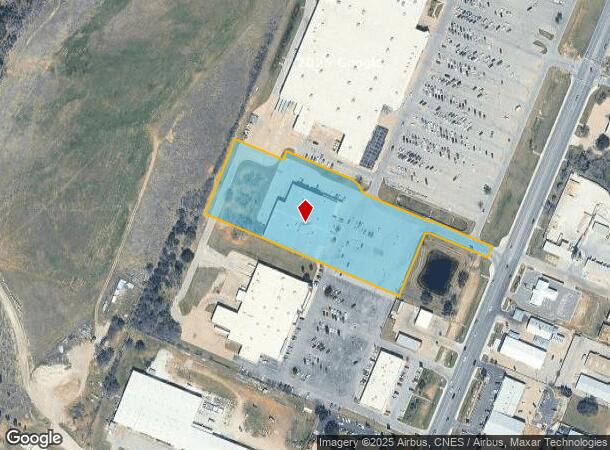
2600 N Us Highway 281
57240
Logan Vandivier
Storebuilding
ABS A0927 LOGAN VANDIVIER, 5.0231 ACRES
X
Burnet
48053C0582G
Texas
2024
5.02 AC
2025
Central Texas Area
960702
Other Market Areas
40,106 SF
DEMOGRAPHICS near 2600 N Us Highway 281
1 Mile
3 Mile
5 Mile
2024 Total Population
1,473
9,307
14,553
2029 Population
1,715
10,916
17,038
Pop Growth 2024-2029
+ 16.43%
+ 17.29%
+ 17.08%
Average Age
43
43
43
2024 Total Households
594
3,857
5,858
HH Growth 2024-2029
+ 15.82%
+ 16.80%
+ 16.59%
Median Household Inc
$58,055
$54,209
$56,988
Avg Household Size
2.40
2.40
2.40
2024 Avg HH Vehicles
2.00
2.00
2.00
Median Home Value
$292,072
$275,265
$267,347
Median Year Built
1992
1997
1995
Nearby Places
Map Layers
Map Styles
 Street
 Aerial
- Restaurants
- Banks
- Shops
- Fitness
- Groceries
Nearby Properties
Address
Land Use
TOTAL SIZE
Lot Size
Zoning
Address
Land Use
TOTAL SIZE
Lot Size
Zoning
118,251 SF
11.34 AC
Address
Land Use
TOTAL SIZE
Lot Size
Zoning
114,375 SF
9.86 AC
Address
Land Use
TOTAL SIZE
Lot Size
Zoning
140,976 SF
8.34 AC
Address
Land Use
TOTAL SIZE
Lot Size
Zoning
112,599 SF
11.74 AC
Address
Land Use
TOTAL SIZE
Lot Size
Zoning
73,344 SF
13.72 AC
Address
Land Use
TOTAL SIZE
Lot Size
Zoning
54,059 SF
20.69 AC
Address
Land Use
TOTAL SIZE
Lot Size
Zoning
202,505 SF
22.65 AC
Address
Land Use
TOTAL SIZE
Lot Size
Zoning
73,721 SF
9.30 AC
Address
Land Use
TOTAL SIZE
Lot Size
Zoning
28,107 SF
8.34 AC
Address
Land Use
TOTAL SIZE
Lot Size
Zoning
48,288 SF
7.89 AC
Address
Land Use
TOTAL SIZE
Lot Size
Zoning
66,194 SF
3.85 AC
Address
Land Use
TOTAL SIZE
Lot Size
Zoning
65,350 SF
35 AC
Address
Land Use
TOTAL SIZE
Lot Size
Zoning
55,484 SF
3.01 AC
Address
Land Use
TOTAL SIZE
Lot Size
Zoning
47,104 SF
2.08 AC
Address
Land Use
TOTAL SIZE
Lot Size
Zoning
110,433 SF
17.07 AC
Address
Land Use
TOTAL SIZE
Lot Size
Zoning
11,679 SF
Address
Land Use
TOTAL SIZE
Lot Size
Zoning
60,103 SF
6.55 AC
Address
Land Use
TOTAL SIZE
Lot Size
Zoning
76,951 SF
8.26 AC
Address
Land Use
TOTAL SIZE
Lot Size
Zoning
39,159 SF
7 AC
Address
Land Use
TOTAL SIZE
Lot Size
Zoning
58,040 SF
16.71 AC
Address
Land Use
TOTAL SIZE
Lot Size
Zoning
44,856 SF
2.90 AC
Address
Land Use
TOTAL SIZE
Lot Size
Zoning
37,440 SF
1.97 AC
Address
Land Use
TOTAL SIZE
Lot Size
Zoning
32,224 SF
10.20 AC
Address
Land Use
TOTAL SIZE
Lot Size
Zoning
6.95 AC
Address
Land Use
TOTAL SIZE
Lot Size
Zoning
30,824 SF
3.31 AC
Address
Land Use
TOTAL SIZE
Lot Size
Zoning
2,855 SF
5.54 AC
Address
Land Use
TOTAL SIZE
Lot Size
Zoning
54,787 SF
17.07 AC
Address
Land Use
TOTAL SIZE
Lot Size
Zoning
27,960 SF
2.01 AC
Address
Land Use
TOTAL SIZE
Lot Size
Zoning
34,848 SF
5.31 AC
The World's #1 Commercial Real Estate Marketplace
Connect with us
© 2025 CoStar Group
The information above has been obtained from sources believed reliable. While we do not doubt its accuracy we have not verified it and make no guarantee, warranty or representation about it. It is your responsibility to independently confirm its accuracy and completeness. Any projections, opinions, assumptions, or estimates used are for example only and do not represent the current or future performance of the property. The value of this transaction to you depends on tax and other factors which should be evaluated by your tax, financial, and legal advisors. You and your advisors should conduct a careful, independent investigation of the property to determine to your satisfaction the suitability of the property for your needs.