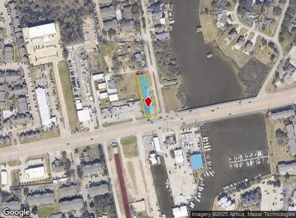
Property Record
2600 Nasa Pkwy, Seabrook, TX 77586


NEARBY LISTINGS FOR SALE OR LEASE
Property Detail
2600 Nasa Pkwy
Houston-The Woodlands-Sugar Land, TX
Lakeside Terrace
0772290020009
LT 9 & TR 10 BLK B LAKESIDE TERRACE
Officebuilding
Harris
AE
Texas
48167C0041G
9
2024
0.53 AC
2025
NASA/Clear Lake
341502
Houston
6,400 SF
DEMOGRAPHICS near 2600 Nasa Pkwy
1 Mile
3 Mile
5 Mile
2024 Total Population
9,255
47,370
115,126
2029 Population
9,596
48,959
119,160
Pop Growth 2024-2029
+ 3.68%
+ 3.35%
+ 3.50%
Average Age
40
41
39
2024 Total Households
4,230
19,930
47,599
HH Growth 2024-2029
+ 3.81%
+ 3.49%
+ 3.56%
Median Household Inc
$76,978
$98,071
$91,812
Avg Household Size
2.20
2.30
2.40
2024 Avg HH Vehicles
2.00
2.00
2.00
Median Home Value
$290,927
$306,957
$295,469
Median Year Built
1984
1991
1990
Nearby Places
Map Layers
Map Styles
 Street
 Aerial
- Restaurants
- Banks
- Shops
- Fitness
- Groceries
PUBLIC TRANSPORTATION
AIRPORT
William P Hobby
DRIVE
WALK
Distance
William P Hobby
35 min
20.0 mi
George Bush Intcntl/Houston
DRIVE
WALK
Distance
George Bush Intcntl/Houston
57 min
43.9 mi
SALE & LEASE HISTORY
LISTING DATE
SALE/LEASE

Oct 14, 2024
For Lease
Nov 07, 2023
For Lease
Mar 03, 2021
For Sale
Aug 16, 2019
For Lease
Nearby Properties
Address
Land Use
TOTAL SIZE
Lot Size
Zoning
Address
Land Use
TOTAL SIZE
Lot Size
Zoning
Address
Land Use
TOTAL SIZE
Lot Size
Zoning
7.04 AC
Address
Land Use
TOTAL SIZE
Lot Size
Zoning
Address
Land Use
TOTAL SIZE
Lot Size
Zoning
780,870 SF
22.72 AC
Address
Land Use
TOTAL SIZE
Lot Size
Zoning
400,835 SF
14.73 AC
Address
Land Use
TOTAL SIZE
Lot Size
Zoning
320,892 SF
15 AC
Address
Land Use
TOTAL SIZE
Lot Size
Zoning
468,294 SF
31.94 AC
Address
Land Use
TOTAL SIZE
Lot Size
Zoning
372,183 SF
11.16 AC
Address
Land Use
TOTAL SIZE
Lot Size
Zoning
415,941 SF
14.35 AC
Address
Land Use
TOTAL SIZE
Lot Size
Zoning
260,988 SF
11.78 AC
Address
Land Use
TOTAL SIZE
Lot Size
Zoning
370,220 SF
28.57 AC
Address
Land Use
TOTAL SIZE
Lot Size
Zoning
126.63 AC
Address
Land Use
TOTAL SIZE
Lot Size
Zoning
273,648 SF
11.48 AC
Address
Land Use
TOTAL SIZE
Lot Size
Zoning
281,944 SF
20.68 AC
Address
Land Use
TOTAL SIZE
Lot Size
Zoning
330,600 SF
14.88 AC
Address
Land Use
TOTAL SIZE
Lot Size
Zoning
196,951 SF
10.90 AC
Address
Land Use
TOTAL SIZE
Lot Size
Zoning
253,306 SF
12.33 AC
Address
Land Use
TOTAL SIZE
Lot Size
Zoning
188,850 SF
9.28 AC
Address
Land Use
TOTAL SIZE
Lot Size
Zoning
214,074 SF
12.70 AC
Address
Land Use
TOTAL SIZE
Lot Size
Zoning
207,624 SF
10.66 AC
Address
Land Use
TOTAL SIZE
Lot Size
Zoning
243,360 SF
12.22 AC
Address
Land Use
TOTAL SIZE
Lot Size
Zoning
227,210 SF
14.88 AC
Address
Land Use
TOTAL SIZE
Lot Size
Zoning
222,005 SF
14.55 AC
Address
Land Use
TOTAL SIZE
Lot Size
Zoning
210,641 SF
7.59 AC
Address
Land Use
TOTAL SIZE
Lot Size
Zoning
93,704 SF
7.81 AC
Address
Land Use
TOTAL SIZE
Lot Size
Zoning
256,771 SF
3.86 AC
Address
Land Use
TOTAL SIZE
Lot Size
Zoning
197,268 SF
3.43 AC
Address
Land Use
TOTAL SIZE
Lot Size
Zoning
115,444 SF
8.42 AC
Address
Land Use
TOTAL SIZE
Lot Size
Zoning
218,026 SF
13.13 AC
Address
Land Use
TOTAL SIZE
Lot Size
Zoning
180,139 SF
4.72 AC
The World's #1 Commercial Real Estate Marketplace
Connect with us
© 2025 CoStar Group
The information above has been obtained from sources believed reliable. While we do not doubt its accuracy we have not verified it and make no guarantee, warranty or representation about it. It is your responsibility to independently confirm its accuracy and completeness. Any projections, opinions, assumptions, or estimates used are for example only and do not represent the current or future performance of the property. The value of this transaction to you depends on tax and other factors which should be evaluated by your tax, financial, and legal advisors. You and your advisors should conduct a careful, independent investigation of the property to determine to your satisfaction the suitability of the property for your needs.