Property Record
2600 New Jersey Ave, Wildwood, NJ 08260


NEARBY LISTINGS FOR SALE OR LEASE
Property Detail
2600 New Jersey Ave
Atlantic City-Hammonton, NJ
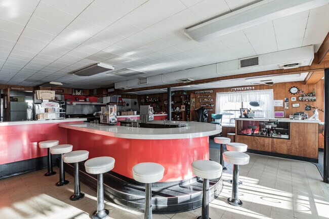
L16.02, RESTAURANT
14-00253-0000-00015-02
Cape May
Restaurantbuilding
New Jersey
AE
15.2
34009C0306F
0.09 AC
2024
South Shore/Vineland
2025
Other Market Areas
021400
DEMOGRAPHICS near 2600 New Jersey Ave
1 Mile
3 Mile
5 Mile
2024 Total Population
8,827
18,518
26,361
2029 Population
9,482
20,162
27,543
Pop Growth 2024-2029
+ 7.42%
+ 8.88%
+ 4.48%
Average Age
46
48
48
2024 Total Households
3,891
8,358
11,706
HH Growth 2024-2029
+ 5.86%
+ 7.68%
+ 3.91%
Median Household Inc
$52,970
$63,521
$69,746
Avg Household Size
2.10
2.10
2.10
2024 Avg HH Vehicles
1.00
1.00
2.00
Median Home Value
$328,813
$360,759
$359,788
Median Year Built
1964
1972
1977
Nearby Places
Map Layers
Map Styles
 Street
 Aerial
- Restaurants
- Banks
- Shops
- Fitness
- Groceries
SALE & LEASE HISTORY
LISTING DATE
SALE/LEASE

Feb 23, 2025
For Sale
Nearby Properties
Address
Land Use
TOTAL SIZE
Lot Size
Zoning
Address
Land Use
TOTAL SIZE
Lot Size
Zoning
165,600 SF
10.73 AC
BRZ
Address
Land Use
TOTAL SIZE
Lot Size
Zoning
3.93 AC
NWM
Address
Land Use
TOTAL SIZE
Lot Size
Zoning
11.41 AC
REC
Address
Land Use
TOTAL SIZE
Lot Size
Zoning
74,412 SF
2.55 AC
ROSE
Address
Land Use
TOTAL SIZE
Lot Size
Zoning
1.40 AC
B
Address
Land Use
TOTAL SIZE
Lot Size
Zoning
2.30 AC
ROSE
Address
Land Use
TOTAL SIZE
Lot Size
Zoning
0.55 AC
M-1A
Address
Land Use
TOTAL SIZE
Lot Size
Zoning
87 SF
M-1A
Address
Land Use
TOTAL SIZE
Lot Size
Zoning
2.25 AC
PARZ
Address
Land Use
TOTAL SIZE
Lot Size
Zoning
0.92 AC
M-1A
Address
Land Use
TOTAL SIZE
Lot Size
Zoning
0.92 AC
M-1A
Address
Land Use
TOTAL SIZE
Lot Size
Zoning
0.92 AC
M-1A
Address
Land Use
TOTAL SIZE
Lot Size
Zoning
5.97 AC
P
Address
Land Use
TOTAL SIZE
Lot Size
Zoning
47,053 SF
0.98 AC
M-1A
Address
Land Use
TOTAL SIZE
Lot Size
Zoning
12,424 SF
1.19 AC
T
Address
Land Use
TOTAL SIZE
Lot Size
Zoning
2.31 AC
RM
Address
Land Use
TOTAL SIZE
Lot Size
Zoning
0.92 AC
M-1A
Address
Land Use
TOTAL SIZE
Lot Size
Zoning
94.91 AC
C
Address
Land Use
TOTAL SIZE
Lot Size
Zoning
10.50 AC
P
Address
Land Use
TOTAL SIZE
Lot Size
Zoning
1.25 AC
M-1B
Address
Land Use
TOTAL SIZE
Lot Size
Zoning
23,156 SF
1.47 AC
M-1C
Address
Land Use
TOTAL SIZE
Lot Size
Zoning
0.74 AC
M-1C
Address
Land Use
TOTAL SIZE
Lot Size
Zoning
3,073 SF
1.74 AC
REC
Address
Land Use
TOTAL SIZE
Lot Size
Zoning
10.88 AC
Address
Land Use
TOTAL SIZE
Lot Size
Zoning
0.64 AC
PARZ
Address
Land Use
TOTAL SIZE
Lot Size
Zoning
0.46 AC
M-1A
Address
Land Use
TOTAL SIZE
Lot Size
Zoning
1.74 AC
REC
Address
Land Use
TOTAL SIZE
Lot Size
Zoning
1.10 AC
OS
Address
Land Use
TOTAL SIZE
Lot Size
Zoning
13,980 SF
2.18 AC
R1
Address
Land Use
TOTAL SIZE
Lot Size
Zoning
0.46 AC
M-1A
The World's #1 Commercial Real Estate Marketplace
Connect with us
© 2026 CoStar Group
The information above has been obtained from sources believed reliable. While we do not doubt its accuracy we have not verified it and make no guarantee, warranty or representation about it. It is your responsibility to independently confirm its accuracy and completeness. Any projections, opinions, assumptions, or estimates used are for example only and do not represent the current or future performance of the property. The value of this transaction to you depends on tax and other factors which should be evaluated by your tax, financial, and legal advisors. You and your advisors should conduct a careful, independent investigation of the property to determine to your satisfaction the suitability of the property for your needs.