Property Record
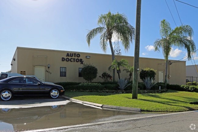
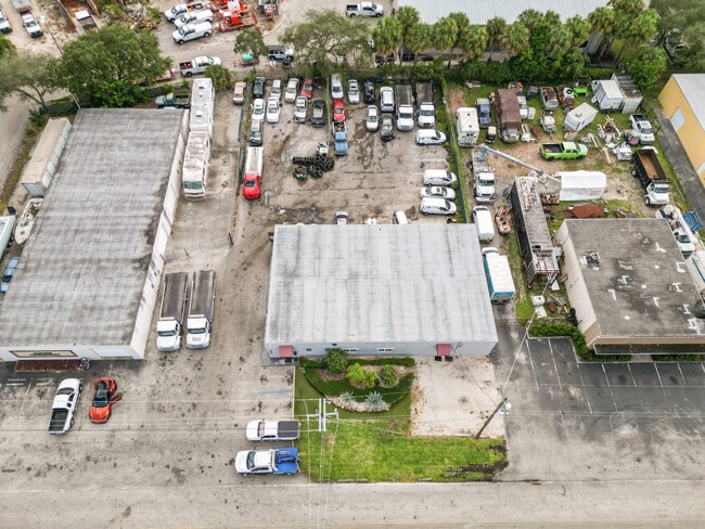
2600 Nw 1St Ave, Boca Raton, FL 33431

This Property Is For Sale
NEARBY LISTINGS FOR SALE OR LEASE
Property Detail
2600 Nw 1St Ave
06-43-47-07-02-034-0200
Boca Raton Hills
Warehouse
BOCA RATON HILLS SEC 3 PT OF PARCEL W LYG BET NW 1ST AVE & FEC RY R/W IN OR1559P188
X
Palm Beach
12099C1177F
Florida
2024
0.41 AC
2025
Boca Raton East
007202
South Florida
4,000 SF
West Palm Beach-Boca Raton-Delray Beach, FL
DEMOGRAPHICS near 2600 Nw 1St Ave
1 Mile
3 Mile
5 Mile
2024 Total Population
13,549
80,277
205,977
2029 Population
14,413
85,357
216,145
Pop Growth 2024-2029
+ 6.38%
+ 6.33%
+ 4.94%
Average Age
43
45
47
2024 Total Households
5,764
34,668
93,574
HH Growth 2024-2029
+ 7.13%
+ 6.85%
+ 5.06%
Median Household Inc
$86,352
$92,729
$79,349
Avg Household Size
2.10
2.10
2.00
2024 Avg HH Vehicles
2.00
2.00
2.00
Median Home Value
$475,995
$626,107
$496,823
Median Year Built
1980
1983
1983
Nearby Places
Map Layers
Map Styles
 Street
 Aerial
- Restaurants
- Banks
- Shops
- Fitness
- Groceries
PUBLIC TRANSPORTATION
COMMUTER RAIL
Boca Raton (Mainline - Brightline)
DRIVE
WALK
Distance
Boca Raton (Mainline - Brightline)
4 min
2.0 mi
Boca Raton (Tri-County Commuter - South Florida Regional Transportation Authority (Tri-Rail))
DRIVE
WALK
Distance
Boca Raton (Tri-County Commuter - South Florida Regional Transportation Authority (Tri-Rail))
8 min
3.3 mi
AIRPORT
Palm Beach International
DRIVE
WALK
Distance
Palm Beach International
34 min
24.8 mi
Fort Lauderdale/Hollywood International
DRIVE
WALK
Distance
Fort Lauderdale/Hollywood International
37 min
26.5 mi
Freight Ports
Port Everglades
DRIVE
WALK
Distance
Port Everglades
36 min
25.1 mi
Nearby Properties
Address
Land Use
TOTAL SIZE
Lot Size
Zoning
Address
Land Use
TOTAL SIZE
Lot Size
Zoning
824,107 SF
39.08 AC
CITY CG
Address
Land Use
TOTAL SIZE
Lot Size
Zoning
2,250,267 SF
260 AC
PL
Address
Land Use
TOTAL SIZE
Lot Size
Zoning
1,481,767 SF
34.49 AC
R-5
Address
Land Use
TOTAL SIZE
Lot Size
Zoning
2,361,481 SF
120.60 AC
PL
Address
Land Use
TOTAL SIZE
Lot Size
Zoning
501,966 SF
5.82 AC
R1D/DDRI
Address
Land Use
TOTAL SIZE
Lot Size
Zoning
779,243 SF
205.02 AC
PL
Address
Land Use
TOTAL SIZE
Lot Size
Zoning
505,418 SF
1.98 AC
DDRI
Address
Land Use
TOTAL SIZE
Lot Size
Zoning
547,946 SF
13.89 AC
DDRI
Address
Land Use
TOTAL SIZE
Lot Size
Zoning
491,320 SF
11.51 AC
LIRP PMD
Address
Land Use
TOTAL SIZE
Lot Size
Zoning
437,556 SF
11.50 AC
LIRP PMD
Address
Land Use
TOTAL SIZE
Lot Size
Zoning
467,728 SF
18.73 AC
LIRP PMD
Address
Land Use
TOTAL SIZE
Lot Size
Zoning
691,385 SF
9.12 AC
DDRI
Address
Land Use
TOTAL SIZE
Lot Size
Zoning
791,490 SF
114.95 AC
R-1-A
Address
Land Use
TOTAL SIZE
Lot Size
Zoning
388,471 SF
12.42 AC
R5A-PUD
Address
Land Use
TOTAL SIZE
Lot Size
Zoning
1,949,101 SF
123.29 AC
LIRP
Address
Land Use
TOTAL SIZE
Lot Size
Zoning
373,856 SF
4.12 AC
LIRP PMD
Address
Land Use
TOTAL SIZE
Lot Size
Zoning
360,718 SF
3.67 AC
LIRP PMD
Address
Land Use
TOTAL SIZE
Lot Size
Zoning
760,812 SF
23.60 AC
MC
Address
Land Use
TOTAL SIZE
Lot Size
Zoning
542,392 SF
27.95 AC
R-1-D
Address
Land Use
TOTAL SIZE
Lot Size
Zoning
617,920 SF
7.75 AC
R-B-1
Address
Land Use
TOTAL SIZE
Lot Size
Zoning
293,358 SF
9.05 AC
LIRP PMD
Address
Land Use
TOTAL SIZE
Lot Size
Zoning
267,063 SF
2.33 AC
DDRI
Address
Land Use
TOTAL SIZE
Lot Size
Zoning
350,010 SF
8.36 AC
R-3-B
Address
Land Use
TOTAL SIZE
Lot Size
Zoning
275,784 SF
2.27 AC
DDRI
Address
Land Use
TOTAL SIZE
Lot Size
Zoning
377,672 SF
35.64 AC
PL
Address
Land Use
TOTAL SIZE
Lot Size
Zoning
228,097 SF
10.63 AC
M-2
Address
Land Use
TOTAL SIZE
Lot Size
Zoning
240,841 SF
2.08 AC
DDRI
Address
Land Use
TOTAL SIZE
Lot Size
Zoning
242,023 SF
15.38 AC
RS
Address
Land Use
TOTAL SIZE
Lot Size
Zoning
259,054 SF
14.95 AC
POI
Address
Land Use
TOTAL SIZE
Lot Size
Zoning
230,420 SF
2.64 AC
DDRI
The World's #1 Commercial Real Estate Marketplace
Connect with us
© 2026 CoStar Group
The information above has been obtained from sources believed reliable. While we do not doubt its accuracy we have not verified it and make no guarantee, warranty or representation about it. It is your responsibility to independently confirm its accuracy and completeness. Any projections, opinions, assumptions, or estimates used are for example only and do not represent the current or future performance of the property. The value of this transaction to you depends on tax and other factors which should be evaluated by your tax, financial, and legal advisors. You and your advisors should conduct a careful, independent investigation of the property to determine to your satisfaction the suitability of the property for your needs.