Property Record
2600 Prairie Rd, Eugene, OR 97402


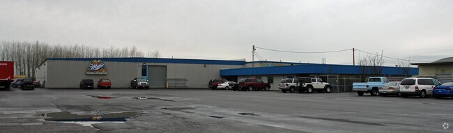
Property Detail
2600 Prairie Rd
Eugene-Springfield, OR
TL 04401
1252277
Lane
Industrialgeneral
Oregon
I-2
4401
B and X Area of moderate flood hazard, usually the area between the limits of the 100-year and 500-year floods.
7.57 AC
2025
Lane County
2025
Portland
002403
NEARBY LISTINGS FOR SALE OR LEASE
DEMOGRAPHICS near 2600 Prairie Rd
1 mile
3 mile
5 mile
2025 Total Population
6,393
67,872
119,988
2030 Population
6,289
66,947
118,710
Pop Growth 2025-2030
(1.63%)
(1.36%)
(1.07%)
Average Age
43
42
42
2025 Total Households
2,442
25,736
49,354
HH Growth 2025-2030
(1.68%)
(1.52%)
(1.19%)
Median Household Inc
$81,029
$73,294
$71,095
Avg Household Size
2.50
2.40
2.30
2025 Avg HH Vehicles
2.00
2.00
2.00
Median Home Value
$424,917
$392,507
$422,356
Median Year Built
1989
1979
1978
Nearby Places
Map Layers
Map Styles
 Street
 Aerial
Transit
 Traffic
 Biking
Places
Listings with unknown addresses are not visible on the map
- Restaurants
- Banks
- Shops
- Fitness
- Groceries
PUBLIC TRANSPORTATION
COMMUTER RAIL
Drive
Walk
Distance
11 min
5.8 mi
AIRPORT
Mahlon Sweet Field
Drive
Walk
Distance
Mahlon Sweet Field
9 min
3.8 mi
Nearby Properties
Address
Land Use
TOTAL SIZE
Lot Size
Zoning
Address
Land Use
TOTAL SIZE
Lot Size
Zoning
Address
Land Use
TOTAL SIZE
Lot Size
Zoning
44.56 AC
PL
Address
Land Use
TOTAL SIZE
Lot Size
Zoning
12.42 AC
AG
Address
Land Use
TOTAL SIZE
Lot Size
Zoning
11.80 AC
PL
Address
Land Use
TOTAL SIZE
Lot Size
Zoning
480 SF
35.67 AC
AG
Address
Land Use
TOTAL SIZE
Lot Size
Zoning
664.30 AC
AO
Address
Land Use
TOTAL SIZE
Lot Size
Zoning
121.21 AC
E40
Address
Land Use
TOTAL SIZE
Lot Size
Zoning
Address
Land Use
TOTAL SIZE
Lot Size
Zoning
22.83 AC
PL
Address
Land Use
TOTAL SIZE
Lot Size
Zoning
45.78 AC
I-3
Address
Land Use
TOTAL SIZE
Lot Size
Zoning
Address
Land Use
TOTAL SIZE
Lot Size
Zoning
6.94 AC
PL
Address
Land Use
TOTAL SIZE
Lot Size
Zoning
14.14 AC
R-1
Address
Land Use
TOTAL SIZE
Lot Size
Zoning
27.47 AC
R-1
Address
Land Use
TOTAL SIZE
Lot Size
Zoning
4.67 AC
PL
Address
Land Use
TOTAL SIZE
Lot Size
Zoning
44.67 AC
I-2
Address
Land Use
TOTAL SIZE
Lot Size
Zoning
4.85 AC
PL
Address
Land Use
TOTAL SIZE
Lot Size
Zoning
29.96 AC
AG
Address
Land Use
TOTAL SIZE
Lot Size
Zoning
14.20 AC
R-1
Address
Land Use
TOTAL SIZE
Lot Size
Zoning
3,634 SF
6.34 AC
R-2
Address
Land Use
TOTAL SIZE
Lot Size
Zoning
12.36 AC
C-1
Address
Land Use
TOTAL SIZE
Lot Size
Zoning
5.98 AC
PL
Address
Land Use
TOTAL SIZE
Lot Size
Zoning
0.97 AC
PL
Address
Land Use
TOTAL SIZE
Lot Size
Zoning
6.94 AC
R-1
Address
Land Use
TOTAL SIZE
Lot Size
Zoning
33.70 AC
R-1
Address
Land Use
TOTAL SIZE
Lot Size
Zoning
3.53 AC
PL
Address
Land Use
TOTAL SIZE
Lot Size
Zoning
37.58 AC
PL
Address
Land Use
TOTAL SIZE
Lot Size
Zoning
3.28 AC
PL
Address
Land Use
TOTAL SIZE
Lot Size
Zoning
Address
Land Use
TOTAL SIZE
Lot Size
Zoning
9.30 AC
R-2
The World's #1 Commercial Real Estate Marketplace
Connect with us
© 2026 CoStar Group
The information above has been obtained from sources believed reliable. While we do not doubt its accuracy we have not verified it and make no guarantee, warranty or representation about it. It is your responsibility to independently confirm its accuracy and completeness. Any projections, opinions, assumptions, or estimates used are for example only and do not represent the current or future performance of the property. The value of this transaction to you depends on tax and other factors which should be evaluated by your tax, financial, and legal advisors. You and your advisors should conduct a careful, independent investigation of the property to determine to your satisfaction the suitability of the property for your needs.