Property Record
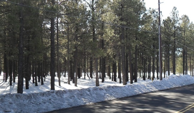
2600 S Flagstaff Ranch Rd, Flagstaff, AZ 86001

Property Detail
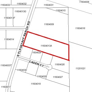
2600 S Flagstaff Ranch Rd
116-04-013A
SIXTEENTH: SW QUARTER: NE SECTION: 24 TOWNSHIP: 21N RANGE: 06E POR DESC AS FLLWS: BEG REF C-N 1/16 COR SEC 24 TH N 89-57-40 E 733.17; TH S 17-49-01 W 451.90 THE POB; TH S 72-10-50 E 780.53; TH S 01-01-19 E 278.75; TH N 72-11-12 W 870.55; TH N 17-49-0
Publicstorage
COCONINO
B and X Area of moderate flood hazard, usually the area between the limits of the 100-year and 500-year floods.
Arizona
2024
5 AC
2025
Flagstaff
001104
Other Market Areas
84,335 SF
Flagstaff, AZ
NEARBY LISTINGS FOR SALE OR LEASE
DEMOGRAPHICS near 2600 S Flagstaff Ranch Rd
1 mile
3 mile
5 mile
2024 Total Population
990
28,014
52,885
2029 Population
1,081
28,101
52,703
Pop Growth 2024-2029
+ 9.19%
+ 0.31%
(0.34%)
Average Age
43
30
32
2024 Total Households
379
7,970
16,880
HH Growth 2024-2029
+ 8.71%
(0.63%)
(1.40%)
Median Household Inc
$172,368
$64,527
$66,835
Avg Household Size
2.50
2.40
2.40
2024 Avg HH Vehicles
2.00
2.00
2.00
Median Home Value
$777,906
$631,738
$671,562
Median Year Built
2010
1999
1995
Nearby Places
Map Layers
Map Styles
 Street
 Aerial
Transit
 Traffic
 Biking
Places
Listings with unknown addresses are not visible on the map
- Restaurants
- Banks
- Shops
- Fitness
- Groceries
PUBLIC TRANSPORTATION
COMMUTER RAIL
Flagstaff (Southwest Chief - Amtrak)
Drive
Walk
Distance
Flagstaff (Southwest Chief - Amtrak)
7 min
3.9 mi
AIRPORT
Flagstaff Pulliam
Drive
Walk
Distance
Flagstaff Pulliam
11 min
6.6 mi
Freight Ports
Port of San Diego
Drive
Walk
Distance
Port of San Diego
535 min
489.2 mi
Nearby Properties
Address
Land Use
TOTAL SIZE
Lot Size
Zoning
Address
Land Use
TOTAL SIZE
Lot Size
Zoning
579,936 SF
6.07 AC
Address
Land Use
TOTAL SIZE
Lot Size
Zoning
602,053 SF
4.81 AC
Address
Land Use
TOTAL SIZE
Lot Size
Zoning
544,788 SF
93.65 AC
Address
Land Use
TOTAL SIZE
Lot Size
Zoning
366,782 SF
2.01 AC
Address
Land Use
TOTAL SIZE
Lot Size
Zoning
233,703 SF
14.92 AC
Address
Land Use
TOTAL SIZE
Lot Size
Zoning
178,737 SF
7.35 AC
Address
Land Use
TOTAL SIZE
Lot Size
Zoning
182,018 SF
11.28 AC
Address
Land Use
TOTAL SIZE
Lot Size
Zoning
176,750 SF
9.53 AC
Address
Land Use
TOTAL SIZE
Lot Size
Zoning
124,394 SF
3.84 AC
Address
Land Use
TOTAL SIZE
Lot Size
Zoning
116,631 SF
5.60 AC
Address
Land Use
TOTAL SIZE
Lot Size
Zoning
141,415 SF
11.27 AC
Address
Land Use
TOTAL SIZE
Lot Size
Zoning
109,305 SF
5.17 AC
Address
Land Use
TOTAL SIZE
Lot Size
Zoning
109,940 SF
6.35 AC
Address
Land Use
TOTAL SIZE
Lot Size
Zoning
96,074 SF
5.48 AC
Address
Land Use
TOTAL SIZE
Lot Size
Zoning
85,008 SF
4.66 AC
Address
Land Use
TOTAL SIZE
Lot Size
Zoning
107,241 SF
9.73 AC
Address
Land Use
TOTAL SIZE
Lot Size
Zoning
109,043 SF
9.01 AC
Address
Land Use
TOTAL SIZE
Lot Size
Zoning
68,065 SF
6.32 AC
Address
Land Use
TOTAL SIZE
Lot Size
Zoning
99,762 SF
5.02 AC
Address
Land Use
TOTAL SIZE
Lot Size
Zoning
88,361 SF
2.91 AC
Address
Land Use
TOTAL SIZE
Lot Size
Zoning
59,846 SF
6.23 AC
Address
Land Use
TOTAL SIZE
Lot Size
Zoning
147,197 SF
17.78 AC
Address
Land Use
TOTAL SIZE
Lot Size
Zoning
59,760 SF
8.05 AC
Address
Land Use
TOTAL SIZE
Lot Size
Zoning
118,276 SF
6.20 AC
Address
Land Use
TOTAL SIZE
Lot Size
Zoning
82,534 SF
2.08 AC
Address
Land Use
TOTAL SIZE
Lot Size
Zoning
50,321 SF
4.40 AC
Address
Land Use
TOTAL SIZE
Lot Size
Zoning
52,904 SF
6.20 AC
Address
Land Use
TOTAL SIZE
Lot Size
Zoning
68,220 SF
4.01 AC
Address
Land Use
TOTAL SIZE
Lot Size
Zoning
65,290 SF
2.18 AC
Address
Land Use
TOTAL SIZE
Lot Size
Zoning
65,348 SF
4.15 AC
The World's #1 Commercial Real Estate Marketplace
Connect with us
© 2026 CoStar Group
The information above has been obtained from sources believed reliable. While we do not doubt its accuracy we have not verified it and make no guarantee, warranty or representation about it. It is your responsibility to independently confirm its accuracy and completeness. Any projections, opinions, assumptions, or estimates used are for example only and do not represent the current or future performance of the property. The value of this transaction to you depends on tax and other factors which should be evaluated by your tax, financial, and legal advisors. You and your advisors should conduct a careful, independent investigation of the property to determine to your satisfaction the suitability of the property for your needs.