Property Record
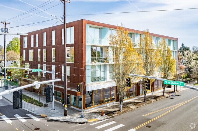
2600 Se Division St, Portland, OR 97202

Property Detail
2600 Se Division St
R623931
CLINTON CONDOMINIUMS, LOT 408
Commercialcondominium
Multnomah
NULL
Oregon
B and X Area of moderate flood hazard, usually the area between the limits of the 100-year and 500-year floods.
408
2025
Hosford-Abernethy
2025
Portland
000901
Portland-Vancouver-Hillsboro, OR-WA
3,966 SF
NEARBY LISTINGS FOR SALE OR LEASE
DEMOGRAPHICS near 2600 Se Division St
1 mile
3 mile
5 mile
2024 Total Population
30,029
226,189
487,037
2029 Population
29,638
224,765
483,025
Pop Growth 2024-2029
(1.30%)
(0.63%)
(0.82%)
Average Age
39
41
41
2024 Total Households
14,267
111,531
220,560
HH Growth 2024-2029
(1.62%)
(0.65%)
(0.91%)
Median Household Inc
$99,348
$89,809
$90,946
Avg Household Size
2.00
1.90
2.10
2024 Avg HH Vehicles
1.00
1.00
1.00
Median Home Value
$723,928
$702,901
$652,264
Median Year Built
1948
1962
1962
Nearby Places
Map Layers
Map Styles
 Street
 Aerial
Transit
 Traffic
 Biking
Places
Listings with unknown addresses are not visible on the map
- Restaurants
- Banks
- Shops
- Fitness
- Groceries
PUBLIC TRANSPORTATION
TRANSIT/SUBWAY
Clinton St/Se 12Th Ave Max Station (MAX Orange Line - TriMet)
Drive
Walk
Distance
Clinton St/Se 12Th Ave Max Station (MAX Orange Line - TriMet)
3 min
16 min
0.8 mi
Se 17Th Ave & Rhine St Max Station (MAX Orange Line - TriMet)
Drive
Walk
Distance
Se 17Th Ave & Rhine St Max Station (MAX Orange Line - TriMet)
4 min
18 min
0.9 mi
COMMUTER RAIL
Portland (Amtrak Cascades - Amtrak, Coast Starlight - Amtrak, Empire Builder - Amtrak)
Drive
Walk
Distance
Portland (Amtrak Cascades - Amtrak, Coast Starlight - Amtrak, Empire Builder - Amtrak)
10 min
3.3 mi
AIRPORT
Portland International
Drive
Walk
Distance
Portland International
23 min
8.8 mi
Freight Ports
Port of Portland
Drive
Walk
Distance
Port of Portland
13 min
6.3 mi
SALE & LEASE HISTORY
LISTING DATE
SALE/LEASE

Nov 16, 2022
For Sale
Nov 08, 2022
For Sale
Nov 08, 2022
For Lease
Aug 23, 2024
For Sale
Apr 07, 2022
For Sale
Nearby Properties
Address
Land Use
TOTAL SIZE
Lot Size
Zoning
Address
Land Use
TOTAL SIZE
Lot Size
Zoning
27.58 AC
EX
Address
Land Use
TOTAL SIZE
Lot Size
Zoning
627,500 SF
16.60 AC
CX
Address
Land Use
TOTAL SIZE
Lot Size
Zoning
822,867 SF
103.39 AC
CI1
Address
Land Use
TOTAL SIZE
Lot Size
Zoning
560,000 SF
0.15 AC
CX
Address
Land Use
TOTAL SIZE
Lot Size
Zoning
409,260 SF
7.41 AC
EX
Address
Land Use
TOTAL SIZE
Lot Size
Zoning
1.09 AC
EX
Address
Land Use
TOTAL SIZE
Lot Size
Zoning
2.24 AC
CX
Address
Land Use
TOTAL SIZE
Lot Size
Zoning
304,836 SF
10.85 AC
CX
Address
Land Use
TOTAL SIZE
Lot Size
Zoning
417,324 SF
0.68 AC
CX
Address
Land Use
TOTAL SIZE
Lot Size
Zoning
598,328 SF
12.32 AC
CX
Address
Land Use
TOTAL SIZE
Lot Size
Zoning
257,700 SF
2.89 AC
EX
Address
Land Use
TOTAL SIZE
Lot Size
Zoning
178,785 SF
10.20 AC
R5
Address
Land Use
TOTAL SIZE
Lot Size
Zoning
128,500 SF
6.95 AC
OS
Address
Land Use
TOTAL SIZE
Lot Size
Zoning
460,000 SF
0.92 AC
CX
Address
Land Use
TOTAL SIZE
Lot Size
Zoning
689,840 SF
0.92 AC
CX
Address
Land Use
TOTAL SIZE
Lot Size
Zoning
125,217 SF
0.23 AC
CX
Address
Land Use
TOTAL SIZE
Lot Size
Zoning
7.78 AC
EX
Address
Land Use
TOTAL SIZE
Lot Size
Zoning
183,664 SF
8.96 AC
R5
Address
Land Use
TOTAL SIZE
Lot Size
Zoning
426,742 SF
0.53 AC
RXD
Address
Land Use
TOTAL SIZE
Lot Size
Zoning
584,483 SF
0.90 AC
CX
Address
Land Use
TOTAL SIZE
Lot Size
Zoning
280,069 SF
18.31 AC
IR
Address
Land Use
TOTAL SIZE
Lot Size
Zoning
247,520 SF
7.74 AC
CX
Address
Land Use
TOTAL SIZE
Lot Size
Zoning
306,000 SF
1.21 AC
NULL
Address
Land Use
TOTAL SIZE
Lot Size
Zoning
596,161 SF
0.92 AC
CX
Address
Land Use
TOTAL SIZE
Lot Size
Zoning
456,760 SF
0.53 AC
EX
Address
Land Use
TOTAL SIZE
Lot Size
Zoning
387,000 SF
0.88 AC
CXD
Address
Land Use
TOTAL SIZE
Lot Size
Zoning
473,746 SF
1.68 AC
Address
Land Use
TOTAL SIZE
Lot Size
Zoning
291,451 SF
1.64 AC
RH
Address
Land Use
TOTAL SIZE
Lot Size
Zoning
262,645 SF
1 AC
CX
Address
Land Use
TOTAL SIZE
Lot Size
Zoning
354,677 SF
0.79 AC
CX
The World's #1 Commercial Real Estate Marketplace
Connect with us
© 2026 CoStar Group
The information above has been obtained from sources believed reliable. While we do not doubt its accuracy we have not verified it and make no guarantee, warranty or representation about it. It is your responsibility to independently confirm its accuracy and completeness. Any projections, opinions, assumptions, or estimates used are for example only and do not represent the current or future performance of the property. The value of this transaction to you depends on tax and other factors which should be evaluated by your tax, financial, and legal advisors. You and your advisors should conduct a careful, independent investigation of the property to determine to your satisfaction the suitability of the property for your needs.