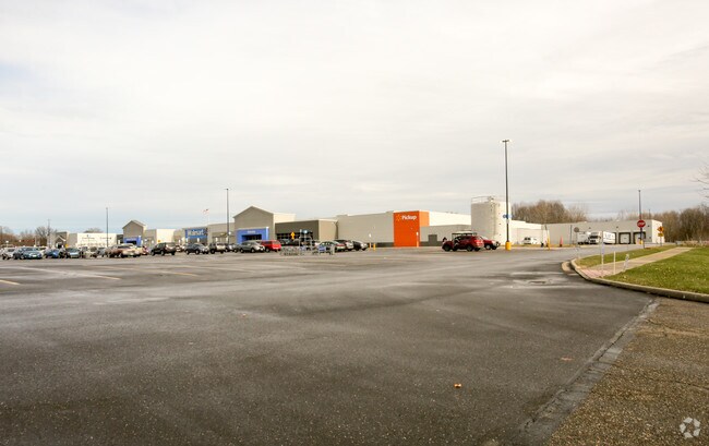
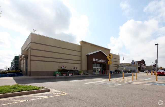
Property Record
2600 State Route 59, Ravenna, OH 44266


NEARBY LISTINGS FOR SALE OR LEASE
Property Detail
2600 State Route 59
Akron, OH
Franklin
29-357-00-00-023-004
LOT 57
Regionalshoppingcenterormallwithanchorstore
Portage
X
Ohio
39133C0143D
57
2024
9.87 AC
2024
Portage County
601100
Cleveland
191,340 SF
DEMOGRAPHICS near 2600 State Route 59
1 Mile
3 Mile
5 Mile
2024 Total Population
1,800
37,102
69,643
2029 Population
1,829
37,658
70,756
Pop Growth 2024-2029
+ 1.61%
+ 1.50%
+ 1.60%
Average Age
42
35
38
2024 Total Households
848
14,475
28,930
HH Growth 2024-2029
+ 1.53%
+ 1.82%
+ 1.70%
Median Household Inc
$34,624
$37,500
$49,467
Avg Household Size
2.10
2.20
2.20
2024 Avg HH Vehicles
2.00
2.00
2.00
Median Home Value
$123,397
$147,411
$176,104
Median Year Built
1968
1973
1973
Nearby Places
Map Layers
Map Styles
 Street
 Aerial
- Restaurants
- Banks
- Shops
- Fitness
- Groceries
PUBLIC TRANSPORTATION
AIRPORT
Akron-Canton Regional
DRIVE
WALK
Distance
Akron-Canton Regional
39 min
27.4 mi
Cleveland-Hopkins International
DRIVE
WALK
Distance
Cleveland-Hopkins International
65 min
45.5 mi
SALE & LEASE HISTORY
LISTING DATE
SALE/LEASE

Sep 24, 2016
For Lease
Oct 18, 2016
For Lease
Nearby Properties
Address
Land Use
TOTAL SIZE
Lot Size
Zoning
Address
Land Use
TOTAL SIZE
Lot Size
Zoning
871,059 SF
404.65 AC
Address
Land Use
TOTAL SIZE
Lot Size
Zoning
485,791 SF
53.13 AC
Address
Land Use
TOTAL SIZE
Lot Size
Zoning
139,790 SF
102.12 AC
Address
Land Use
TOTAL SIZE
Lot Size
Zoning
183,977 SF
10.12 AC
Address
Land Use
TOTAL SIZE
Lot Size
Zoning
86,411 SF
0.23 AC
Address
Land Use
TOTAL SIZE
Lot Size
Zoning
173,811 SF
9.34 AC
Address
Land Use
TOTAL SIZE
Lot Size
Zoning
61,748 SF
17.12 AC
Address
Land Use
TOTAL SIZE
Lot Size
Zoning
57,455 SF
28.81 AC
Address
Land Use
TOTAL SIZE
Lot Size
Zoning
141,562 SF
1.63 AC
Address
Land Use
TOTAL SIZE
Lot Size
Zoning
150,616 SF
12.63 AC
Address
Land Use
TOTAL SIZE
Lot Size
Zoning
161,135 SF
68.79 AC
Address
Land Use
TOTAL SIZE
Lot Size
Zoning
179,055 SF
19.68 AC
Address
Land Use
TOTAL SIZE
Lot Size
Zoning
8.12 AC
Address
Land Use
TOTAL SIZE
Lot Size
Zoning
28,438 SF
9 AC
Address
Land Use
TOTAL SIZE
Lot Size
Zoning
310,705 SF
9.96 AC
Address
Land Use
TOTAL SIZE
Lot Size
Zoning
216,994 SF
10.94 AC
Address
Land Use
TOTAL SIZE
Lot Size
Zoning
5.75 AC
Address
Land Use
TOTAL SIZE
Lot Size
Zoning
34,394 SF
3.59 AC
Address
Land Use
TOTAL SIZE
Lot Size
Zoning
125,410 SF
119.68 AC
Address
Land Use
TOTAL SIZE
Lot Size
Zoning
176,320 SF
1.73 AC
Address
Land Use
TOTAL SIZE
Lot Size
Zoning
33,561 SF
2.62 AC
Address
Land Use
TOTAL SIZE
Lot Size
Zoning
73,306 SF
0.78 AC
Address
Land Use
TOTAL SIZE
Lot Size
Zoning
24,210 SF
2.34 AC
Address
Land Use
TOTAL SIZE
Lot Size
Zoning
158,664 SF
11.30 AC
Address
Land Use
TOTAL SIZE
Lot Size
Zoning
40.29 AC
Address
Land Use
TOTAL SIZE
Lot Size
Zoning
23,668 SF
2.32 AC
Address
Land Use
TOTAL SIZE
Lot Size
Zoning
66,771 SF
6.97 AC
Address
Land Use
TOTAL SIZE
Lot Size
Zoning
29,132 SF
4.47 AC
Address
Land Use
TOTAL SIZE
Lot Size
Zoning
178,341 SF
25.82 AC
The World's #1 Commercial Real Estate Marketplace
Connect with us
© 2026 CoStar Group
The information above has been obtained from sources believed reliable. While we do not doubt its accuracy we have not verified it and make no guarantee, warranty or representation about it. It is your responsibility to independently confirm its accuracy and completeness. Any projections, opinions, assumptions, or estimates used are for example only and do not represent the current or future performance of the property. The value of this transaction to you depends on tax and other factors which should be evaluated by your tax, financial, and legal advisors. You and your advisors should conduct a careful, independent investigation of the property to determine to your satisfaction the suitability of the property for your needs.