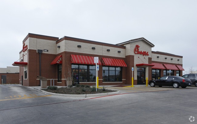
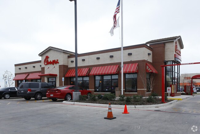
Property Record
2600 Sw Military Dr, San Antonio, TX 78224
NEARBY LISTINGS FOR SALE OR LEASE
Property Detail
2600 Sw Military Dr
San Antonio-New Braunfels, TX
Alisons Corner Subd
17550-001-0060
NCB 17550 BLK 1 LOT 6 (ALISONS CORNER SUBD) PER PLAT 9630/43-46
Restaurantdrivein
Bexar
X
Texas
48029C0560F
6
2024
0.91 AC
2025
South
151200
San Antonio
4,447 SF
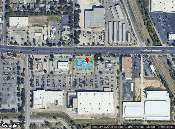
DEMOGRAPHICS near 2600 Sw Military Dr
1 Mile
3 Mile
5 Mile
2024 Total Population
10,815
99,202
241,764
2029 Population
11,416
104,852
256,883
Pop Growth 2024-2029
+ 5.56%
+ 5.70%
+ 6.25%
Average Age
37
37
36
2024 Total Households
3,575
32,159
77,325
HH Growth 2024-2029
+ 5.79%
+ 5.86%
+ 6.60%
Median Household Inc
$37,634
$43,024
$40,001
Avg Household Size
2.90
3.00
2.90
2024 Avg HH Vehicles
2.00
2.00
2.00
Median Home Value
$87,104
$106,543
$112,209
Median Year Built
1965
1962
1964
Nearby Places
Map Layers
Map Styles
 Street
 Aerial
- Restaurants
- Banks
- Shops
- Fitness
- Groceries
PUBLIC TRANSPORTATION
COMMUTER RAIL
San Antonio Amtrak Station (Sunset Limited - Amtrak, Texas Eagle - Amtrak)
DRIVE
WALK
Distance
San Antonio Amtrak Station (Sunset Limited - Amtrak, Texas Eagle - Amtrak)
13 min
7.7 mi
AIRPORT
San Antonio International
DRIVE
WALK
Distance
San Antonio International
21 min
14.0 mi
Freight Ports
Port of Corpus Christi
DRIVE
WALK
Distance
Port of Corpus Christi
151 min
144.6 mi
Nearby Properties
Address
Land Use
TOTAL SIZE
Lot Size
Zoning
Address
Land Use
TOTAL SIZE
Lot Size
Zoning
180,980 SF
1,373.90 AC
Address
Land Use
TOTAL SIZE
Lot Size
Zoning
548,048 SF
27.53 AC
Address
Land Use
TOTAL SIZE
Lot Size
Zoning
324,153 SF
17.31 AC
Address
Land Use
TOTAL SIZE
Lot Size
Zoning
447,169 SF
46.74 AC
Address
Land Use
TOTAL SIZE
Lot Size
Zoning
71,607 SF
10.46 AC
Address
Land Use
TOTAL SIZE
Lot Size
Zoning
218,003 SF
12.33 AC
Address
Land Use
TOTAL SIZE
Lot Size
Zoning
Address
Land Use
TOTAL SIZE
Lot Size
Zoning
11,553 SF
67.15 AC
Address
Land Use
TOTAL SIZE
Lot Size
Zoning
80,936 SF
13.48 AC
Address
Land Use
TOTAL SIZE
Lot Size
Zoning
231,592 SF
47.96 AC
Address
Land Use
TOTAL SIZE
Lot Size
Zoning
45,363 SF
4.29 AC
Address
Land Use
TOTAL SIZE
Lot Size
Zoning
143,067 SF
11.69 AC
Address
Land Use
TOTAL SIZE
Lot Size
Zoning
56,875 SF
10.04 AC
Address
Land Use
TOTAL SIZE
Lot Size
Zoning
188,948 SF
20.59 AC
Address
Land Use
TOTAL SIZE
Lot Size
Zoning
166,270 SF
13.95 AC
Address
Land Use
TOTAL SIZE
Lot Size
Zoning
141,606 SF
13.74 AC
Address
Land Use
TOTAL SIZE
Lot Size
Zoning
67,184 SF
60.16 AC
Address
Land Use
TOTAL SIZE
Lot Size
Zoning
360,000 SF
0.01 AC
Address
Land Use
TOTAL SIZE
Lot Size
Zoning
109,591 SF
5.65 AC
Address
Land Use
TOTAL SIZE
Lot Size
Zoning
47.74 AC
Address
Land Use
TOTAL SIZE
Lot Size
Zoning
73,178 SF
23.11 AC
Address
Land Use
TOTAL SIZE
Lot Size
Zoning
144,137 SF
10.44 AC
Address
Land Use
TOTAL SIZE
Lot Size
Zoning
258,170 SF
17.89 AC
Address
Land Use
TOTAL SIZE
Lot Size
Zoning
34,344 SF
9.79 AC
Address
Land Use
TOTAL SIZE
Lot Size
Zoning
72,868 SF
14.79 AC
Address
Land Use
TOTAL SIZE
Lot Size
Zoning
51,960 SF
8 AC
Address
Land Use
TOTAL SIZE
Lot Size
Zoning
86,352 SF
5.05 AC
Address
Land Use
TOTAL SIZE
Lot Size
Zoning
120,339 SF
7.28 AC
Address
Land Use
TOTAL SIZE
Lot Size
Zoning
137,586 SF
13.50 AC
Address
Land Use
TOTAL SIZE
Lot Size
Zoning
51.98 AC
The World's #1 Commercial Real Estate Marketplace
Connect with us
© 2025 CoStar Group
The information above has been obtained from sources believed reliable. While we do not doubt its accuracy we have not verified it and make no guarantee, warranty or representation about it. It is your responsibility to independently confirm its accuracy and completeness. Any projections, opinions, assumptions, or estimates used are for example only and do not represent the current or future performance of the property. The value of this transaction to you depends on tax and other factors which should be evaluated by your tax, financial, and legal advisors. You and your advisors should conduct a careful, independent investigation of the property to determine to your satisfaction the suitability of the property for your needs.