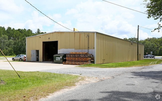
Property Record
2600 Us Highway 41 S, Valdosta, GA 31601

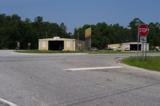
NEARBY LISTINGS FOR SALE OR LEASE
Property Detail
2600 Us Highway 41 S
Valdosta, GA
Pinecrest
0166-040
L7-8 & PT9 BK 3 PINECREST
Warehouse
Lowndes
X
Georgia
13101C0025A
7-9
2024
0.80 AC
2024
Valdosta/Lake Park
011500
Other Market Areas
5,400 SF
DEMOGRAPHICS near 2600 Us Highway 41 S
1 Mile
3 Mile
5 Mile
2024 Total Population
646
9,094
28,012
2029 Population
670
9,519
29,337
Pop Growth 2024-2029
+ 3.72%
+ 4.67%
+ 4.73%
Average Age
40
38
36
2024 Total Households
255
3,427
10,647
HH Growth 2024-2029
+ 3.92%
+ 4.84%
+ 4.99%
Median Household Inc
$34,642
$28,637
$25,250
Avg Household Size
2.50
2.50
2.40
2024 Avg HH Vehicles
2.00
2.00
2.00
Median Home Value
$164,285
$147,697
$121,510
Median Year Built
1987
1992
1982
Nearby Places
Map Layers
Map Styles
 Street
 Aerial
- Restaurants
- Banks
- Shops
- Fitness
- Groceries
PUBLIC TRANSPORTATION
AIRPORT
Valdosta Regional
DRIVE
WALK
Distance
Valdosta Regional
6 min
3.8 mi
Freight Ports
Jacksonville Port
DRIVE
WALK
Distance
Jacksonville Port
140 min
122.0 mi
SALE & LEASE HISTORY
LISTING DATE
SALE/LEASE

Oct 06, 2016
For Sale
Feb 06, 2017
For Sale
Aug 17, 2017
For Sale
Nearby Properties
Address
Land Use
TOTAL SIZE
Lot Size
Zoning
Address
Land Use
TOTAL SIZE
Lot Size
Zoning
2,496 SF
63.73 AC
M-2
Address
Land Use
TOTAL SIZE
Lot Size
Zoning
100,000 SF
25.27 AC
M-1
Address
Land Use
TOTAL SIZE
Lot Size
Zoning
56,879 SF
63 AC
CON
Address
Land Use
TOTAL SIZE
Lot Size
Zoning
2,610 SF
10 AC
R-M
Address
Land Use
TOTAL SIZE
Lot Size
Zoning
480 SF
10 AC
R-M
Address
Land Use
TOTAL SIZE
Lot Size
Zoning
8,320 SF
61 AC
E-A
Address
Land Use
TOTAL SIZE
Lot Size
Zoning
21,558 SF
30.25 AC
M-2
Address
Land Use
TOTAL SIZE
Lot Size
Zoning
54,000 SF
9.15 AC
M-2
Address
Land Use
TOTAL SIZE
Lot Size
Zoning
12,650 SF
55.68 AC
M-2
Address
Land Use
TOTAL SIZE
Lot Size
Zoning
80,000 SF
11.51 AC
M-2
Address
Land Use
TOTAL SIZE
Lot Size
Zoning
150,862 SF
30 AC
M-1
Address
Land Use
TOTAL SIZE
Lot Size
Zoning
35,520 SF
16.58 AC
M-2
Address
Land Use
TOTAL SIZE
Lot Size
Zoning
57,902 SF
5.25 AC
C-H
Address
Land Use
TOTAL SIZE
Lot Size
Zoning
36,000 SF
6.58 AC
M-2
Address
Land Use
TOTAL SIZE
Lot Size
Zoning
152,725 SF
10.27 AC
M-2
Address
Land Use
TOTAL SIZE
Lot Size
Zoning
63,960 SF
10 AC
M-2
Address
Land Use
TOTAL SIZE
Lot Size
Zoning
2,766 SF
50 AC
E-A
Address
Land Use
TOTAL SIZE
Lot Size
Zoning
87,500 SF
4.51 AC
M-2
Address
Land Use
TOTAL SIZE
Lot Size
Zoning
131,250 SF
6.75 AC
M-2
Address
Land Use
TOTAL SIZE
Lot Size
Zoning
118,200 SF
9.66 AC
M-2
Address
Land Use
TOTAL SIZE
Lot Size
Zoning
59,106 SF
23.93 AC
O-I
Address
Land Use
TOTAL SIZE
Lot Size
Zoning
45,000 SF
8.41 AC
M-2
Address
Land Use
TOTAL SIZE
Lot Size
Zoning
47,645 SF
5.06 AC
R-P
Address
Land Use
TOTAL SIZE
Lot Size
Zoning
64,064 SF
6.81 AC
R-6
Address
Land Use
TOTAL SIZE
Lot Size
Zoning
2,816 SF
45.91 AC
CON
Address
Land Use
TOTAL SIZE
Lot Size
Zoning
68,040 SF
8.54 AC
M-2
Address
Land Use
TOTAL SIZE
Lot Size
Zoning
49,125 SF
85.29 AC
E-A
Address
Land Use
TOTAL SIZE
Lot Size
Zoning
61,875 SF
69.63 AC
E-A
Address
Land Use
TOTAL SIZE
Lot Size
Zoning
17,892 SF
10.18 AC
PPD
The World's #1 Commercial Real Estate Marketplace
Connect with us
© 2026 CoStar Group
The information above has been obtained from sources believed reliable. While we do not doubt its accuracy we have not verified it and make no guarantee, warranty or representation about it. It is your responsibility to independently confirm its accuracy and completeness. Any projections, opinions, assumptions, or estimates used are for example only and do not represent the current or future performance of the property. The value of this transaction to you depends on tax and other factors which should be evaluated by your tax, financial, and legal advisors. You and your advisors should conduct a careful, independent investigation of the property to determine to your satisfaction the suitability of the property for your needs.