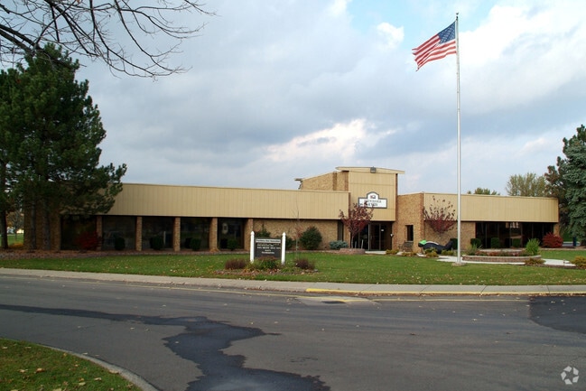
Property Record
2600 W Auburn Rd, Rochester Hills, MI 48309


NEARBY LISTINGS FOR SALE OR LEASE
Property Detail
2600 W Auburn Rd
15-29-300-004
T3N, R11E, SEC 29 PART OF NW 1/4 BEG AT W 1/4 COR, TH N 00-04-15 E 0.74 FT, TH N 67-17-00 E 823.88 FT TO SLY LINE M-59 HWY,
Charitableorganization
Oakland
X
Michigan
26125C0393F
100.78 AC
2024
Rochester
2022
Detroit
194500
Detroit-Warren-Dearborn, MI
DEMOGRAPHICS near 2600 W Auburn Rd
1 Mile
3 Mile
5 Mile
2024 Total Population
4,356
55,276
185,562
2029 Population
4,314
54,818
184,176
Pop Growth 2024-2029
(0.96%)
(0.83%)
(0.75%)
Average Age
48
43
41
2024 Total Households
1,954
22,492
72,833
HH Growth 2024-2029
(1.07%)
(0.77%)
(0.74%)
Median Household Inc
$87,543
$104,347
$97,320
Avg Household Size
2.20
2.40
2.40
2024 Avg HH Vehicles
2.00
2.00
2.00
Median Home Value
$313,074
$338,688
$350,336
Median Year Built
1988
1982
1978
Nearby Places
Map Layers
Map Styles
 Street
 Aerial
- Restaurants
- Banks
- Shops
- Fitness
- Groceries
PUBLIC TRANSPORTATION
COMMUTER RAIL
Pontiac Amtrak Station (Wolverine - Amtrak)
DRIVE
WALK
Distance
Pontiac Amtrak Station (Wolverine - Amtrak)
12 min
5.8 mi
Troy Amtrak Station (Wolverine - Amtrak)
DRIVE
WALK
Distance
Troy Amtrak Station (Wolverine - Amtrak)
16 min
8.4 mi
AIRPORT
Windsor International
DRIVE
WALK
Distance
Windsor International
54 min
34.7 mi
Freight Ports
Port of Toledo
DRIVE
WALK
Distance
Port of Toledo
104 min
85.2 mi
Nearby Properties
Address
Land Use
TOTAL SIZE
Lot Size
Zoning
Address
Land Use
TOTAL SIZE
Lot Size
Zoning
7,879,586 SF
457.68 AC
TR
Address
Land Use
TOTAL SIZE
Lot Size
Zoning
671,780 SF
Address
Land Use
TOTAL SIZE
Lot Size
Zoning
453,700 SF
Address
Land Use
TOTAL SIZE
Lot Size
Zoning
404,427 SF
28.15 AC
TR
Address
Land Use
TOTAL SIZE
Lot Size
Zoning
337,992 SF
18.96 AC
TR
Address
Land Use
TOTAL SIZE
Lot Size
Zoning
104,434 SF
8.64 AC
Address
Land Use
TOTAL SIZE
Lot Size
Zoning
288,288 SF
15 AC
Address
Land Use
TOTAL SIZE
Lot Size
Zoning
331,412 SF
24.25 AC
O1
Address
Land Use
TOTAL SIZE
Lot Size
Zoning
131,817 SF
67 AC
SP
Address
Land Use
TOTAL SIZE
Lot Size
Zoning
144,450 SF
11.22 AC
OSC
Address
Land Use
TOTAL SIZE
Lot Size
Zoning
144,450 SF
11.22 AC
Address
Land Use
TOTAL SIZE
Lot Size
Zoning
214,772 SF
Address
Land Use
TOTAL SIZE
Lot Size
Zoning
337,992 SF
Address
Land Use
TOTAL SIZE
Lot Size
Zoning
136,962 SF
43.80 AC
OSC
Address
Land Use
TOTAL SIZE
Lot Size
Zoning
360,186 SF
38.44 AC
RM2
Address
Land Use
TOTAL SIZE
Lot Size
Zoning
210,000 SF
14.46 AC
TR
Address
Land Use
TOTAL SIZE
Lot Size
Zoning
14.48 AC
Address
Land Use
TOTAL SIZE
Lot Size
Zoning
321,936 SF
29.11 AC
RM1
Address
Land Use
TOTAL SIZE
Lot Size
Zoning
64,217 SF
39.13 AC
Address
Land Use
TOTAL SIZE
Lot Size
Zoning
135,230 SF
Address
Land Use
TOTAL SIZE
Lot Size
Zoning
209,596 SF
9.16 AC
TR
Address
Land Use
TOTAL SIZE
Lot Size
Zoning
75,717 SF
9.13 AC
TR
Address
Land Use
TOTAL SIZE
Lot Size
Zoning
120,859 SF
14.63 AC
Address
Land Use
TOTAL SIZE
Lot Size
Zoning
135,230 SF
15.26 AC
Address
Land Use
TOTAL SIZE
Lot Size
Zoning
Address
Land Use
TOTAL SIZE
Lot Size
Zoning
120,859 SF
Address
Land Use
TOTAL SIZE
Lot Size
Zoning
21.52 AC
AI
Address
Land Use
TOTAL SIZE
Lot Size
Zoning
128,290 SF
The World's #1 Commercial Real Estate Marketplace
Connect with us
© 2026 CoStar Group
The information above has been obtained from sources believed reliable. While we do not doubt its accuracy we have not verified it and make no guarantee, warranty or representation about it. It is your responsibility to independently confirm its accuracy and completeness. Any projections, opinions, assumptions, or estimates used are for example only and do not represent the current or future performance of the property. The value of this transaction to you depends on tax and other factors which should be evaluated by your tax, financial, and legal advisors. You and your advisors should conduct a careful, independent investigation of the property to determine to your satisfaction the suitability of the property for your needs.