Property Record
2600 W Ironwood Hill Dr, Tucson, AZ 85745


NEARBY LISTINGS FOR SALE OR LEASE
Property Detail
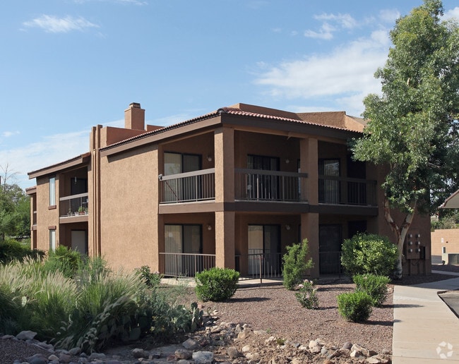
2600 W Ironwood Hill Dr
Tucson, AZ
Null
103-20-083F
PTN S1068.23 E460.54 W2 SE4 SW4 LYG N & ADJ RD 9.04 AC SEC 33-13-13
Apartment
Pima
X
Arizona
04019C1669L
25
2025
9.04 AC
2025
Ward 1
004412
Tucson
93,838 SF
DEMOGRAPHICS near 2600 W Ironwood Hill Dr
1 Mile
3 Mile
5 Mile
2024 Total Population
10,550
60,532
174,451
2029 Population
11,089
63,105
180,924
Pop Growth 2024-2029
+ 5.11%
+ 4.25%
+ 3.71%
Average Age
39
39
38
2024 Total Households
4,333
26,748
76,115
HH Growth 2024-2029
+ 5.12%
+ 4.40%
+ 3.81%
Median Household Inc
$66,848
$42,340
$42,657
Avg Household Size
2.40
2.20
2.10
2024 Avg HH Vehicles
2.00
2.00
2.00
Median Home Value
$259,305
$195,885
$223,290
Median Year Built
1990
1982
1980
Nearby Places
Map Layers
Map Styles
 Street
 Aerial
- Restaurants
- Banks
- Shops
- Fitness
- Groceries
PUBLIC TRANSPORTATION
COMMUTER RAIL
Tucson Amtrak Station (Sunset Limited - Amtrak, Texas Eagle - Amtrak)
DRIVE
WALK
Distance
Tucson Amtrak Station (Sunset Limited - Amtrak, Texas Eagle - Amtrak)
10 min
5.2 mi
AIRPORT
Tucson International
DRIVE
WALK
Distance
Tucson International
22 min
12.7 mi
Freight Ports
Port of San Diego
DRIVE
WALK
Distance
Port of San Diego
434 min
407.8 mi
Nearby Properties
Address
Land Use
TOTAL SIZE
Lot Size
Zoning
Address
Land Use
TOTAL SIZE
Lot Size
Zoning
134,710 SF
9.59 AC
I1
Address
Land Use
TOTAL SIZE
Lot Size
Zoning
819,879 SF
44.77 AC
SP
Address
Land Use
TOTAL SIZE
Lot Size
Zoning
655,604 SF
233.08 AC
RX2
Address
Land Use
TOTAL SIZE
Lot Size
Zoning
106,852 SF
19.50 AC
I1
Address
Land Use
TOTAL SIZE
Lot Size
Zoning
868,743 SF
17.17 AC
O3
Address
Land Use
TOTAL SIZE
Lot Size
Zoning
52,531 SF
11.37 AC
SR
Address
Land Use
TOTAL SIZE
Lot Size
Zoning
39,508 SF
7.29 AC
MU
Address
Land Use
TOTAL SIZE
Lot Size
Zoning
27,678 SF
64.08 AC
R2
Address
Land Use
TOTAL SIZE
Lot Size
Zoning
1,216,456 SF
28.73 AC
Address
Land Use
TOTAL SIZE
Lot Size
Zoning
288,815 SF
14.96 AC
Address
Land Use
TOTAL SIZE
Lot Size
Zoning
122,413 SF
21.85 AC
I1
Address
Land Use
TOTAL SIZE
Lot Size
Zoning
177,018 SF
16.78 AC
C2
Address
Land Use
TOTAL SIZE
Lot Size
Zoning
248,388 SF
20.45 AC
O3
Address
Land Use
TOTAL SIZE
Lot Size
Zoning
36,100 SF
2.42 AC
I1
Address
Land Use
TOTAL SIZE
Lot Size
Zoning
24,100 SF
4.96 AC
MU
Address
Land Use
TOTAL SIZE
Lot Size
Zoning
21,000 SF
9.34 AC
Address
Land Use
TOTAL SIZE
Lot Size
Zoning
291,038 SF
16.42 AC
C1
Address
Land Use
TOTAL SIZE
Lot Size
Zoning
214,907 SF
12.03 AC
C1
Address
Land Use
TOTAL SIZE
Lot Size
Zoning
147,258 SF
6.43 AC
Address
Land Use
TOTAL SIZE
Lot Size
Zoning
176,857 SF
14.20 AC
R2
Address
Land Use
TOTAL SIZE
Lot Size
Zoning
10.60 AC
Address
Land Use
TOTAL SIZE
Lot Size
Zoning
55,016 SF
3.63 AC
O3
Address
Land Use
TOTAL SIZE
Lot Size
Zoning
230,676 SF
14.99 AC
Address
Land Use
TOTAL SIZE
Lot Size
Zoning
6,052 SF
64.41 AC
R2
Address
Land Use
TOTAL SIZE
Lot Size
Zoning
7,079 SF
3.79 AC
C1
Address
Land Use
TOTAL SIZE
Lot Size
Zoning
140,080 SF
27.29 AC
MU
Address
Land Use
TOTAL SIZE
Lot Size
Zoning
199,949 SF
20.31 AC
Address
Land Use
TOTAL SIZE
Lot Size
Zoning
96,380 SF
9.32 AC
CR4
Address
Land Use
TOTAL SIZE
Lot Size
Zoning
85,734 SF
32.24 AC
RX1
Address
Land Use
TOTAL SIZE
Lot Size
Zoning
199,949 SF
21.87 AC
The World's #1 Commercial Real Estate Marketplace
Connect with us
© 2026 CoStar Group
The information above has been obtained from sources believed reliable. While we do not doubt its accuracy we have not verified it and make no guarantee, warranty or representation about it. It is your responsibility to independently confirm its accuracy and completeness. Any projections, opinions, assumptions, or estimates used are for example only and do not represent the current or future performance of the property. The value of this transaction to you depends on tax and other factors which should be evaluated by your tax, financial, and legal advisors. You and your advisors should conduct a careful, independent investigation of the property to determine to your satisfaction the suitability of the property for your needs.