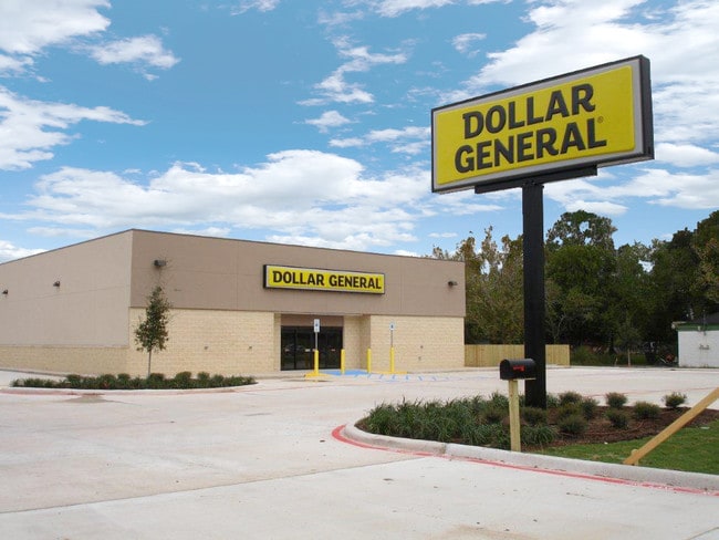
Property Record
2600 W Main St, Baytown, TX 77520


NEARBY LISTINGS FOR SALE OR LEASE
Property Detail
2600 W Main St
Houston-The Woodlands-Sugar Land, TX
Baytown Dtp
1380330010001
LT 1 BLK 1 BAYTOWN DTP
Storebuilding
Harris
AE
Texas
48201C0935M
1
2024
1.08 AC
2025
Channelview
254800
Houston
8,980 SF
DEMOGRAPHICS near 2600 W Main St
1 Mile
3 Mile
5 Mile
2024 Total Population
5,431
35,999
87,104
2029 Population
5,603
37,112
89,736
Pop Growth 2024-2029
+ 3.17%
+ 3.09%
+ 3.02%
Average Age
38
36
36
2024 Total Households
1,781
12,588
30,985
HH Growth 2024-2029
+ 3.14%
+ 3.02%
+ 2.92%
Median Household Inc
$49,952
$50,980
$53,005
Avg Household Size
3.00
2.80
2.70
2024 Avg HH Vehicles
2.00
2.00
2.00
Median Home Value
$90,031
$134,430
$161,492
Median Year Built
1953
1973
1980
Nearby Places
Map Layers
Map Styles
 Street
 Aerial
- Restaurants
- Banks
- Shops
- Fitness
- Groceries
PUBLIC TRANSPORTATION
AIRPORT
William P Hobby
DRIVE
WALK
Distance
William P Hobby
39 min
25.7 mi
George Bush Intcntl/Houston
DRIVE
WALK
Distance
George Bush Intcntl/Houston
45 min
36.7 mi
Freight Ports
Port of Houston
DRIVE
WALK
Distance
Port of Houston
31 min
21.4 mi
SALE & LEASE HISTORY
LISTING DATE
SALE/LEASE

Sep 23, 2016
For Sale
Jul 02, 2018
For Sale
Nearby Properties
Address
Land Use
TOTAL SIZE
Lot Size
Zoning
Address
Land Use
TOTAL SIZE
Lot Size
Zoning
1,019.77 AC
Address
Land Use
TOTAL SIZE
Lot Size
Zoning
Address
Land Use
TOTAL SIZE
Lot Size
Zoning
815.98 AC
Address
Land Use
TOTAL SIZE
Lot Size
Zoning
857.55 AC
Address
Land Use
TOTAL SIZE
Lot Size
Zoning
1,019 AC
Address
Land Use
TOTAL SIZE
Lot Size
Zoning
Address
Land Use
TOTAL SIZE
Lot Size
Zoning
816.17 AC
Address
Land Use
TOTAL SIZE
Lot Size
Zoning
816.17 AC
Address
Land Use
TOTAL SIZE
Lot Size
Zoning
874.07 AC
Address
Land Use
TOTAL SIZE
Lot Size
Zoning
323,413 SF
26.41 AC
Address
Land Use
TOTAL SIZE
Lot Size
Zoning
209,703 SF
11.18 AC
Address
Land Use
TOTAL SIZE
Lot Size
Zoning
225,497 SF
10.90 AC
Address
Land Use
TOTAL SIZE
Lot Size
Zoning
Address
Land Use
TOTAL SIZE
Lot Size
Zoning
816.17 AC
Address
Land Use
TOTAL SIZE
Lot Size
Zoning
425.97 AC
Address
Land Use
TOTAL SIZE
Lot Size
Zoning
270,282 SF
15.19 AC
Address
Land Use
TOTAL SIZE
Lot Size
Zoning
7.79 AC
Address
Land Use
TOTAL SIZE
Lot Size
Zoning
203,740 SF
12 AC
Address
Land Use
TOTAL SIZE
Lot Size
Zoning
1,127,747 SF
59.72 AC
Address
Land Use
TOTAL SIZE
Lot Size
Zoning
16.85 AC
Address
Land Use
TOTAL SIZE
Lot Size
Zoning
140,514 SF
7.94 AC
Address
Land Use
TOTAL SIZE
Lot Size
Zoning
425.97 AC
Address
Land Use
TOTAL SIZE
Lot Size
Zoning
753.69 AC
Address
Land Use
TOTAL SIZE
Lot Size
Zoning
261,760 SF
12.62 AC
Address
Land Use
TOTAL SIZE
Lot Size
Zoning
201,090 SF
12.93 AC
Address
Land Use
TOTAL SIZE
Lot Size
Zoning
510.69 AC
Address
Land Use
TOTAL SIZE
Lot Size
Zoning
178,630 SF
11 AC
Address
Land Use
TOTAL SIZE
Lot Size
Zoning
96,085 SF
8.70 AC
Address
Land Use
TOTAL SIZE
Lot Size
Zoning
218,622 SF
10.77 AC
Address
Land Use
TOTAL SIZE
Lot Size
Zoning
170,436 SF
9.59 AC
The World's #1 Commercial Real Estate Marketplace
Connect with us
© 2025 CoStar Group
The information above has been obtained from sources believed reliable. While we do not doubt its accuracy we have not verified it and make no guarantee, warranty or representation about it. It is your responsibility to independently confirm its accuracy and completeness. Any projections, opinions, assumptions, or estimates used are for example only and do not represent the current or future performance of the property. The value of this transaction to you depends on tax and other factors which should be evaluated by your tax, financial, and legal advisors. You and your advisors should conduct a careful, independent investigation of the property to determine to your satisfaction the suitability of the property for your needs.