Property Record
2600 Wade Hampton Blvd, Greenville, SC 29615


NEARBY LISTINGS FOR SALE OR LEASE
-
-
View all Greenville listings for sale on LoopNet.com
Property Detail
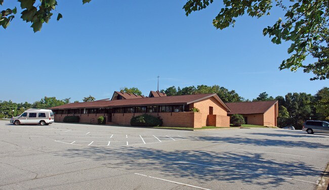
2600 Wade Hampton Blvd
Greenville-Anderson-Mauldin, SC
James M Edwards
P015.09-01-016.00
18 THRU 22 31 THRU 35 PT 17
Religious
Greenville
X
South Carolina
45045C0339E
016.00
2025
6.10 AC
2024
Greer/Taylors
001805
Greenville/Spartanburg
DEMOGRAPHICS near 2600 Wade Hampton Blvd
1 Mile
3 Mile
5 Mile
2024 Total Population
6,935
66,299
158,733
2029 Population
7,590
72,486
174,954
Pop Growth 2024-2029
+ 9.44%
+ 9.33%
+ 10.22%
Average Age
39
39
39
2024 Total Households
2,873
27,712
67,484
HH Growth 2024-2029
+ 9.54%
+ 9.45%
+ 10.43%
Median Household Inc
$63,136
$65,086
$67,007
Avg Household Size
2.40
2.30
2.30
2024 Avg HH Vehicles
2.00
2.00
2.00
Median Home Value
$226,464
$253,564
$275,130
Median Year Built
1968
1977
1983
Nearby Places
Map Layers
Map Styles
 Street
 Aerial
- Restaurants
- Banks
- Shops
- Fitness
- Groceries
PUBLIC TRANSPORTATION
COMMUTER RAIL
DRIVE
WALK
Distance
11 min
5.3 mi
AIRPORT
Greenville Spartanburg International
DRIVE
WALK
Distance
Greenville Spartanburg International
18 min
10.0 mi
Nearby Properties
Address
Land Use
TOTAL SIZE
Lot Size
Zoning
Address
Land Use
TOTAL SIZE
Lot Size
Zoning
14.41 AC
RM2
Address
Land Use
TOTAL SIZE
Lot Size
Zoning
11.99 AC
RM2
Address
Land Use
TOTAL SIZE
Lot Size
Zoning
12.11 AC
C2
Address
Land Use
TOTAL SIZE
Lot Size
Zoning
0.73 AC
C3
Address
Land Use
TOTAL SIZE
Lot Size
Zoning
11.82 AC
RM2
Address
Land Use
TOTAL SIZE
Lot Size
Zoning
8.94 AC
RM2
Address
Land Use
TOTAL SIZE
Lot Size
Zoning
1.09 AC
OD
Address
Land Use
TOTAL SIZE
Lot Size
Zoning
0.47 AC
OD
Address
Land Use
TOTAL SIZE
Lot Size
Zoning
9.13 AC
RM2
Address
Land Use
TOTAL SIZE
Lot Size
Zoning
10 AC
RM
Address
Land Use
TOTAL SIZE
Lot Size
Zoning
10.59 AC
RM2
Address
Land Use
TOTAL SIZE
Lot Size
Zoning
5.61 AC
RM2
Address
Land Use
TOTAL SIZE
Lot Size
Zoning
3.06 AC
C2
Address
Land Use
TOTAL SIZE
Lot Size
Zoning
4.95 AC
C1
Address
Land Use
TOTAL SIZE
Lot Size
Zoning
97.93 AC
OD
Address
Land Use
TOTAL SIZE
Lot Size
Zoning
4.18 AC
C2
Address
Land Use
TOTAL SIZE
Lot Size
Zoning
3,247 SF
15.64 AC
R6
Address
Land Use
TOTAL SIZE
Lot Size
Zoning
Address
Land Use
TOTAL SIZE
Lot Size
Zoning
61.73 AC
OD
Address
Land Use
TOTAL SIZE
Lot Size
Zoning
3.22 AC
OD
Address
Land Use
TOTAL SIZE
Lot Size
Zoning
8.98 AC
C1
Address
Land Use
TOTAL SIZE
Lot Size
Zoning
8.95 AC
OD
Address
Land Use
TOTAL SIZE
Lot Size
Zoning
33.85 AC
S1
Address
Land Use
TOTAL SIZE
Lot Size
Zoning
26.30 AC
R20
Address
Land Use
TOTAL SIZE
Lot Size
Zoning
24.30 AC
PD
Address
Land Use
TOTAL SIZE
Lot Size
Zoning
85.24 AC
C2,R12
Address
Land Use
TOTAL SIZE
Lot Size
Zoning
41.90 AC
RMA
Address
Land Use
TOTAL SIZE
Lot Size
Zoning
19.31 AC
R6
Address
Land Use
TOTAL SIZE
Lot Size
Zoning
9 AC
RM2
Address
Land Use
TOTAL SIZE
Lot Size
Zoning
3.40 AC
C2
The World's #1 Commercial Real Estate Marketplace
Connect with us
© 2025 CoStar Group
The information above has been obtained from sources believed reliable. While we do not doubt its accuracy we have not verified it and make no guarantee, warranty or representation about it. It is your responsibility to independently confirm its accuracy and completeness. Any projections, opinions, assumptions, or estimates used are for example only and do not represent the current or future performance of the property. The value of this transaction to you depends on tax and other factors which should be evaluated by your tax, financial, and legal advisors. You and your advisors should conduct a careful, independent investigation of the property to determine to your satisfaction the suitability of the property for your needs.