Property Record
2600 Wadhams Rd, Kimball, MI 48074

NEARBY LISTINGS FOR SALE OR LEASE
-
-
View all Kimball listings for sale on LoopNet.com
Property Detail
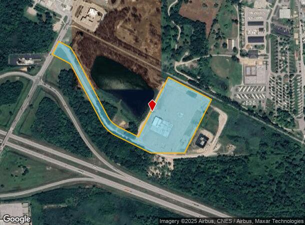
2600 Wadhams Rd
Detroit-Warren-Dearborn, MI
BEG N 85D 38M 51S E 1340.66', N 03D 03M 24S W 119.81', N 64D 12M 19S W 1091.17' FROM QUARTER CORNER COMMON TO SECTIONS 2 &
74-25-002-3005-010
St. Clair
Industrialgeneral
Michigan
2024
12.60 AC
2025
St Clair & Lapeer Counties
634600
Detroit
DEMOGRAPHICS near 2600 Wadhams Rd
1 Mile
3 Mile
5 Mile
2024 Total Population
777
13,602
45,234
2029 Population
782
13,485
44,912
Pop Growth 2024-2029
+ 0.64%
(0.86%)
(0.71%)
Average Age
43
43
41
2024 Total Households
314
5,418
17,557
HH Growth 2024-2029
+ 0.32%
(1.05%)
(0.93%)
Median Household Inc
$56,562
$59,085
$57,496
Avg Household Size
2.40
2.50
2.50
2024 Avg HH Vehicles
2.00
2.00
2.00
Median Home Value
$164,893
$174,135
$165,008
Median Year Built
1989
1978
1973
Nearby Places
Map Layers
Map Styles
 Street
 Aerial
- Restaurants
- Banks
- Shops
- Fitness
- Groceries
PUBLIC TRANSPORTATION
COMMUTER RAIL
Port Huron Amtrak Station (Blue Water - Amtrak)
DRIVE
WALK
Distance
Port Huron Amtrak Station (Blue Water - Amtrak)
10 min
6.5 mi
Freight Ports
Port of Toledo
DRIVE
WALK
Distance
Port of Toledo
146 min
121.5 mi
Nearby Properties
Address
Land Use
TOTAL SIZE
Lot Size
Zoning
Address
Land Use
TOTAL SIZE
Lot Size
Zoning
39,747 SF
3.11 AC
R-2 RES
Address
Land Use
TOTAL SIZE
Lot Size
Zoning
10,991 SF
119.58 AC
MIXED
Address
Land Use
TOTAL SIZE
Lot Size
Zoning
20,736 SF
10.20 AC
R-1
Address
Land Use
TOTAL SIZE
Lot Size
Zoning
5,359 SF
42.87 AC
R-4 RES
Address
Land Use
TOTAL SIZE
Lot Size
Zoning
7,785 SF
35.62 AC
C-2 COMM
Address
Land Use
TOTAL SIZE
Lot Size
Zoning
42,720 SF
6.21 AC
C-2 COMM
Address
Land Use
TOTAL SIZE
Lot Size
Zoning
25,756 SF
4.79 AC
R-1
Address
Land Use
TOTAL SIZE
Lot Size
Zoning
12,832 SF
116.08 AC
AG
Address
Land Use
TOTAL SIZE
Lot Size
Zoning
20,520 SF
60.04 AC
R-1
Address
Land Use
TOTAL SIZE
Lot Size
Zoning
92,819 SF
31.18 AC
C-2 COMM
Address
Land Use
TOTAL SIZE
Lot Size
Zoning
44,576 SF
4.40 AC
B-3
Address
Land Use
TOTAL SIZE
Lot Size
Zoning
76,760 SF
29 AC
C-2 COMM
Address
Land Use
TOTAL SIZE
Lot Size
Zoning
21,432 SF
6.69 AC
R-1
Address
Land Use
TOTAL SIZE
Lot Size
Zoning
3,387 SF
83.39 AC
AG
Address
Land Use
TOTAL SIZE
Lot Size
Zoning
33 AC
RMH
Address
Land Use
TOTAL SIZE
Lot Size
Zoning
27,719 SF
9.08 AC
MIXED
Address
Land Use
TOTAL SIZE
Lot Size
Zoning
23,519 SF
4.97 AC
C-2 COMM
Address
Land Use
TOTAL SIZE
Lot Size
Zoning
5,829 SF
65.90 AC
MHP
Address
Land Use
TOTAL SIZE
Lot Size
Zoning
18,540 SF
2 AC
R-1
Address
Land Use
TOTAL SIZE
Lot Size
Zoning
48,885 SF
7.75 AC
I-L
Address
Land Use
TOTAL SIZE
Lot Size
Zoning
48,775 SF
7.01 AC
I-1 LIGHT
Address
Land Use
TOTAL SIZE
Lot Size
Zoning
11,987 SF
5 AC
R-1
Address
Land Use
TOTAL SIZE
Lot Size
Zoning
393 AC
AG
Address
Land Use
TOTAL SIZE
Lot Size
Zoning
40,927 SF
1.79 AC
C-2 COMM
Address
Land Use
TOTAL SIZE
Lot Size
Zoning
3.29 AC
C-2 COMM
Address
Land Use
TOTAL SIZE
Lot Size
Zoning
50 AC
MIXED
Address
Land Use
TOTAL SIZE
Lot Size
Zoning
3.07 AC
MIXED
Address
Land Use
TOTAL SIZE
Lot Size
Zoning
9,185 SF
4.31 AC
C-1 COMM
Address
Land Use
TOTAL SIZE
Lot Size
Zoning
12,544 SF
1.86 AC
R-1
Address
Land Use
TOTAL SIZE
Lot Size
Zoning
1,684 SF
15 AC
R-4 RES
The World's #1 Commercial Real Estate Marketplace
Connect with us
© 2025 CoStar Group
The information above has been obtained from sources believed reliable. While we do not doubt its accuracy we have not verified it and make no guarantee, warranty or representation about it. It is your responsibility to independently confirm its accuracy and completeness. Any projections, opinions, assumptions, or estimates used are for example only and do not represent the current or future performance of the property. The value of this transaction to you depends on tax and other factors which should be evaluated by your tax, financial, and legal advisors. You and your advisors should conduct a careful, independent investigation of the property to determine to your satisfaction the suitability of the property for your needs.