Property Record
2600 Westown Pky, West Des Moines, IA 50266
Current Lease Availabilities
NEARBY LISTINGS FOR SALE OR LEASE
Property Detail
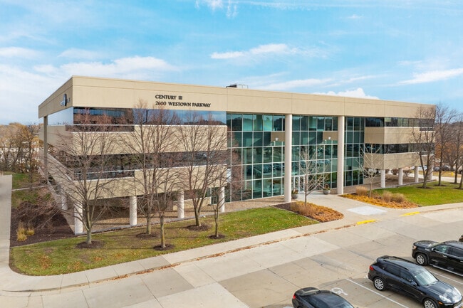
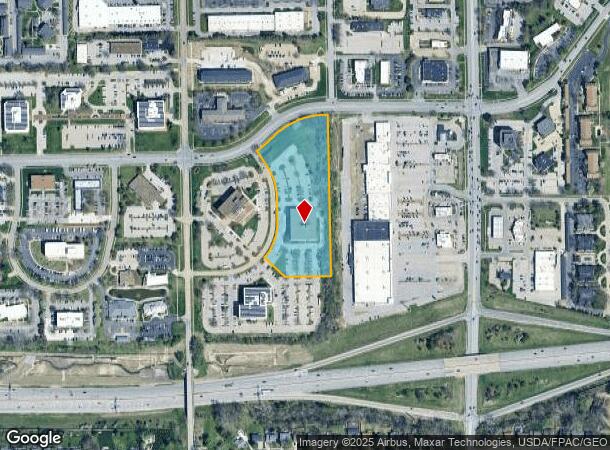
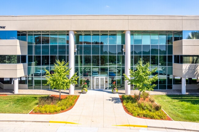
2600 Westown Pky
Des Moines-West Des Moines, IA
Westown Park
320-04947031103
-EX S & W OFLN BEG NW COR THN E 81.67F NELY 312.5F SELY 300.04F S 145F SWLY 228.52F SE 164.25F E 273.06F TO PT 349.18F N OF SE COR- LT 2 WESTOWN PARK
Officebuilding
Polk
X
Iowa
19153C0326F
2
2024
6.96 AC
2025
Western Suburbs
011114
Des Moines
99,976 SF
DEMOGRAPHICS near 2600 Westown Pky
1 Mile
3 Mile
5 Mile
2024 Total Population
7,328
78,800
188,966
2029 Population
7,563
81,581
199,922
Pop Growth 2024-2029
+ 3.21%
+ 3.53%
+ 5.80%
Average Age
40
40
39
2024 Total Households
3,200
34,300
80,542
HH Growth 2024-2029
+ 3.78%
+ 3.79%
+ 6.10%
Median Household Inc
$72,278
$74,037
$75,281
Avg Household Size
2.20
2.20
2.30
2024 Avg HH Vehicles
2.00
2.00
2.00
Median Home Value
$252,290
$238,788
$244,708
Median Year Built
1972
1976
1978
Nearby Places
- Restaurants
- Banks
- Shops
- Fitness
- Groceries
PUBLIC TRANSPORTATION
AIRPORT
Des Moines International
DRIVE
WALK
Distance
Des Moines International
18 min
8.0 mi
Freight Ports
Port Milwaukee
DRIVE
WALK
Distance
Port Milwaukee
425 min
380.1 mi
Nearby Properties
Address
Land Use
TOTAL SIZE
Lot Size
Zoning
Address
Land Use
TOTAL SIZE
Lot Size
Zoning
472,476 SF
12.48 AC
PUD OFFICE
Address
Land Use
TOTAL SIZE
Lot Size
Zoning
18,093 SF
38.92 AC
Address
Land Use
TOTAL SIZE
Lot Size
Zoning
255,521 SF
60.90 AC
RE
Address
Land Use
TOTAL SIZE
Lot Size
Zoning
422,683 SF
46.57 AC
PCP
Address
Land Use
TOTAL SIZE
Lot Size
Zoning
407,183 SF
17.02 AC
PUD
Address
Land Use
TOTAL SIZE
Lot Size
Zoning
415,320 SF
51.16 AC
PUD
Address
Land Use
TOTAL SIZE
Lot Size
Zoning
241,324 SF
21.67 AC
PUD B&C
Address
Land Use
TOTAL SIZE
Lot Size
Zoning
322,220 SF
7.61 AC
Address
Land Use
TOTAL SIZE
Lot Size
Zoning
231,695 SF
4.29 AC
Address
Land Use
TOTAL SIZE
Lot Size
Zoning
275,227 SF
18.31 AC
PCP
Address
Land Use
TOTAL SIZE
Lot Size
Zoning
387,456 SF
15.72 AC
PUD HD
Address
Land Use
TOTAL SIZE
Lot Size
Zoning
182,866 SF
10.21 AC
Address
Land Use
TOTAL SIZE
Lot Size
Zoning
243,217 SF
16.31 AC
PUD HD
Address
Land Use
TOTAL SIZE
Lot Size
Zoning
189,691 SF
27.03 AC
PCP
Address
Land Use
TOTAL SIZE
Lot Size
Zoning
572,809 SF
42.13 AC
M-2
Address
Land Use
TOTAL SIZE
Lot Size
Zoning
341,024 SF
12.15 AC
RH
Address
Land Use
TOTAL SIZE
Lot Size
Zoning
444,073 SF
28.05 AC
RH
Address
Land Use
TOTAL SIZE
Lot Size
Zoning
67,691 SF
7.30 AC
Address
Land Use
TOTAL SIZE
Lot Size
Zoning
151,344 SF
10.43 AC
C-3
Address
Land Use
TOTAL SIZE
Lot Size
Zoning
195,931 SF
13.66 AC
Address
Land Use
TOTAL SIZE
Lot Size
Zoning
228,243 SF
19.64 AC
PUD HD
Address
Land Use
TOTAL SIZE
Lot Size
Zoning
221,654 SF
26.38 AC
PUD MD
Address
Land Use
TOTAL SIZE
Lot Size
Zoning
83,370 SF
0.98 AC
C-3
Address
Land Use
TOTAL SIZE
Lot Size
Zoning
79,916 SF
7.82 AC
PUD OFFICE
Address
Land Use
TOTAL SIZE
Lot Size
Zoning
308,117 SF
18.33 AC
RH
Address
Land Use
TOTAL SIZE
Lot Size
Zoning
80,045 SF
5.07 AC
C-3
Address
Land Use
TOTAL SIZE
Lot Size
Zoning
168,898 SF
17.54 AC
PUD
Address
Land Use
TOTAL SIZE
Lot Size
Zoning
235,620 SF
13.18 AC
RH
Address
Land Use
TOTAL SIZE
Lot Size
Zoning
94,136 SF
18.48 AC
PUD
Address
Land Use
TOTAL SIZE
Lot Size
Zoning
66,708 SF
9.75 AC
The World's #1 Commercial Real Estate Marketplace
Connect with us
© 2025 CoStar Group
The information above has been obtained from sources believed reliable. While we do not doubt its accuracy we have not verified it and make no guarantee, warranty or representation about it. It is your responsibility to independently confirm its accuracy and completeness. Any projections, opinions, assumptions, or estimates used are for example only and do not represent the current or future performance of the property. The value of this transaction to you depends on tax and other factors which should be evaluated by your tax, financial, and legal advisors. You and your advisors should conduct a careful, independent investigation of the property to determine to your satisfaction the suitability of the property for your needs.