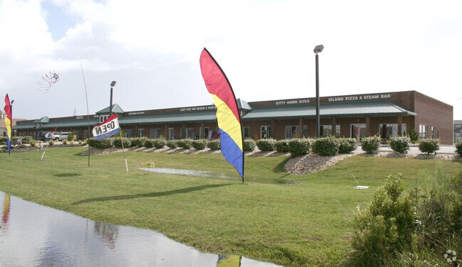
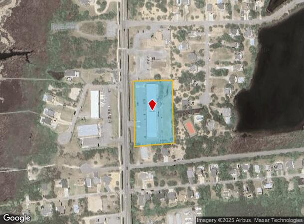
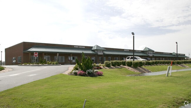
Property Record
26006 N Nc Highway 12, Waves, NC 27982
NEARBY LISTINGS FOR SALE OR LEASE
Property Detail
26006 N Nc Highway 12
Kill Devil Hills, NC
St Waves
014324103
LOT:1-A BLK: SEC: PL: E SL: 532
Stripcommercialcenter
Dare
AE
North Carolina
3730065700K
1-a
2025
2.35 AC
2025
Coastal Carolina
970502
Other Market Areas
19,952 SF
DEMOGRAPHICS near 26006 N Nc Highway 12
1 mile
3 mile
5 mile
2024 Total Population
0
0
0
2029 Population
0
0
0
Pop Growth 2024-2029
0.00%
0.00%
0.00%
Average Age
0
0
0
2024 Total Households
0
0
0
HH Growth 2024-2029
0.00%
0.00%
0.00%
Median Household Inc
$0
$0
$0
Avg Household Size
.00
.00
.00
2024 Avg HH Vehicles
.00
.00
.00
Median Home Value
$0
$0
$0
Median Year Built
0
0
0
Nearby Places
Map Layers
Map Styles
 Street
 Aerial
Transit
 Traffic
 Biking
Places
Listings with unknown addresses are not visible on the map
- Restaurants
- Banks
- Shops
- Fitness
- Groceries
SALE & LEASE HISTORY
LISTING DATE
SALE/LEASE

Sep 25, 2016
For Lease
Nearby Properties
Address
Land Use
TOTAL SIZE
Lot Size
Zoning
Address
Land Use
TOTAL SIZE
Lot Size
Zoning
1,600 SF
23.24 AC
Address
Land Use
TOTAL SIZE
Lot Size
Zoning
7,272 SF
48.38 AC
Address
Land Use
TOTAL SIZE
Lot Size
Zoning
84.97 AC
Address
Land Use
TOTAL SIZE
Lot Size
Zoning
12,851 SF
2.13 AC
Address
Land Use
TOTAL SIZE
Lot Size
Zoning
19,977 SF
Address
Land Use
TOTAL SIZE
Lot Size
Zoning
18,932 SF
0.84 AC
Address
Land Use
TOTAL SIZE
Lot Size
Zoning
Address
Land Use
TOTAL SIZE
Lot Size
Zoning
26.13 AC
Address
Land Use
TOTAL SIZE
Lot Size
Zoning
15,729 SF
1.98 AC
Address
Land Use
TOTAL SIZE
Lot Size
Zoning
6,142 SF
0.71 AC
Address
Land Use
TOTAL SIZE
Lot Size
Zoning
15,174 SF
1.92 AC
Address
Land Use
TOTAL SIZE
Lot Size
Zoning
1,344 SF
6.01 AC
Address
Land Use
TOTAL SIZE
Lot Size
Zoning
5,232 SF
0.46 AC
Address
Land Use
TOTAL SIZE
Lot Size
Zoning
11,200 SF
1.95 AC
Address
Land Use
TOTAL SIZE
Lot Size
Zoning
7,320 SF
4.81 AC
Address
Land Use
TOTAL SIZE
Lot Size
Zoning
6,747 SF
0.52 AC
Address
Land Use
TOTAL SIZE
Lot Size
Zoning
5,392 SF
0.51 AC
Address
Land Use
TOTAL SIZE
Lot Size
Zoning
4,818 SF
0.28 AC
Address
Land Use
TOTAL SIZE
Lot Size
Zoning
4,859 SF
0.29 AC
Address
Land Use
TOTAL SIZE
Lot Size
Zoning
5,241 SF
0.46 AC
Address
Land Use
TOTAL SIZE
Lot Size
Zoning
4,794 SF
0.47 AC
Address
Land Use
TOTAL SIZE
Lot Size
Zoning
4,794 SF
0.46 AC
Address
Land Use
TOTAL SIZE
Lot Size
Zoning
4,575 SF
0.47 AC
Address
Land Use
TOTAL SIZE
Lot Size
Zoning
9,416 SF
1.21 AC
Address
Land Use
TOTAL SIZE
Lot Size
Zoning
2,799 SF
4.48 AC
Address
Land Use
TOTAL SIZE
Lot Size
Zoning
7,183 SF
3.47 AC
Address
Land Use
TOTAL SIZE
Lot Size
Zoning
5,119 SF
0.34 AC
Address
Land Use
TOTAL SIZE
Lot Size
Zoning
7,501 SF
0.55 AC
Address
Land Use
TOTAL SIZE
Lot Size
Zoning
6,936 SF
3.26 AC
The World's #1 Commercial Real Estate Marketplace
Connect with us
© 2026 CoStar Group
The information above has been obtained from sources believed reliable. While we do not doubt its accuracy we have not verified it and make no guarantee, warranty or representation about it. It is your responsibility to independently confirm its accuracy and completeness. Any projections, opinions, assumptions, or estimates used are for example only and do not represent the current or future performance of the property. The value of this transaction to you depends on tax and other factors which should be evaluated by your tax, financial, and legal advisors. You and your advisors should conduct a careful, independent investigation of the property to determine to your satisfaction the suitability of the property for your needs.