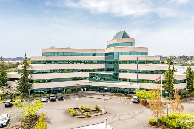
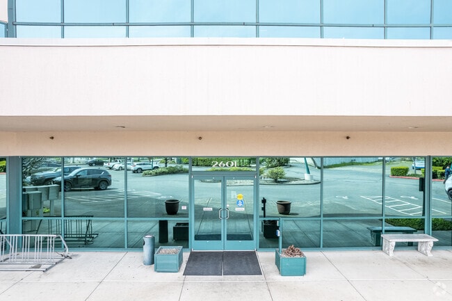
Property Record
2601 25Th St Se, Salem, OR 97302

Current Lease Availabilities
Property Detail
2601 25Th St Se
582587
MILLERS MILL CREEK RURAL HOME TRACTS LOT FR 11 ACRES 4.42
Officebuilding
Marion
IC
Oregon
AO River or stream flood hazard areas, and areas with a 1% or greater chance of shallow flooding each year. These areas have a 26% chance of flooding over the life of a 30-year mortgage.
11
2024
4.42 AC
2025
Marion County
001000
Portland
67,470 SF
Salem, OR
NEARBY LISTINGS FOR SALE OR LEASE
DEMOGRAPHICS near 2601 25Th St Se
1 mile
3 mile
5 mile
2025 Total Population
4,359
103,904
216,715
2030 Population
4,445
105,314
218,935
Pop Growth 2025-2030
+ 1.97%
+ 1.36%
+ 1.02%
Average Age
36
39
39
2025 Total Households
1,644
37,779
78,182
HH Growth 2025-2030
+ 2.19%
+ 1.41%
+ 1.10%
Median Household Inc
$57,868
$66,051
$70,754
Avg Household Size
2.60
2.50
2.60
2025 Avg HH Vehicles
2.00
2.00
2.00
Median Home Value
$362,851
$391,711
$421,292
Median Year Built
1963
1974
1978
Nearby Places
Map Layers
Map Styles
 Street
 Aerial
Transit
 Traffic
 Biking
Places
Listings with unknown addresses are not visible on the map
- Restaurants
- Banks
- Shops
- Fitness
- Groceries
PUBLIC TRANSPORTATION
COMMUTER RAIL
Salem (Amtrak Cascades - Amtrak, Coast Starlight - Amtrak)
Drive
Walk
Distance
Salem (Amtrak Cascades - Amtrak, Coast Starlight - Amtrak)
4 min
2.1 mi
Freight Ports
Port of Portland
Drive
Walk
Distance
Port of Portland
67 min
52.1 mi
Nearby Properties
Address
Land Use
TOTAL SIZE
Lot Size
Zoning
Address
Land Use
TOTAL SIZE
Lot Size
Zoning
978,999 SF
25.74 AC
PE
Address
Land Use
TOTAL SIZE
Lot Size
Zoning
236,837 SF
20.76 AC
PE
Address
Land Use
TOTAL SIZE
Lot Size
Zoning
1,018,020 SF
61.75 AC
EC
Address
Land Use
TOTAL SIZE
Lot Size
Zoning
118,829 SF
3.49 AC
CB
Address
Land Use
TOTAL SIZE
Lot Size
Zoning
257,350 SF
19.78 AC
PH
Address
Land Use
TOTAL SIZE
Lot Size
Zoning
145,520 SF
1.70 AC
PM
Address
Land Use
TOTAL SIZE
Lot Size
Zoning
466,506 SF
52.60 AC
EC
Address
Land Use
TOTAL SIZE
Lot Size
Zoning
120,642 SF
4 AC
CB
Address
Land Use
TOTAL SIZE
Lot Size
Zoning
305,230 SF
9.76 AC
PS
Address
Land Use
TOTAL SIZE
Lot Size
Zoning
166,344 SF
1.70 AC
PM
Address
Land Use
TOTAL SIZE
Lot Size
Zoning
183,400 SF
7.17 AC
PE; CB
Address
Land Use
TOTAL SIZE
Lot Size
Zoning
264,504 SF
28.17 AC
PS
Address
Land Use
TOTAL SIZE
Lot Size
Zoning
393,453 SF
24.18 AC
CR
Address
Land Use
TOTAL SIZE
Lot Size
Zoning
Address
Land Use
TOTAL SIZE
Lot Size
Zoning
341,320 SF
17.85 AC
PH
Address
Land Use
TOTAL SIZE
Lot Size
Zoning
137,002 SF
6.27 AC
PE
Address
Land Use
TOTAL SIZE
Lot Size
Zoning
158,880 SF
8.80 AC
RM2; RM1;
Address
Land Use
TOTAL SIZE
Lot Size
Zoning
33,560 SF
4.95 AC
CR
Address
Land Use
TOTAL SIZE
Lot Size
Zoning
122,333 SF
0.48 AC
CB
Address
Land Use
TOTAL SIZE
Lot Size
Zoning
98,733 SF
1.13 AC
CB
Address
Land Use
TOTAL SIZE
Lot Size
Zoning
152,237 SF
8.16 AC
RM2; RM1
Address
Land Use
TOTAL SIZE
Lot Size
Zoning
77,198 SF
1.71 AC
PM
Address
Land Use
TOTAL SIZE
Lot Size
Zoning
209,780 SF
19.85 AC
IC
Address
Land Use
TOTAL SIZE
Lot Size
Zoning
170,756 SF
2.65 AC
PS
Address
Land Use
TOTAL SIZE
Lot Size
Zoning
62,708 SF
30.21 AC
PH
Address
Land Use
TOTAL SIZE
Lot Size
Zoning
114,647 SF
5.72 AC
RM2; RM1
Address
Land Use
TOTAL SIZE
Lot Size
Zoning
193,237 SF
9.98 AC
IG
Address
Land Use
TOTAL SIZE
Lot Size
Zoning
105,152 SF
2.39 AC
CR
The World's #1 Commercial Real Estate Marketplace
Connect with us
© 2026 CoStar Group
The information above has been obtained from sources believed reliable. While we do not doubt its accuracy we have not verified it and make no guarantee, warranty or representation about it. It is your responsibility to independently confirm its accuracy and completeness. Any projections, opinions, assumptions, or estimates used are for example only and do not represent the current or future performance of the property. The value of this transaction to you depends on tax and other factors which should be evaluated by your tax, financial, and legal advisors. You and your advisors should conduct a careful, independent investigation of the property to determine to your satisfaction the suitability of the property for your needs.