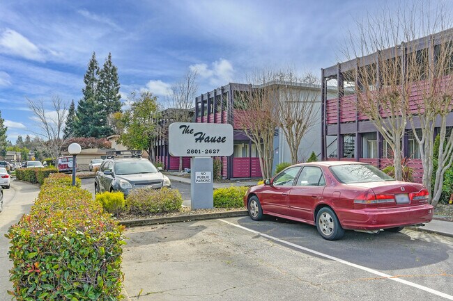
Property Record
2601 Carmichael Way, Carmichael, CA 95608


Property Detail
2601 Carmichael Way
273-0191-017
LOT 15 & S 104 FT OF LOT 14 FAIR OAKS BLVD RANCHOS NO 2 ANNEX
Apartment
Sacramento
RD-40
California
B and X Area of moderate flood hazard, usually the area between the limits of the 100-year and 500-year floods.
15,14
2025
0.63 AC
2025
Outer Carmichael/Citrus Heights
007802
Sacramento
13,256 SF
Sacramento-Roseville-Folsom, CA
NEARBY LISTINGS FOR SALE OR LEASE
DEMOGRAPHICS near 2601 Carmichael Way
1 mile
3 mile
5 mile
2025 Total Population
14,674
132,769
350,474
2030 Population
14,859
133,843
354,093
Pop Growth 2025-2030
+ 1.26%
+ 0.81%
+ 1.03%
Average Age
43
41
40
2025 Total Households
5,813
51,694
137,409
HH Growth 2025-2030
+ 1.38%
+ 0.82%
+ 1.05%
Median Household Inc
$78,197
$88,861
$82,078
Avg Household Size
2.40
2.50
2.50
2025 Avg HH Vehicles
2.00
2.00
2.00
Median Home Value
$682,974
$550,748
$496,763
Median Year Built
1974
1970
1972
Nearby Places
Map Layers
Map Styles
 Street
 Aerial
Layers
 Traffic
 Biking
Places
Listings with unknown addresses are not visible on the map
- Restaurants
- Banks
- Shops
- Fitness
- Groceries
PUBLIC TRANSPORTATION
AIRPORT
Sacramento International
Drive
Walk
Distance
Sacramento International
31 min
19.7 mi
Freight Ports
Port of Stockton
Drive
Walk
Distance
Port of Stockton
71 min
58.0 mi
SALE & LEASE HISTORY
LISTING DATE
SALE/LEASE

May 25, 2017
For Sale
Mar 12, 2025
For Sale
Mar 06, 2019
For Sale
Nearby Properties
Address
Land Use
TOTAL SIZE
Lot Size
Zoning
Address
Land Use
TOTAL SIZE
Lot Size
Zoning
512,630 SF
37.68 AC
SPA (NPA)
Address
Land Use
TOTAL SIZE
Lot Size
Zoning
223,046 SF
10.99 AC
RD 20
Address
Land Use
TOTAL SIZE
Lot Size
Zoning
192,500 SF
11.78 AC
OPMU
Address
Land Use
TOTAL SIZE
Lot Size
Zoning
162,023 SF
8.96 AC
OIMU
Address
Land Use
TOTAL SIZE
Lot Size
Zoning
278,877 SF
13.17 AC
RD-30
Address
Land Use
TOTAL SIZE
Lot Size
Zoning
75,700 SF
4.02 AC
RD-40
Address
Land Use
TOTAL SIZE
Lot Size
Zoning
221,337 SF
12.19 AC
RD 25
Address
Land Use
TOTAL SIZE
Lot Size
Zoning
156,032 SF
9.31 AC
OPMU
Address
Land Use
TOTAL SIZE
Lot Size
Zoning
169,618 SF
10.44 AC
RD-4
Address
Land Use
TOTAL SIZE
Lot Size
Zoning
198,413 SF
9.24 AC
RD 30
Address
Land Use
TOTAL SIZE
Lot Size
Zoning
140,102 SF
3.30 AC
RD-20
Address
Land Use
TOTAL SIZE
Lot Size
Zoning
89,098 SF
4.93 AC
RD-40
Address
Land Use
TOTAL SIZE
Lot Size
Zoning
302,966 SF
15.94 AC
RD 30
Address
Land Use
TOTAL SIZE
Lot Size
Zoning
258,819 SF
13.47 AC
RD 30
Address
Land Use
TOTAL SIZE
Lot Size
Zoning
43,183 SF
12.35 AC
H F
Address
Land Use
TOTAL SIZE
Lot Size
Zoning
72,119 SF
2.38 AC
BP (NPA)
Address
Land Use
TOTAL SIZE
Lot Size
Zoning
1,484 SF
4.94 AC
RD-20
Address
Land Use
TOTAL SIZE
Lot Size
Zoning
218,823 SF
10.77 AC
HDR
Address
Land Use
TOTAL SIZE
Lot Size
Zoning
115,593 SF
6.31 AC
OPMU
Address
Land Use
TOTAL SIZE
Lot Size
Zoning
185,550 SF
8.67 AC
SC
Address
Land Use
TOTAL SIZE
Lot Size
Zoning
90,972 SF
2.36 AC
RD-40
Address
Land Use
TOTAL SIZE
Lot Size
Zoning
184,249 SF
10.72 AC
OIMU (FBSP
Address
Land Use
TOTAL SIZE
Lot Size
Zoning
135,053 SF
6.66 AC
LC SC RD-4
Address
Land Use
TOTAL SIZE
Lot Size
Zoning
137,939 SF
5.25 AC
CMU (FBSP)
Address
Land Use
TOTAL SIZE
Lot Size
Zoning
157,500 SF
12.91 AC
OPMU
Address
Land Use
TOTAL SIZE
Lot Size
Zoning
110,533 SF
4.17 AC
RD-5 RD-40
Address
Land Use
TOTAL SIZE
Lot Size
Zoning
64,250 SF
2.38 AC
OPMU
Address
Land Use
TOTAL SIZE
Lot Size
Zoning
124,604 SF
8.50 AC
OPMU
Address
Land Use
TOTAL SIZE
Lot Size
Zoning
166,300 SF
8.04 AC
RD-40 RD-2
Address
Land Use
TOTAL SIZE
Lot Size
Zoning
218,591 SF
12.05 AC
RD 30
The World's #1 Commercial Real Estate Marketplace
Connect with us
© 2026 CoStar Group
The information above has been obtained from sources believed reliable. While we do not doubt its accuracy we have not verified it and make no guarantee, warranty or representation about it. It is your responsibility to independently confirm its accuracy and completeness. Any projections, opinions, assumptions, or estimates used are for example only and do not represent the current or future performance of the property. The value of this transaction to you depends on tax and other factors which should be evaluated by your tax, financial, and legal advisors. You and your advisors should conduct a careful, independent investigation of the property to determine to your satisfaction the suitability of the property for your needs.