Property Record
2601 S Interstate 35, Round Rock, TX 78664
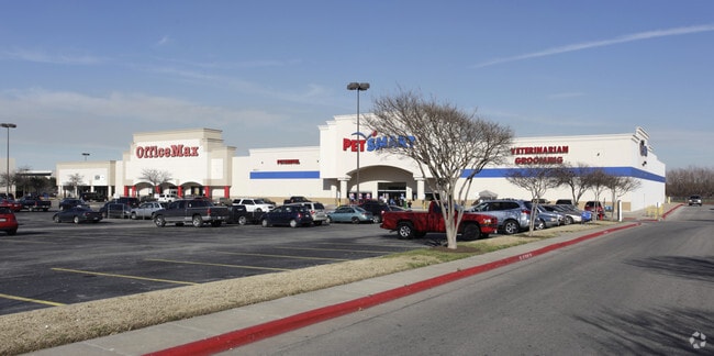

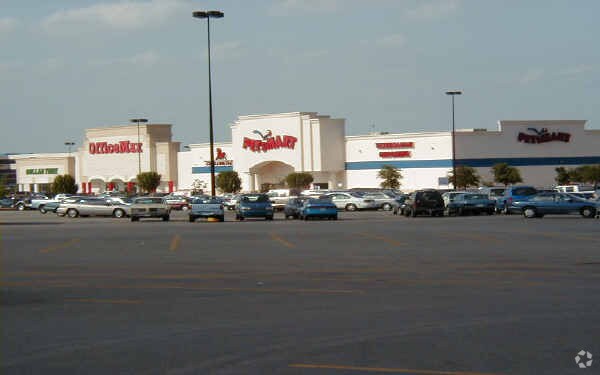

Property Detail
2601 S Interstate 35
Austin-Round Rock-San Marcos, TX
REFERENCE ONLY - S6379 BOARDWALK 2 SUB SEC 6, LOT 1/PT, ACRES 19.8294 R577470/NON-REF
R362158
Williamson
Commercialnec
Texas
C1
1
0
19.83 AC
2025
Round Rock
020709
Austin
162,856 SF
NEARBY LISTINGS FOR SALE OR LEASE
DEMOGRAPHICS near 2601 S Interstate 35
1 mile
3 mile
5 mile
2025 Total Population
10,841
101,490
262,085
2030 Population
12,164
111,253
286,319
Pop Growth 2025-2030
+ 12.20%
+ 9.62%
+ 9.25%
Average Age
38
37
37
2025 Total Households
4,394
40,109
99,465
HH Growth 2025-2030
+ 12.81%
+ 10.34%
+ 9.61%
Median Household Inc
$85,132
$89,977
$99,321
Avg Household Size
2.40
2.50
2.60
2025 Avg HH Vehicles
2.00
2.00
2.00
Median Home Value
$338,612
$377,266
$435,310
Median Year Built
1993
1998
2001
Nearby Places
Map Layers
Map Styles
 Street
 Aerial
Transit
 Traffic
 Biking
Places
Listings with unknown addresses are not visible on the map
- Restaurants
- Banks
- Shops
- Fitness
- Groceries
PUBLIC TRANSPORTATION
AIRPORT
Austin-Bergstrom International
Drive
Walk
Distance
Austin-Bergstrom International
40 min
26.9 mi
Freight Ports
Calhoun Port
Drive
Walk
Distance
Calhoun Port
203 min
175.0 mi
Nearby Properties
Address
Land Use
TOTAL SIZE
Lot Size
Zoning
Address
Land Use
TOTAL SIZE
Lot Size
Zoning
2,089,779 SF
167.49 AC
Address
Land Use
TOTAL SIZE
Lot Size
Zoning
956,707 SF
71.90 AC
C1
Address
Land Use
TOTAL SIZE
Lot Size
Zoning
536,741 SF
80.32 AC
SF2
Address
Land Use
TOTAL SIZE
Lot Size
Zoning
422,682 SF
95.18 AC
Address
Land Use
TOTAL SIZE
Lot Size
Zoning
485,021 SF
50.17 AC
C1
Address
Land Use
TOTAL SIZE
Lot Size
Zoning
428,011 SF
25 AC
Address
Land Use
TOTAL SIZE
Lot Size
Zoning
466,256 SF
38.33 AC
Address
Land Use
TOTAL SIZE
Lot Size
Zoning
533,151 SF
26.90 AC
PUD
Address
Land Use
TOTAL SIZE
Lot Size
Zoning
445,321 SF
12.52 AC
Address
Land Use
TOTAL SIZE
Lot Size
Zoning
543,958 SF
60.19 AC
Address
Land Use
TOTAL SIZE
Lot Size
Zoning
273,462 SF
47.12 AC
Address
Land Use
TOTAL SIZE
Lot Size
Zoning
470,992 SF
25.92 AC
Address
Land Use
TOTAL SIZE
Lot Size
Zoning
323,284 SF
14.21 AC
Address
Land Use
TOTAL SIZE
Lot Size
Zoning
295,750 SF
21.46 AC
Address
Land Use
TOTAL SIZE
Lot Size
Zoning
361,440 SF
19.35 AC
Address
Land Use
TOTAL SIZE
Lot Size
Zoning
362,216 SF
19.72 AC
Address
Land Use
TOTAL SIZE
Lot Size
Zoning
618,605 SF
14.11 AC
PUD
Address
Land Use
TOTAL SIZE
Lot Size
Zoning
326,015 SF
11.11 AC
Address
Land Use
TOTAL SIZE
Lot Size
Zoning
477,454 SF
22.28 AC
Address
Land Use
TOTAL SIZE
Lot Size
Zoning
332,752 SF
10.30 AC
Address
Land Use
TOTAL SIZE
Lot Size
Zoning
140,409 SF
17.15 AC
Address
Land Use
TOTAL SIZE
Lot Size
Zoning
330,541 SF
20.90 AC
PUD
Address
Land Use
TOTAL SIZE
Lot Size
Zoning
216,198 SF
9.47 AC
Address
Land Use
TOTAL SIZE
Lot Size
Zoning
673,809 SF
9.03 AC
PUD
Address
Land Use
TOTAL SIZE
Lot Size
Zoning
379,953 SF
11.74 AC
PUD
Address
Land Use
TOTAL SIZE
Lot Size
Zoning
285,835 SF
25.69 AC
C1
Address
Land Use
TOTAL SIZE
Lot Size
Zoning
203,198 SF
14.04 AC
Address
Land Use
TOTAL SIZE
Lot Size
Zoning
283,866 SF
12.18 AC
Address
Land Use
TOTAL SIZE
Lot Size
Zoning
344,341 SF
19.19 AC
PUD
Address
Land Use
TOTAL SIZE
Lot Size
Zoning
409,875 SF
25.28 AC
MF
The World's #1 Commercial Real Estate Marketplace
Connect with us
© 2026 CoStar Group
The information above has been obtained from sources believed reliable. While we do not doubt its accuracy we have not verified it and make no guarantee, warranty or representation about it. It is your responsibility to independently confirm its accuracy and completeness. Any projections, opinions, assumptions, or estimates used are for example only and do not represent the current or future performance of the property. The value of this transaction to you depends on tax and other factors which should be evaluated by your tax, financial, and legal advisors. You and your advisors should conduct a careful, independent investigation of the property to determine to your satisfaction the suitability of the property for your needs.