Property Record
2601 Us Highway 17 N, Bowling Green, FL 33834
NEARBY LISTINGS FOR SALE OR LEASE
-
-
View all Bowling Green listings for sale on LoopNet.com
Property Detail
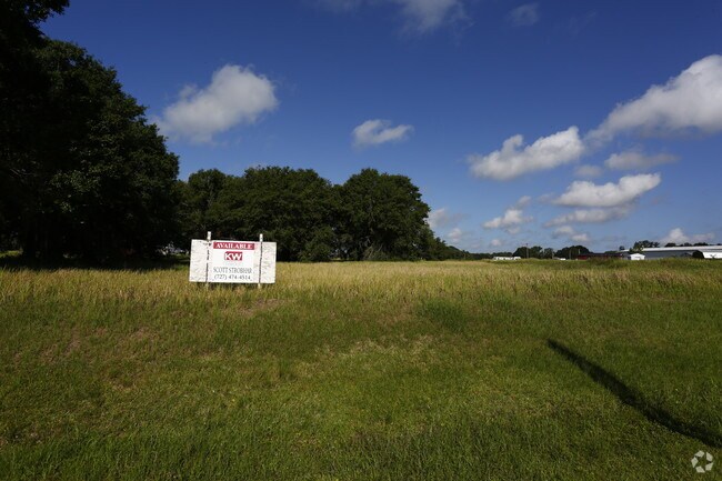
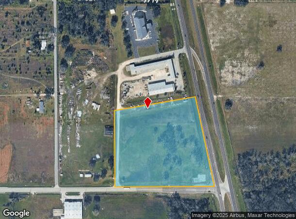
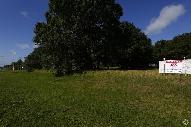
2601 Us Highway 17 N
2133-25-0000-00620-0000
8.50 AC COM SW COR OF SW1/4 OF NW1/4 RUN S 89 54 50 E 410 FT FOR POB THENCE CONT SAME LINE 683.13 FT TO W R/W LINE OF US HWY17 THENCE N 11 53 48 W ALONG SAID R/W LINE 703.72 FT THENCE S 79 51 50 W 547.61 FT THENCE S & // TO W LINE OF SAID TRACT 591.2
Commercialacreage
Hardee
X
Florida
12049C0177D
8.50 AC
2025
Florida Central South Area
2025
Other Market Areas
970202
Wauchula, FL
DEMOGRAPHICS near 2601 Us Highway 17 N
1 Mile
3 Mile
5 Mile
2024 Total Population
1,907
7,462
16,405
2029 Population
1,974
7,852
17,065
Pop Growth 2024-2029
+ 3.51%
+ 5.23%
+ 4.02%
Average Age
38
38
37
2024 Total Households
664
2,506
5,446
HH Growth 2024-2029
+ 3.61%
+ 5.35%
+ 4.13%
Median Household Inc
$46,489
$44,675
$39,242
Avg Household Size
2.90
3.00
2.90
2024 Avg HH Vehicles
2.00
2.00
2.00
Median Home Value
$230,434
$133,021
$122,283
Median Year Built
1978
1980
1979
Nearby Places
Map Layers
Map Styles
 Street
 Aerial
- Restaurants
- Banks
- Shops
- Fitness
- Groceries
SALE & LEASE HISTORY
LISTING DATE
SALE/LEASE

Jun 20, 2017
For Sale
Jun 02, 2017
For Sale
Dec 27, 2017
For Sale
Nearby Properties
Address
Land Use
TOTAL SIZE
Lot Size
Zoning
Address
Land Use
TOTAL SIZE
Lot Size
Zoning
60.50 AC
F-R
Address
Land Use
TOTAL SIZE
Lot Size
Zoning
47,399 SF
55.51 AC
C-2
Address
Land Use
TOTAL SIZE
Lot Size
Zoning
107,610 SF
14.32 AC
C-1
Address
Land Use
TOTAL SIZE
Lot Size
Zoning
6 AC
P-I
Address
Land Use
TOTAL SIZE
Lot Size
Zoning
122,608 SF
10.32 AC
R-3
Address
Land Use
TOTAL SIZE
Lot Size
Zoning
45,018 SF
17.48 AC
P-SP
Address
Land Use
TOTAL SIZE
Lot Size
Zoning
1,260 SF
39.68 AC
P-I
Address
Land Use
TOTAL SIZE
Lot Size
Zoning
13.28 AC
F-R
Address
Land Use
TOTAL SIZE
Lot Size
Zoning
31,216 SF
5.16 AC
C-2
Address
Land Use
TOTAL SIZE
Lot Size
Zoning
1,224 SF
47.28 AC
A-1
Address
Land Use
TOTAL SIZE
Lot Size
Zoning
581.63 AC
A-1
Address
Land Use
TOTAL SIZE
Lot Size
Zoning
80,858 SF
8.63 AC
C/IBC
Address
Land Use
TOTAL SIZE
Lot Size
Zoning
68,254 SF
11 AC
R-3
Address
Land Use
TOTAL SIZE
Lot Size
Zoning
41,794 SF
4.07 AC
C/IBC
Address
Land Use
TOTAL SIZE
Lot Size
Zoning
38,275 SF
18.72 AC
C-2
Address
Land Use
TOTAL SIZE
Lot Size
Zoning
27,168 SF
3.62 AC
C-1
Address
Land Use
TOTAL SIZE
Lot Size
Zoning
36,053 SF
15.50 AC
C-2
Address
Land Use
TOTAL SIZE
Lot Size
Zoning
62.17 AC
A-1
Address
Land Use
TOTAL SIZE
Lot Size
Zoning
7,680 SF
181.93 AC
A-1
Address
Land Use
TOTAL SIZE
Lot Size
Zoning
173.72 AC
A-1
Address
Land Use
TOTAL SIZE
Lot Size
Zoning
181.06 AC
A-1
Address
Land Use
TOTAL SIZE
Lot Size
Zoning
1,864 SF
487.82 AC
A-1
Address
Land Use
TOTAL SIZE
Lot Size
Zoning
5,004 SF
162.50 AC
A-1
Address
Land Use
TOTAL SIZE
Lot Size
Zoning
5,495 SF
269.87 AC
A-1
Address
Land Use
TOTAL SIZE
Lot Size
Zoning
196.63 AC
A-1
Address
Land Use
TOTAL SIZE
Lot Size
Zoning
11,332 SF
4.29 AC
P-R
Address
Land Use
TOTAL SIZE
Lot Size
Zoning
53 AC
F-R
Address
Land Use
TOTAL SIZE
Lot Size
Zoning
85.85 AC
A-1
Address
Land Use
TOTAL SIZE
Lot Size
Zoning
9,056 SF
4.31 AC
C/IBC
Address
Land Use
TOTAL SIZE
Lot Size
Zoning
1,734 SF
98 AC
A-1
The World's #1 Commercial Real Estate Marketplace
Connect with us
© 2025 CoStar Group
The information above has been obtained from sources believed reliable. While we do not doubt its accuracy we have not verified it and make no guarantee, warranty or representation about it. It is your responsibility to independently confirm its accuracy and completeness. Any projections, opinions, assumptions, or estimates used are for example only and do not represent the current or future performance of the property. The value of this transaction to you depends on tax and other factors which should be evaluated by your tax, financial, and legal advisors. You and your advisors should conduct a careful, independent investigation of the property to determine to your satisfaction the suitability of the property for your needs.